Harris joins Planet’s Application Developer Program
Anonym
We are incredibly excited to officially launch our new membership to Planet’s Application Developer Program! As part of this program, ENVI algorithms and Planet data work in tandem to bring best-in-class analytics together with multi-temporal high quality imagery, delivering robust end-to-end solutions that solve the most challenging geospatial problems.
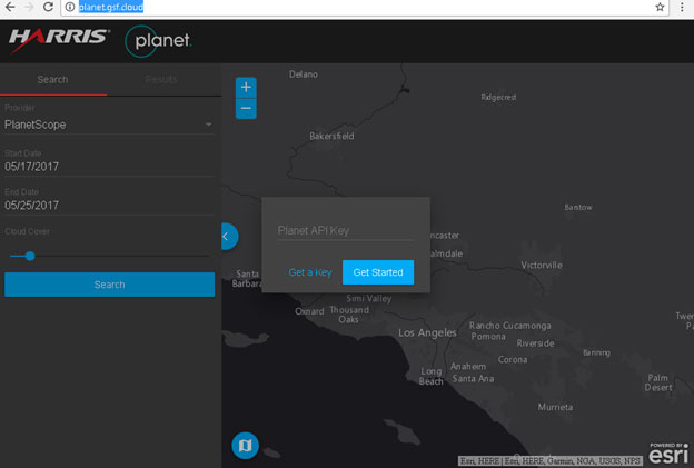
*Note: A Planet API key is required to run this application. Sign up here.
For the Developer:
ENVI Tasks provide an API to the algorithms you’ve trusted for years. Now, those discrete processing tasks are de-coupled from the desktop and can easily be chained together to build custom workflows across industries ranging from agriculture, to energy, to maritime solutions, and beyond.
Likewise, the Planet API makes it easy to access daily global imagery. Not only does the API provide fully functional access to the Planet Scope 4-band imagery, but users can also access RapidEye 5-band imagery, as well as Landsat and Sentinel-2, for seamless integration to any geospatial application. Download the latest ENVI desktop plugin to pull Planet imagery directly into ENVI.
What this means is that now developers have API access to both best-of-breed analytics along with a robust collection of multi-modal, multi-temporal data that when combined make it easier than ever to exploit analytics, derive information, and make informed decisions.
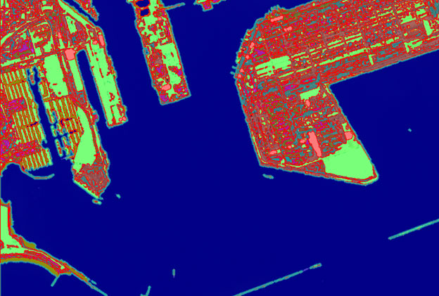
Automated classification raster and vector output from ENVI running on this Planet DOVE scene to delineate water, boats, and various land features.
For the Geospatial Business Professional:
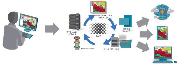
If you prefer to skip the API and go straight to getting the answers, the Harris Geospatial Services Framework (GSF) is a modern platform framework that enables exposure to the analytics you need in a way that’s easy to consume. That means you can quickly and seamlessly access information about crop health, infrastructure status, maritime port activity, or hundreds of other applications that use geospatial data to provide answers.
Check out our integration demo to search the Planet archive and apply an ENVI workflow for crop health. This application is intended to showcase how exposure to on-demand analytics can be simple. The API access, data and technology integration, and cloud deployment are taken care of “behind the scenes”, freeing you up to focus on running your business and serving your customers. View Esri Story Map-based documentation here.
For the Analyst:
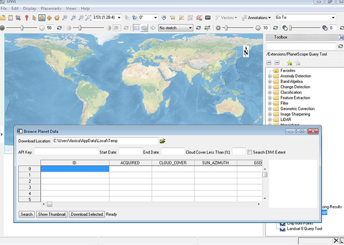
We didn’t forget the important jobs of R&D and workflow development! The new plugin to ENVI at the desktop lets you select an area of interest, browse the Planet catalog, and select data to download directly into ENVI. From there, more than 170 tasks, 50+ workflows, and all the interactivity you need is available to build and prototype solutions for your enterprise deployment.
Summary:
Harris and Planet have joined forces to take geospatial applications to a whole new dimension. We hope you’re as excited as we are about this partnership. We’re always eager to hear what users are doing and how we can help make your jobs easier. Most importantly, we want to add value to your business, so let us know how you think we’re doing.