Use ENVI and DigitalGlobe Data to Help Recovery Efforts in Nepal
Anonym

This past week, NV5 (formerly Exelis) and Maxar (formerly DigitalGlobe) agreed to provide a new commercial offering of cloud-based ENVI analytics for the DigitalGlobe Geospatial Big Data Platform (GBD). The agreement will enable imagery users to easily combine powerful geospatial analytics with the vast DigitalGlobe image library to solve challenging environmental, natural resource and global security problems.
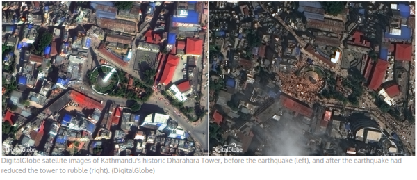
In response to the devastating 7.8 magnitude earthquake that struck central Nepal on April 25, DigitalGlobe has made high resolution satellite imagery of the affected areas freely available online to all groups involved in the response and recovery effort. This imagery can be accessed via https://services.digitalglobe.com/myDigitalGlobe/login. For more information on how to access DigitalGlobe high resolution imagery to aid in recovery efforts, see this blog post.
In addition to the offerings that DigitalGlobe has made available, DigitalGlobe and Exelis have put their new partnership to good use by setting up Amazon instances allowing free access to the data and ENVI image analysis software for anyone that would like to lend their image analysis skills to generate useful products for response and recovery efforts. If you are interested, contact us at geospatialinfo@nv5.com.