Solution
The ENVI Deep Learning module has intuitive tools and workflows that require no programming, enabling users to create accurate deep learning models and algorithms in a matter of minutes. This allows disaster responders to quickly preprocess, label, train, and classify imagery to make critical decisions. The ENVI Deep Learning module is used after a disaster to assess and quantify damage, locate and identify hazards, evaluate access to infrastructure, map flooding and much more.
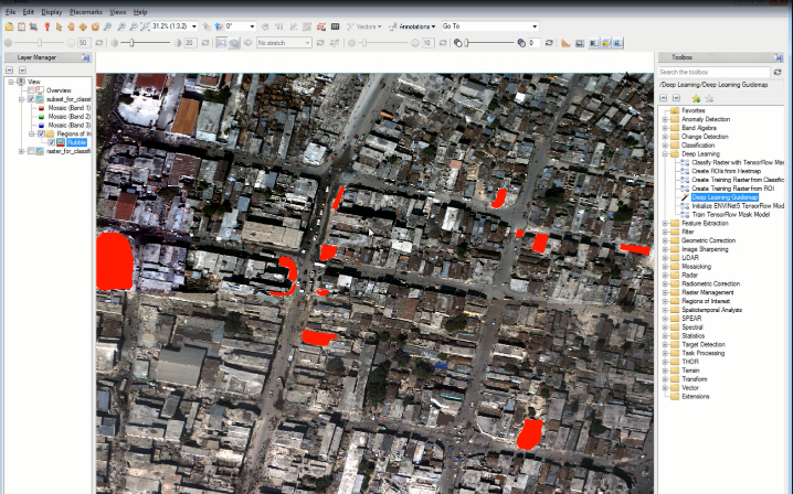 The ROI tool within ENVI was used to create training data with just a few clicks.
Benefits
The ENVI Deep Learning module can be used to quickly and accurately extract actionable information, which accelerates response times. This tool improves awareness which enables relief organizations to make safer and more informed decisions as the situation unfolds. In the aftermath of an event, the ENVI Deep Learning module is also valuable in the support of rebuilding and recovery efforts.
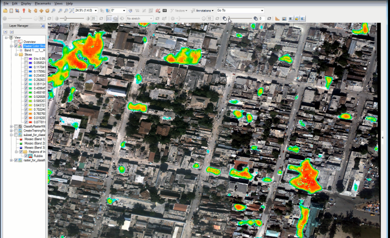 The deep learning results show the probability of buildings that have been destroyed and are now rubble.