10102
ENVI LiDAR has merged into ENVI 5.3
Starting with ENVI 5.3, the ENVI LiDAR application has been merged into the ENVI application and there is no longer a separate installation for this product. Like other ENVI modules, the ENVI LiDAR application is available for use to licensed users.
Note that ENVI Lidar tools are available on Windows platforms only. For information on Platform and Feature Support, please see the following help article:
www.harrisgeospatial.com/Support/SelfHelpTools/HelpArticles/HelpArticles-Detail/TabId/2718/ArtMID/10220/ArticleID/15463/ENVI--ESE-53-and-IDL-85-Platform-and-Feature-Support.aspx
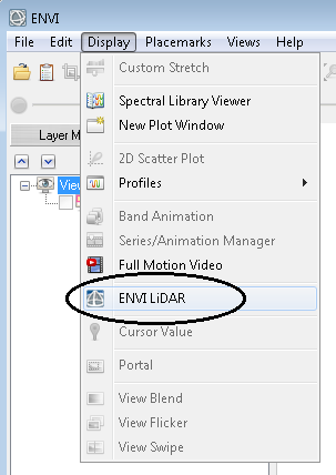
To open the ENVI LiDAR application select LiDAR > Launch ENVI LiDAR from the Toolbox, or select Display > ENVI LiDAR from the ENVI menu bar.
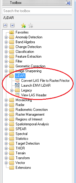
ENVI's Lidar tool allows a user to open and visualize LiDAR datasets and extract a DEM, DSM and orthophoto from the LiDAR points.
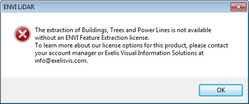
Starting with ENVI 5.3, the ability to extract building, tree and powerline features is licensed through the Feature Extraction module rather than a separate ENVI LiDAR license feature. If you are not licensed for ENVI Feature Extraction and attempt to extract these types of features, you will encounter the following message in ENVI LiDAR:
To request a Feature Extraction license for ENVI LiDAR or for additional questions on the ENVI LiDAR application or licensing, please contact Technical Support.
Reviewed 6/8/2016 MM