The Rise of Image Services
Anonym
Last week, myself and several colleagues here at Exelis Visual Information Solutions attended the 2014 Esri User Conference in beautiful San Diego, California. The Esri User Conference is an exciting experience because it's not often you get a chance to spend the better part of a week with thousands of other people that share a common interest in GIS technology. Throughout the week, I met with a wide range of GIS users, developers, and advocates that all approach the field from slightly different angles. The beauty of the Esri User Conference is that it brings all of these people together into one place. The effect of the experience for me is equal parts inspiring and daunting. Inspiring because seeing what other people are doing with GIS can fuel a lot of ideas about what I can do with the technology that I am working with. Daunting because in the world of GIS, no matter how much I think I know, the Esri User Conference serves as a stark reminder that this industry moves fast and you have to keep up.
This year, one of the things that really stuck out for me is how quickly access to imagery is improving. I saw this everywhere at the Esri User Conference. It wasn't long ago that getting access to imagery required sending out requests for hard copies of data to be sent via CDs or other forms of storage. More recently, freely-available data sources such as Landsat imagery from the USGS EROS Center and NAIP imagery from the National Map Viewer have allowed us to download imagery for a specific area of interest. This has been a great improvement over sending out for hard copies of data files and is the method I use most frequently for accessing imagery.
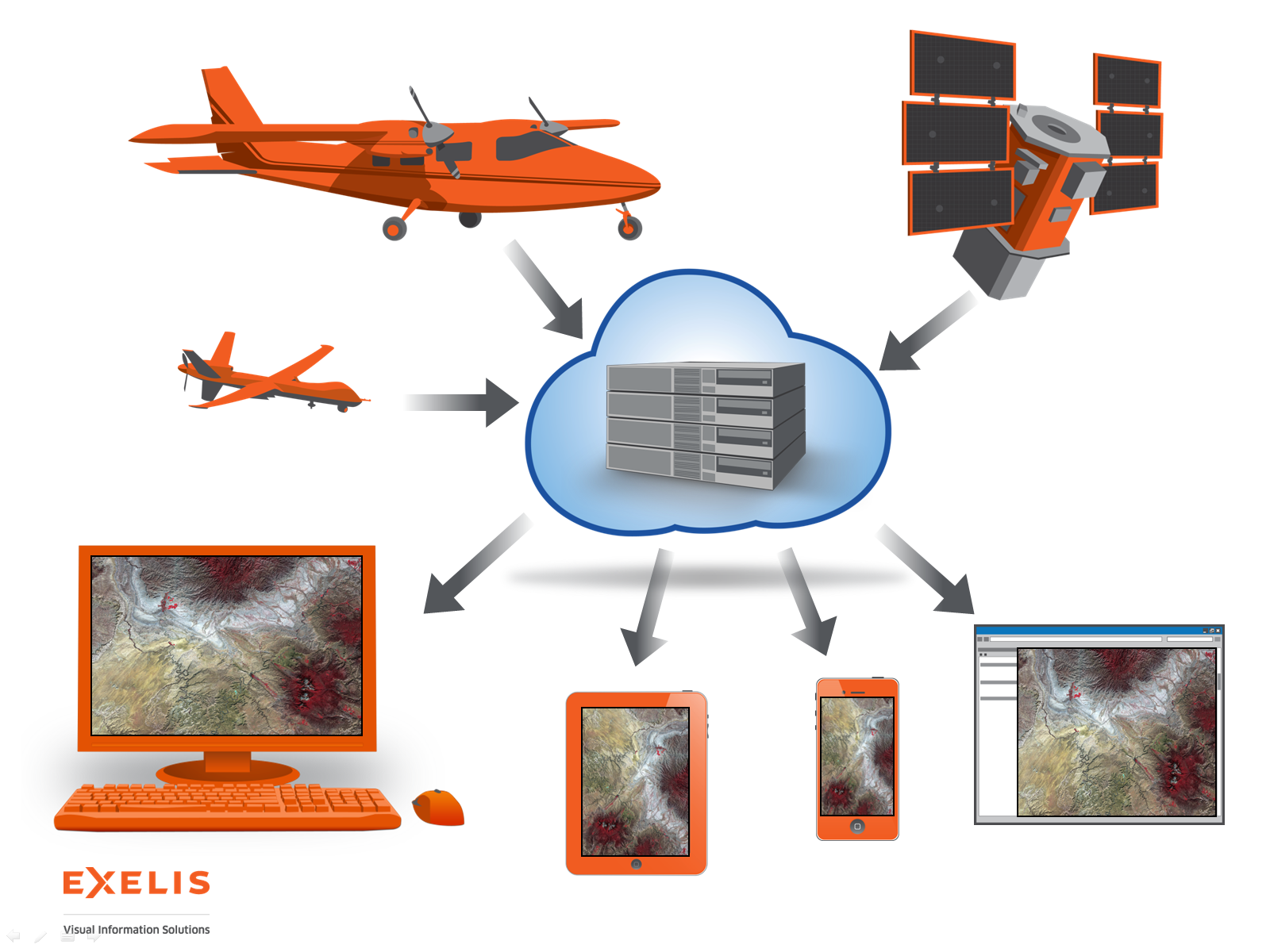
For several years, there has also been a growing use of image services to provide imagery to GIS users. Image services are great because they provide access to image data through a web service. This allows us to quickly access and view imagery on the fly. Because image services are accessible through a URL, we can access image services from virtually anywhere an internet connection is available. With collections of imagery from airborne, spaceborne, and unmanned aerial vehicle sensors growing at an unprecedented rate, image services provide a method for rapidly disseminating huge stores of data to GIS users.
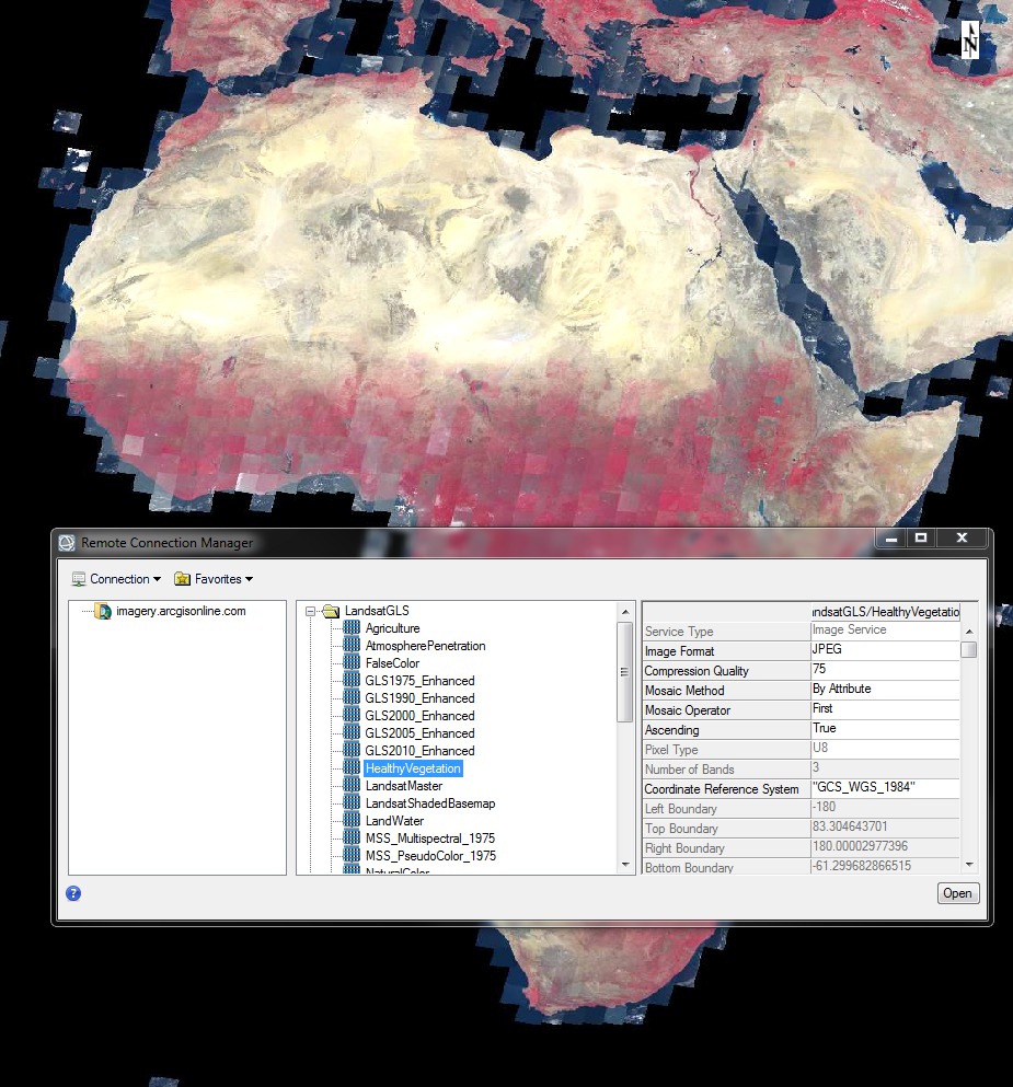
For several years, Esri has worked with the USGS to provide Landsat Image Services that are consumable by desktop products such as ENVI (see screenshot below) and ArcMap. These image services are also consumable in online applications, such as ArcGIS Online or custom web applications. One of the more exciting things that I saw at this year's Esri User Conference was how easy it was to access high resolution multispectral imagery from DigitalGlobe through an image service. This is available through ArcGIS Marketplace. With a little help from our friends at DigitalGlobe, we were actually very quickly able to consume DigitalGlobe's image service into one of our custom web applications and perform image analysis using ENVI cloud analytics on the fly - right on the showroom floor. We were even able to do this with an image service created by one of our users at a local university. For me, this was the big "aha moment" of the conference. Sometimes it really is that easy.
The expanse of image services is going to provide GIS users with much more timely access to many forms of imagery over much larger expanses of land. Image services provide a quick way to view, download, pre-process and analyze imagery. If you have any questions about how to access image services in your desktop or online applications, please feel free to contact us at info@exelisvis.com.