Exploring the Toulouse Hyperspectral Dataset Using ENVI/IDL
Hyperspectral imagery has changed how we understand and analyze the world around us, offering unprecedented detail across a broad spectrum of wavelengths. An exciting dataset we looked at recently was the Toulouse hyperspectral dataset, a comprehensive airborne dataset that includes surface reflectance spectra, 3D point clouds, thermal infrared data, and ground truth data, all captured over Toulouse, France. But how can we harness this data to extract meaningful insights? That’s where ENVI® and IDL® come into play.
In this blog post, we’ll dive into how you can use IDL to create an ENVI Spectral Library from the Toulouse dataset’s reflectance spectra, and then leverage ENVI to identify materials within the data. Whether you’re a seasoned remote sensing professional or new to hyperspectral analysis, this step-by-step guide will help you unlock the full potential of the Toulouse Hyperspectral dataset and other datasets that are similar.
Step 1. Create a Spectral Library Using IDL
Creating a spectral library is a crucial step for material identification in hyperspectral data. The Toulouse dataset contains a wealth of spectral data, but with 540 ASCII files nested in multiple folders, manually importing these into ENVI would be time consuming and inefficient. Instead, we’ll harness the power of IDL to automate the process.
By writing an IDL script, you can efficiently read the spectral data and generate a spectral library using the “ENVISpectralLibrary” object. I created an IDL notebook that guides you through this process. The notebook, accessible through the official IDL plugin for Visual Studio code and IDL 9.0, allows you to navigate to your local directory, import the spectral data, and create a spectral library file (.sli). You can find the complete notebook and instructions in the following GitHub repository:
https://github.com/hgs-dstarbuc/djs-spectral-lib-notebook/tree/main
Step 2. Analyzing the Data in ENVI
With the spectral library ready, it’s time to dive into ENVI, the industry-leading software for geospatial imagery analysis. ENVI’s user-friendly interface makes it easy to explore and analyze complex datasets, even for those of who aren’t remote sensing experts.
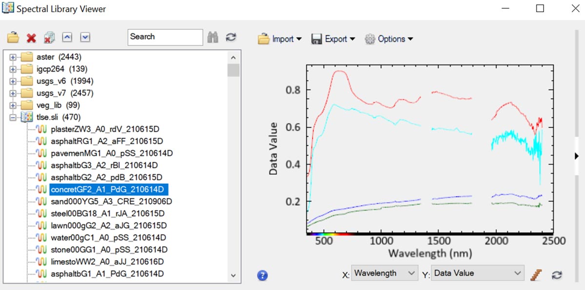
First, open ENVI and then navigate to “Display” > “Spectral Library Viewer”. From there, click on the “Open” icon and locate the spectral library file you created with IDL (named “tlse.sli” by default). Once loaded, you can expand the library in a folded tree and select various spectra to view them.
Here’s a screen shot of what you will see:
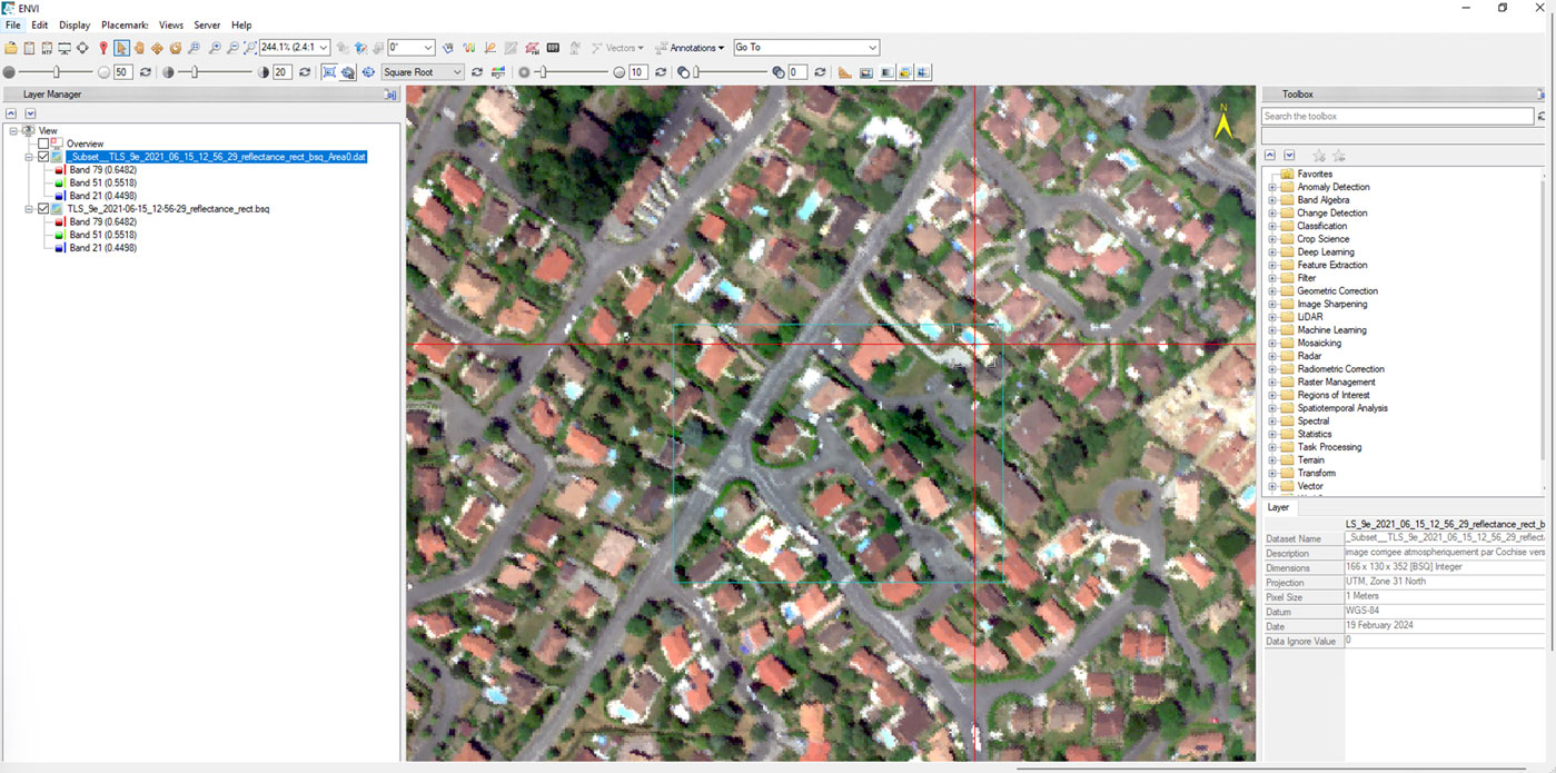
Next, I took subset of one of the hyperspectral images from the Toulouse dataset and opened it in ENVI. Using the spectral profile tool, I clicked on the “Identify” button, which opens the “Material Identification” dialog – a powerful feature introduced in ENVI 6.0. By selecting the “tlse.sli” spectral library, you can start to identify materials in the image with just a few clicks. Let’s explore some examples:
Identifying grass: I selected an area of grass in the image, and the Material Identification tool accurately identified various lawn types as the most likely materials.
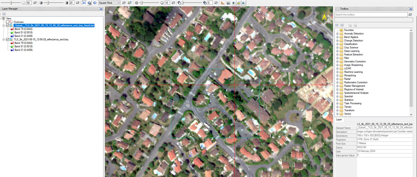
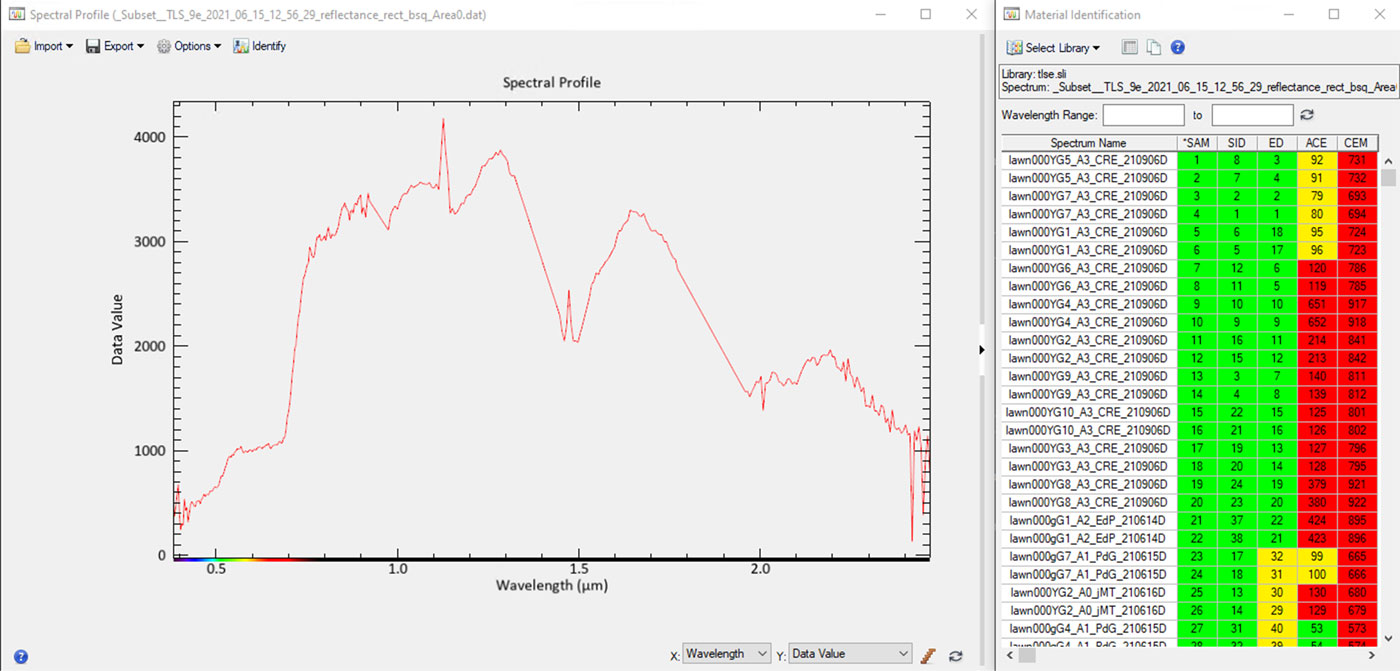
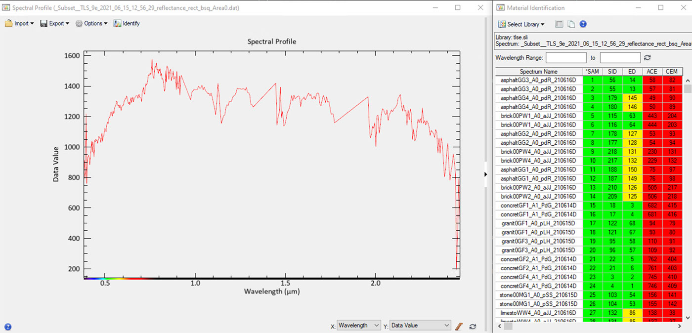
Identifying asphalt: Next I selected a road segment. The tool correctly identified asphalt as the primary material.
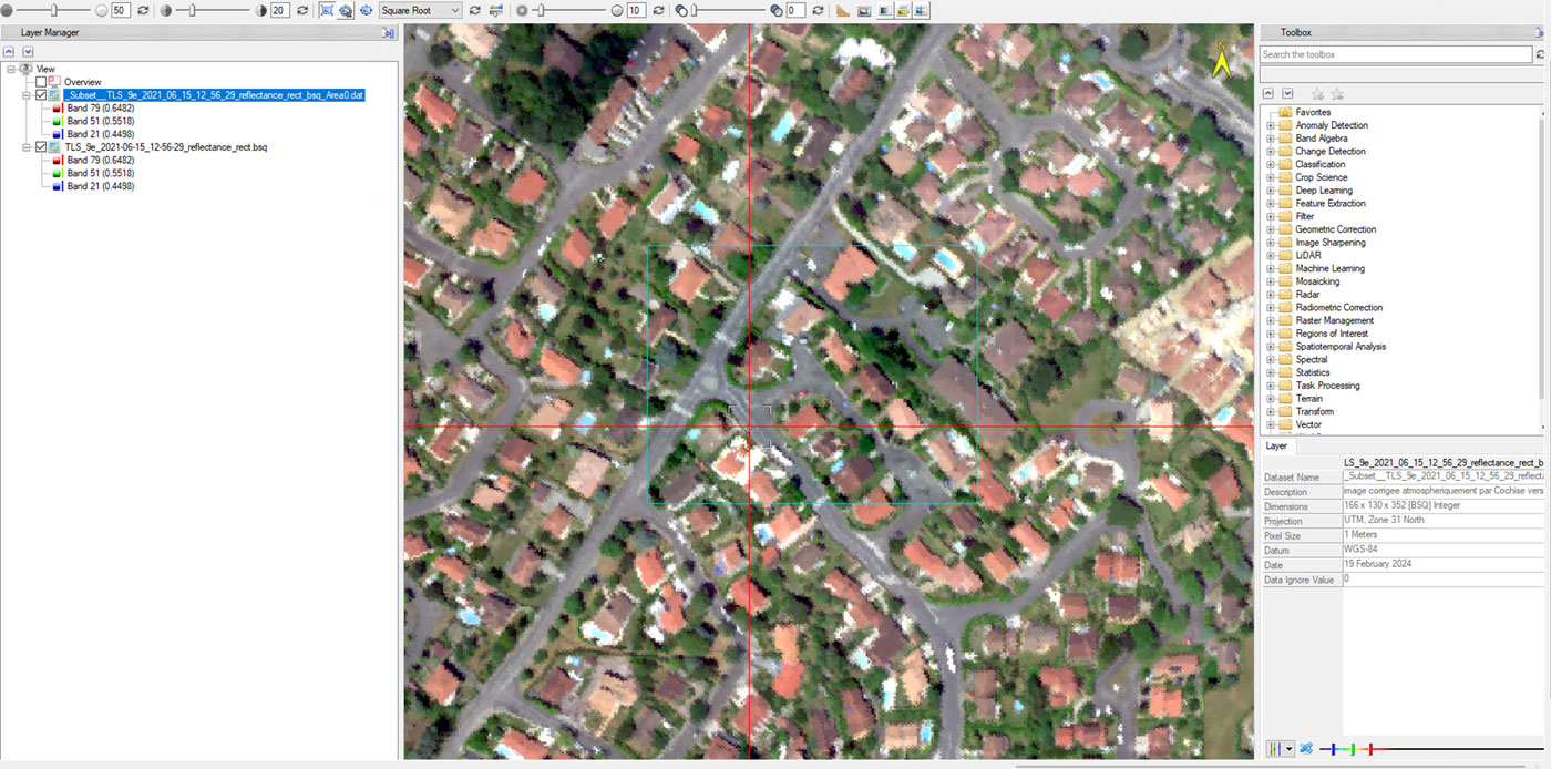
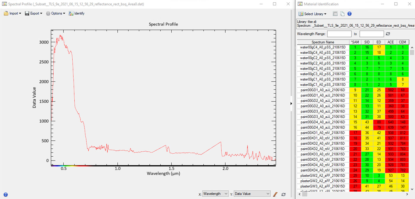
Identifying water: Finally, I selected a body of water, and the tool identified water-related materials.
Transforming Data Into Insights
The Toulouse Hyperspectral Dataset, combined with the power of ENVI and IDL, offers a rich playground for geospatial analysis. From creating spectral libraries to accurately identifying materials, these tools simplify complex processes and open up new possibilities for research and practical applications. Whether you’re working on urban microclimate studies, environmental monitoring, or any other geospatial project, this workflow provides a robust foundation for generating actionable insights.
Citations:
Roupioz L., et al. (April, 2023). “Multi-source datasets acquired over Toulouse (France) in 2021 for urban microclimate studies during the CAMCATT/AI4GEO field campaign.” Data in Brief, Volume 48, June 2023, 109109. https://www.sciencedirect.com/science/article/pii/S2352340923002287
Romain Thoreau et al (2023). “Toulouse Hyperspectral Data Set: a benchmark data set to assess semi-supervised spectral representation learning and pixel-wise classification techniques”. 2311.08863