Imagery of the Month – Fort McMurray Fire Roars On
Anonym
The Fort McMurray Fire is still making headlines and shows no signs of slowing down more than three weeks after it began. The devastating path of the fire has burned over 2018 square miles and destroyed some 2,400 homes and buildings. Wildfire Manager Chad Morrison is expecting weeks, if not months, of fighting the fire as it continues its path North crossing over from Alberta into Saskatchewan. Hot, dry weather conditions combined with only millimeters of moisture on the southern end of the fire haven’t helped containment efforts.
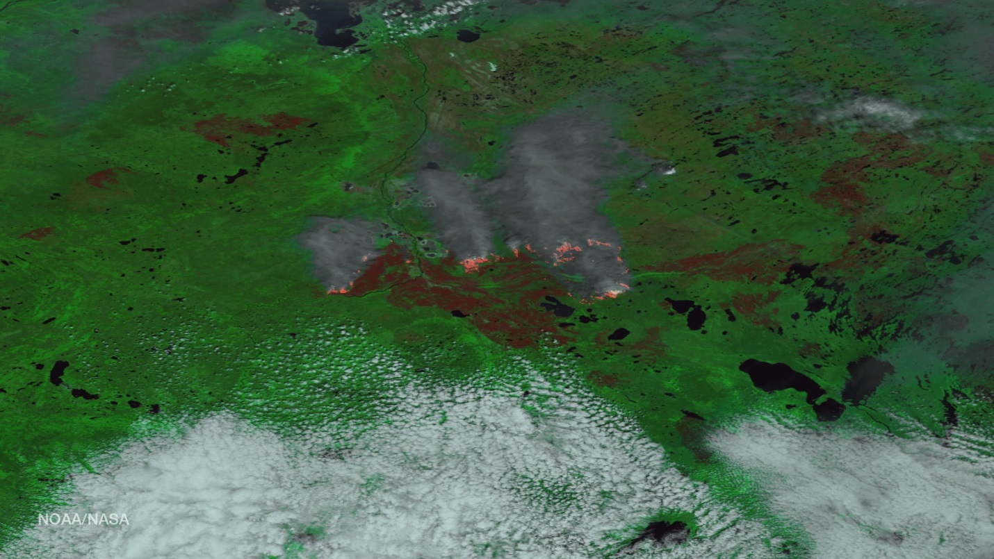
NASA continues to aid the firefighting effort by capturing a vast amount of Imagery over the fire from their Modis, Landsat 8, and Suomi NPP satellites (shown below). The sensors on the satellites allow penetration of the clouds and smoke and make it possible to see hotspots using thermal and IR bands. This helps those managing the firefighting efforts to deploy assets in areas where there are hotspots, regardless of the smoke of cloud coverage. The imagery captured also aides in the recovery efforts and allows the government to widely asses the areas burned and see what has survived the blaze.
Clear weather aligned with Suomi NPP’s flight over Fort McMurray on May 24th giving a spectacular view of the fire. The image shows the sheer size of the burn and the intensity at which it continues to burn.

(Credit Nasa/NOAA)
The Image above has been processed, making it easy to identify the burn scar, as well as see where the fire continues to roar near the North side of the scar. Having both thermal and visible imagery makes it possible to classify cloud, smoke, land, and then the active blaze itself.
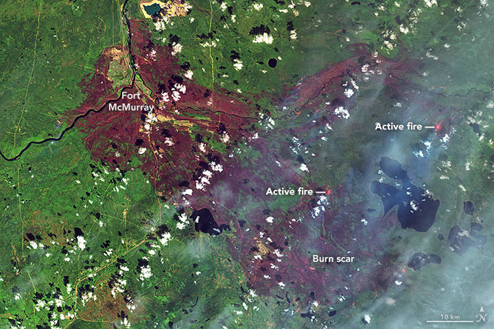
Though the Suomi Image is my image of the month, there was one additional image from Joshua Stevens at NASA Earth Observatory from May 12th that shows another close perspective from Landsat 8 of the burn scar itself surrounding Fort McMurray and the fire burning to the South/Southwest.

(Credits: NASA EarthObservatory image by Joshua Stevens, using Landsat data from the U.S. Geological Survey)
The contrast of the burn scar and surrounding healthy vegetation shows the extent the fire has scorched this area. Hopefully, additional wildfire crews that have been approved, and cooperating weather, will help get the upper hand on the blaze in the coming weeks. Containing the fire is just the first step in getting the residents of Fort McMurray on the road to rebuilding their town.