Landsat Program Well Worth It's Price Tag
Anonym
A recent report by the Landsat Advisory Group of the National Geospatial Advisory Committee took a rigorous look at the value of Landsat-based information over the lifetime of the program. Their conclusion, not surprisingly, shows that Landsat has provided a spectacular return on public investment. The paper reports that the economic value of just one year of Landsat data, estimated to be $2.19 billion, far exceeds the total cost of building, launching and managing Landsat instruments.
The fact that Landsat data is most often used by non-commercial entities makes it difficult to estimate its economic value. Nevertheless, the committee was able to form an estimate based on cost savings from operational efficiency improvements, cost of alternatives to using Landsat data, and opportunity costs due to decision-making support provided by Landsat data.
The report asserts that people use Landsat because it is more efficient than any other technology at providing required information. It concludes that the savings realized due to the Landsat program will continue to accelerate as the program continues.

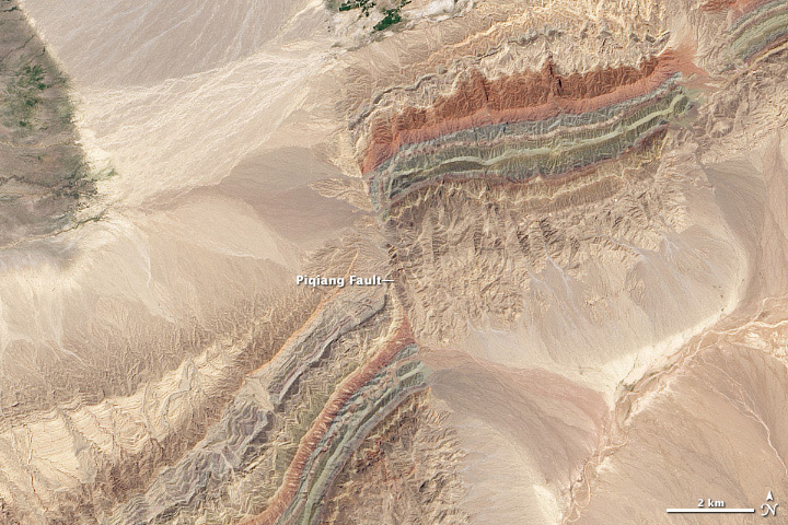
Landsat 8 OLI image of the Piqiang Fault in The northwestern Xinjiang province of China acquired on July 30, 2013. This beautiful image was the winner of NASA's 2015 Tournament Earth contest. (Courtesy of the NASA Earth Observatory)