Let it Snow, Let it Snow...
Anonym
I’ll be the first to admit that amidst my complaints about the cold and frosty winter air, the 10.5 inches of new snow in my backyard over the weekend was more than beautiful and offered a welcome change of scenery, not to mention an inviting cup of hot chocolate after sledding with the kids. So, with another storm on its way to Colorado and three more positioned to hit the East coast this week, I thought I would look into some fun maps and practical applications related to remote sensing and snowfall.
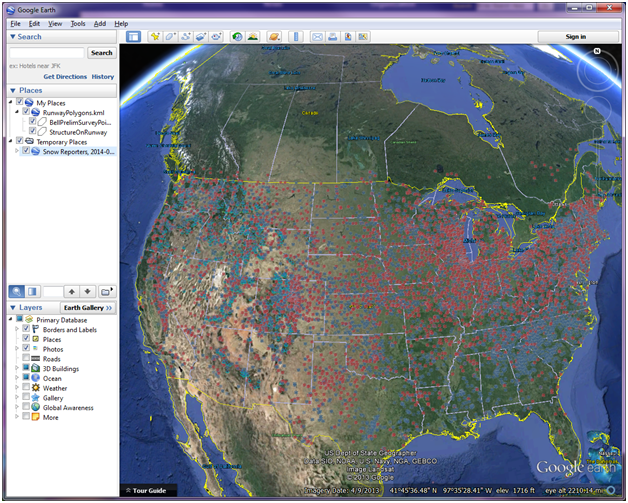
One of my favorite applications is on the National Operational Hydrologic Remote Sensing Center (NOHRS) page on the NOAA site. It combines 3D mapping with additional data layers to paint a picture of snowfall amounts across the US. I expected to see some oblong shapes over the Western mountains and along the Northeast similar to the shape of the jet stream pictures we see every day on the news. Instead, I was shocked to find that there has been measurable snow in every state of the continental US in the past few days!

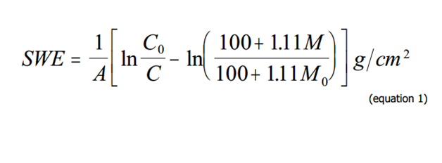
With all the recent snowfall, another obvious remote sensing application that came to mind was spring flooding, using airborne surveys for flood forecast modeling. NOAA does a great job creating such models and compiling relevant data that are based on Snow Water Equivalent(SWE) and soil moisture contents as measured by the NOAA Airborne Snow Survey Program. A detailed user guide outlining steps that go into this modeling is published on the site, and by page 2 you will hit some heavy-duty math.

But if you read on, you might agree that there are some pretty interesting factors that go into flood modeling, and remote sensing has a very well suited role.
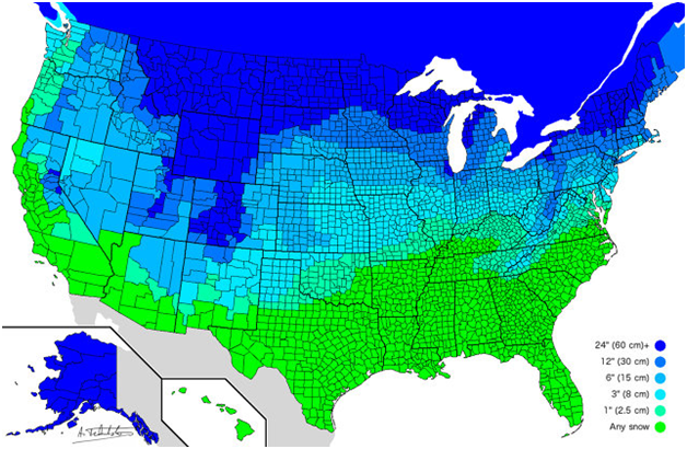
Perhaps on a lighter note, and pretty exciting to pass along to the kiddos ahead of the coming storms is this “How many inches will it take to close my school” map courtesy of Redit editor atrubetskoy:
I would love to hear about the winter-related remote sensing applications you are working on this year!
