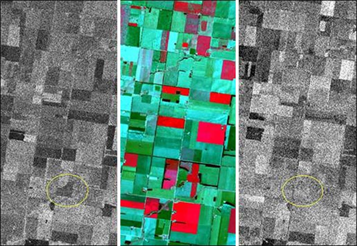
Images were captured of the same location by NovaSAR-1, Sentinel-1, and Sentinel-2. (Left) NovaSAR-1 HH acquired June 20; (Middle) Sentinel-2 June 21; (Right) Sentinel-1 June 15.
NovaSAR-1 was launched in 2018 and is close to being operational. The S-band SAR platform provides medium resolution (6 - 30m) data, which is ideal for applications in the following fields:
- flood monitoring
- agricultural crop assessment
- forest monitoring (temperate and rain forest)
- land-use mapping
- disaster management
- maritime applications
Data from Sentinel-1 and 2 and NovaSAR-1 complement each other well. In the image highlighted to the left, one can see the way that the way NovaSAR-1 C-band and Sentinel-1 S-band interact with ground cover can be quite different for an identical agricultural area.
ENVI® SARscape® and ENVI SARscape Analytics can be used to easily process and analyze just about all SAR data like that from NovaSAR-1 and Sentinel-1. Their automated SAR-based analytical workflows can run at-scale to solve problems across a wide range of disciplines including disaster mitigation and response, urban development and land use, agriculture, change detection, and monitoring across land and sea.