X
1582 Rate this article:
4.8

Rapid Wildfire Mapping in Los Angeles County

JP Metcalf

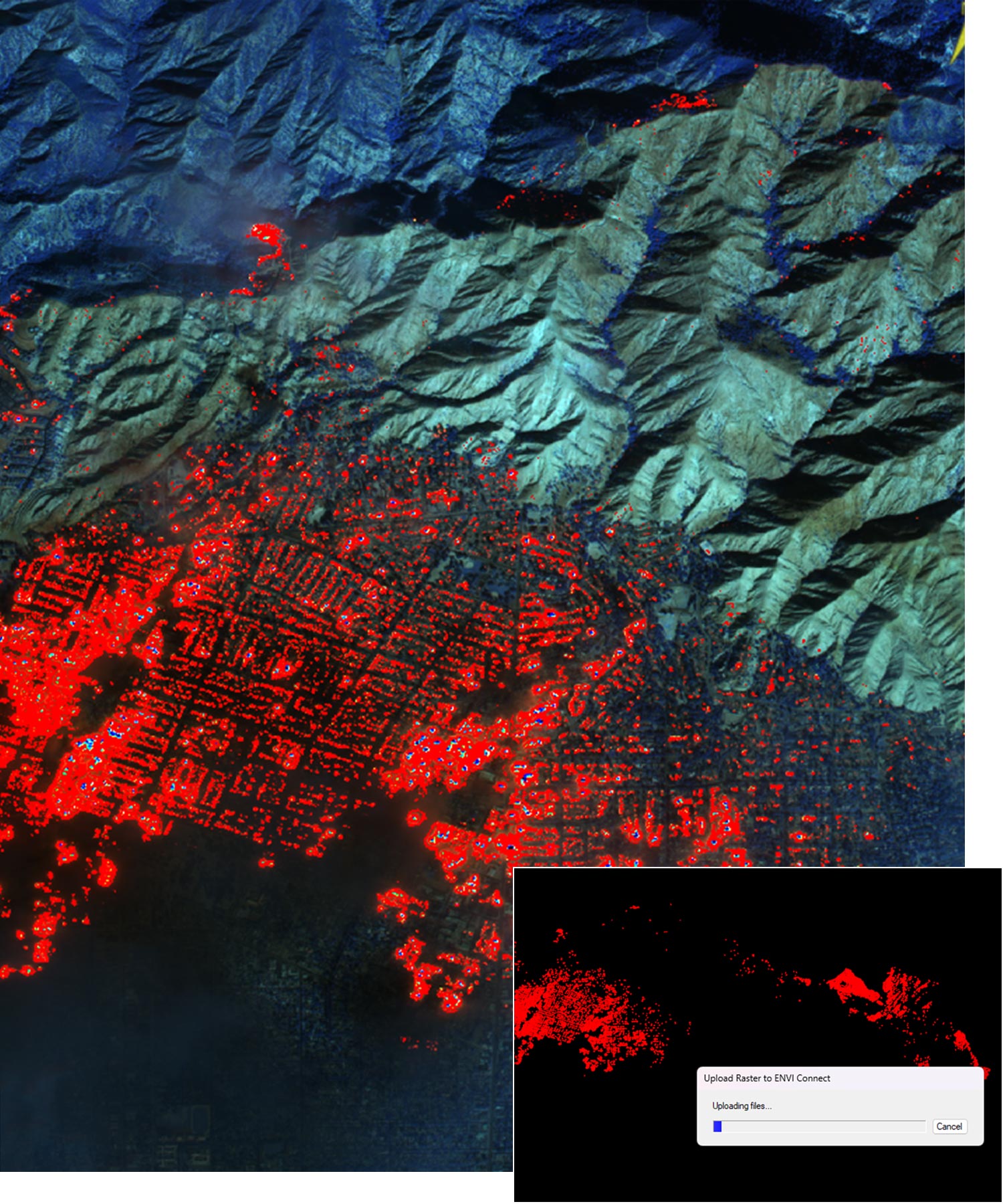
On January 8, WorldView-3 shortwave infrared (SWIR) imagery captured the ongoing devastation of the wildfires in Los Angeles County. The data revealed the extent of the burned areas at the time of the capture, offering critical insights for rapid response and recovery.

To analyze the affected region, we utilized a random forest classification in ENVI® software to identify and delineate the burned zones with precision. Utilizing the powerful machine-learning algorithms in ENVI allowed us to process the imagery efficiently, highlighting the areas impacted by the fire.


The results, shown in the red-highlighted regions, were then pushed to ENVI Connect, a cloud-based platform for geospatial collaboration and mapping.

The integration with ENVI Connect enables responders and analysts to quickly share results, collaborate, and act on the data. This workflow demonstrates the power of combining advanced classification techniques with seamless cloud-based tools to support rapid decision-making in wildfire disaster scenarios.

This case highlights how advanced geospatial technology can bridge the gap between data acquisition and actionable insights. The ability to map wildfire extent rapidly with ENVI and facilitate collaboration through ENVI Connect underscores the importance of geospatial tools in disaster response and recovery.


NV5’s Commitment to Helping Los Angeles

To support the disaster response and recovery efforts in LA, NV5 is currently offering temporary licenses for ENVI® and ENVI SARscape software to those assisting on the front lines. If you or your organization are involved in disaster response efforts in LA, we encourage you to take advantage of this opportunity. For more information about the temporary license or how our solutions or services can assist in disaster response, please contact us.