SAR Data Used to Extract Damage From Beirut Explosion
Amanda O'Connor
On August 4, a huge explosion devastated the port area of Beirut, Lebanon just after 18:00 (3:00pm GMT). The Sentinel-1 sensor operated by the European Space Agency (ESA) captured Synthetic Aperture Radar (SAR) data of the area at 3:45am.
The use of SAR data is increasing around the world due to its many benefits such as the ability to capture data at night, understand moisture content and see through smoke and cloud cover. SAR data is complex and very large so working with it isn’t always easy. SAR use varies throughout the world, but with free and easy Sentinel-1 access, use is growing, and analytics tools make using data from SAR sensors easier. NV5 Geospatial, in close collaboration with partner sarmap SA, have created easy-to-use tools for some of the most common SAR processing applications to democratize the benefits of SAR data to more users.
The above image shows a coherence map created from the Sentinel-1 both before the explosion in Beirut (on the left) and soon after (on the right). Dark areas show stark dissimilarity between the collects. The Sentinel-1 data were collected at 3:45 am, showing the value of collecting in the dark when the event happend late in the day. The Sentinel-1 data was processed using ENVI SARscape Analytics by sarmap sa.
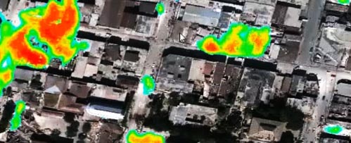
The Sentinel-2 RGB image (on the left) was collected July 24, 2020. The image on the right shows the damage detected superimposed onto the image. Damage could include debris, dust covering objects, structures altered by the explosion. The change detection workflow was run using ENVI SARscape Analytics to detect the coherence and intensity between before and after images of the area where the explosion occurred. This kind of change detection tracks subtle changes in structures and outputs a classification result.
The image on the left (Bilal Hussein/AP) is the port of Beirut following the blast, the image on the right shows the intact storage elevators (not red). The red areas indicate structures altered by the explosion.
The explosion in Beirut shows how SAR sensors and analytics can provide actionable information before smoke has cleared to assess destruction, guide aid and route emergency services, even with clouds or if something like this were to happen at night.
For more about ENVI SARscape, click here. If you would like additional information, please contact us at GeospatialInfo@NV5.com.
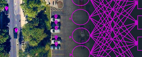
AUTOMATE ANALYTICS
Automate analytics with deep learning for fast, accurate results.

RECORDED WEBINAR
See how ENVI Deep Learning is used for environmental, natural resource, and disaster response.
SHORT DEMO VIDEO
Real-time, actionable intelligence to relief organizations.