Helios Proves To Be a Force Multiplier
Helios® was originally conceived to provide localized real-time weather information to detect the occurrence and impact of weather on road conditions along highways. By leveraging the Closed-Circuit TV network for highway traffic management and applying advanced analytics and machine learning to those feeds, Helios can detect and verify when roads are wet, snow covered, icy, and even provide alerts for fog conditions among others.
Overtime, Helios’ “eyes-on-the-ground” capabilities have also been used to help improve weather forecast and road models. The ability to detect ground truth fills the gaps that both satellite and radar miss (just because radar shows green, does not necessarily mean precipitation is hitting the ground). By providing on-the-ground-weather condition verification, Helios helps meteorologists fine-tune their algorithms to improve the accuracy of their weather forecasts.
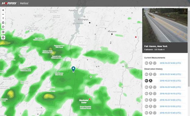
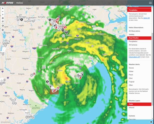
Fig 1. In this graphic, Helios analytics camera shows roads are in fact dry while radar shows rain.
Last month, during Hurricane Florence, Helios proved again to be useful in other ways beyond those two use cases above. Thousands of citizens, and hundreds of Departments of Transportation (DOT) staff, emergency personnel, news organizations, big retail stores and others signed up to access Helios at no cost for the duration of the storm and its aftermath. We know that emergency and rescue personnel do best when they have actual verifiable intelligence about the locations they’re responding to. During Florence, DOTs, first responders and police benefitted from accessing the Helios’ camera network to validate and identify roads that were flooded so they could properly re-route traffic and emergency personnel avoid these roads when deploying emergency vehicles.
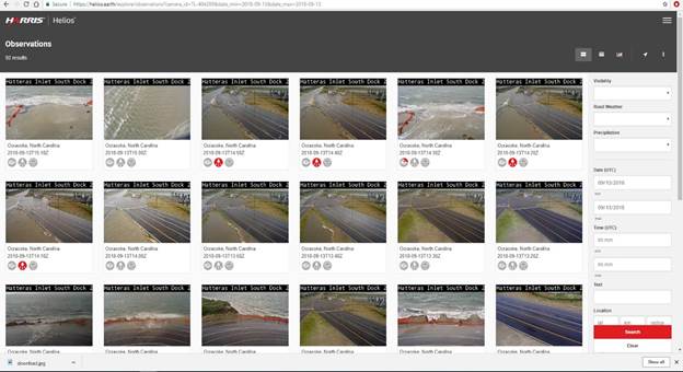
Fig 2. Helios extensive camera network and deep machine learning capabilities can automatically flag hazardous road conditions, such as storm surge and/or pooling water, to improve the efficiency and effectiveness of DOT response or to send alerts to drivers of this dangerous condition. Furthermore, it can document as the storm progresses for additional situational awareness.
As the 2018 winter season begins, Helios will again assist DOTs and all those organizations involved in securing safe navigation for those tasked with the free movement of freight. Helios can be used to track winter storms and enhance situational awareness by providing a second set of eyes on the ground to provide verification of weather impact on our roads.
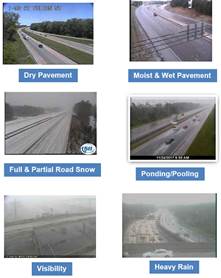
Fig 3. Helios instantly analyzes any set of persistent cameras and provides the current state of the weather and its impact on the ground.
Helios has become a force multiplier by providing a set of new perspectives on the weather with detailed verification of the unfolding impacts on the ground. If you’re interested in learning more, watch this webinar – Avoid Dangerous Road Conditions with Hyperlocal Weather Info.