The Half-Century Mark for a Milestone in Aerial Reconnaissance
The SR-71 Strategic Reconnaissance Aircraft Set the Bar High a Long Time Ago
Anonym
Little noted during the holiday season was the passing of the 50th anniversary of the first flight (on December 22, 1964) of the remarkable Lockheed SR-71, the fastest air-breathing manned aircraft in history. It's almost hard to conceive of how advanced and ahead of its time the "Blackbird" was, especially considering that it has already been sixteen years since NASA retired the last one from the flight line.
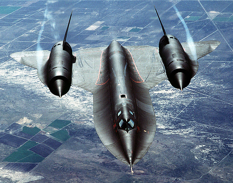
Photo: U.S. Air Force photo by Tech. Sgt. Michael Haggerty/Public Domain
During the 1950s, Lockheed's famous Skunk Works had developed the high-flying but relatively slow U-2 to perform reconnaissance missions for the Central Intelligence Agency. After a U-2 piloted by Francis Gary Powers was shot down over the Soviet Union in 1960, the CIA returned to Lockheed and renowned aircraft designer Kelly Johnson with a request to come up with something that would be effectively invulnerable to the weapons of the era. After a relatively short period of time, the innovative A-12 had been developed. It would go on to provide the conceptual design basis for the SR-71.
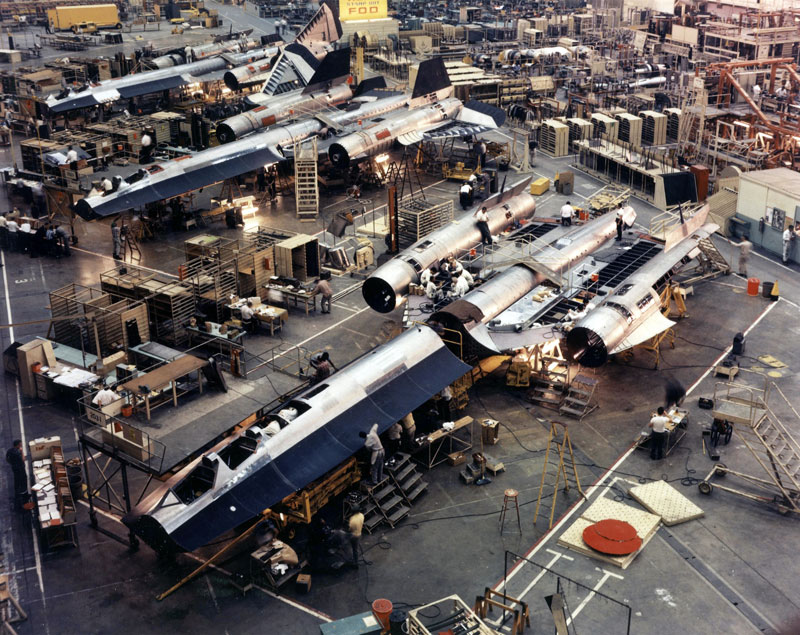
SR-71 Assembly line at the Skunk Works Photo: CIA/Public Domain
Capable of velocity in excess of three times the speed of sound and cruising at altitudes greater than 85,000 feet, the SR-71 was operated in service between 1966 and 1998 by the United States Air Force to perform a strategic reconnaissance role, and between 1992 and 1999 by NASA as a high-altitude research platform. It was flown by a flight crew of two seated in tandem cockpits, with the pilot forward and the "Reconnaissance Systems Officer" monitoring and operating the sensor and electronic systems from the rear cockpit. The vehicle carried electronic countermeasures and implemented early attempts at stealth design to minimize its radar cross-section and evade interception, but its principle defense was simply the high speed and cruising altitude that it operated at. Many times it accelerated away from Surface-to-Air Missiles (SAMs) that had been fired at it. No SR-71 was ever shot down.
All sensors carried by the SR-71 were located either in the nose or in bays housed within the fuselage side elements known as chines. The nose section was detachable in order that the vehicle could be quickly equipped with any one of several noses: an Optical Bar Camera, a nose containing either a Goodyear or Loral ground mapping radar, or an Advanced Synthetic Aperture Radar (ASARS I). Originally the chine bays housed the Operational Objective Cameras made by Hycon. These cameras had a 13-inch focal length and used 9x9 inch film. The OOCs were replaced in the early 1970s the Technical Objective Cameras, manufactured by the Itek Corporation with focal lengths of 36, 48, and eventually 66 inches. The chine bays also housed a number of SIGINT recorders to capture the electronic signature of search radars and SAM systems as it flew overhead.
NASA recognized the value of the SR-71 as a testbed vehicle for high speed, high altitude aeronautical research. Operating from a base at NASA's Dryden Flight Research Center, the aircraft could provide ideal environmental characteristics for a variety of research and experimentation in a variety of areas including aerodynamics, thermal protection, propulsion and atmospheric disciplines. NASA flew a series of flights using the SR-71 as a science camera platform, for example using an upward-looking ultraviolet sensor loaded into the nose bay to observe a number of celestial objects in the UV spectrum unavailable to ground-based systems.
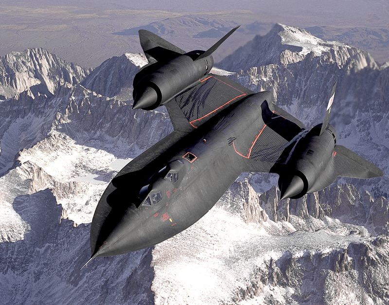
Photo: Judson Brohmer/USAF - NASA Website/Public Domain
The SR-71 had expensive operating costs, and all of the remaining aircraft have long been retired and dispersed to different museums. Modern reconnaissance satellites carry much of the strategic reconnaissance load formerly shouldered by the SR-71, but the orbital characteristics of most satellites do not provide the flexibility to perform urgent reconnaissance tasks within short time windows. We now live in an age in which the use of unmanned aerial drones is exploding, especially in the area of reconnaissance. However, there may come a day when we see a true successor to this superlative airplane. Whatever form that may take, it's hard to imagine anything after fifty years in retrospect representing as big of a leap forward as the Blackbird does today.