UAS & the New Frontier into Commercial Airspace
Anonym
Unmanned Aircraft Systems (UAS) technology is certainly nothing new when considering the applications around the world. In fact, in a recent article published in UAS News, "Senators question FAA about faster drone regulation" that very point is driven home citing the 20+ years of commercial UAS applications around the globe. Yamaha Motor of Japan is highlighted as an example of using UAS technology in precision agriculture to achieve an 1100% efficiency increase in crop fertilization. Couple that with the projected $82 billion the industry will bring to commercial markets in the next several years, and we have the makings for a very powerful story which has my full attention.
While it is well known that UAS technologies have been part of US military and research operations for some time, it was only very recently that the FAA announced six selected test sites around the country which will be instrumental to bring unmanned aircraft applications into US commercial airspace. The key initial directives for these sites include six research areas that focus on safety, logistics, and environmental impact assessments. Once standards are procedures are established and restrictions on commercial operations are lifted – I am eager to participate in implementing software solutions that go along with exploiting UAS payloads to derive information products that solve interesting problems. I feel very lucky to have a front-row seat to witness and participate as these projects unfold.
A few of the projects that have caught my eye are:
 Delair-Tech UAV will be the first to fly over New York
 Bordeaux Classified Vineyards Invest in UAS Technology
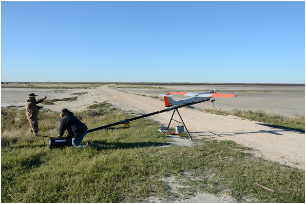 Texas A&M-Corpus Christi blazes path for commercial drones
Are you working in the UAS sector? I’d love to hear your goals and learn from your experiences!