NV5 Geospatial provides the tools to ingest SAR data, which can be quite complex, and extract information like where the land surface slumped and where the debris accumulated. Our Japanese team was able to do just this using PALSAR data from JAXA, the Japanese Space Agency. The data consisted of pre and post event scenes to measure and determine the areas that lost land and where that debris ended up. This type of information is critical for recovery and rescue efforts to understand the impact to infrastructure (i.e. roads and buildings) and the environment (i.e. dammed rivers and future landslide risk areas). The PALSAR-2 images below have been overlaid on an aerial image and highlight the changes that have occurred. Red areas indicate the areas where there was a loss of land and blue areas indicate an increase.
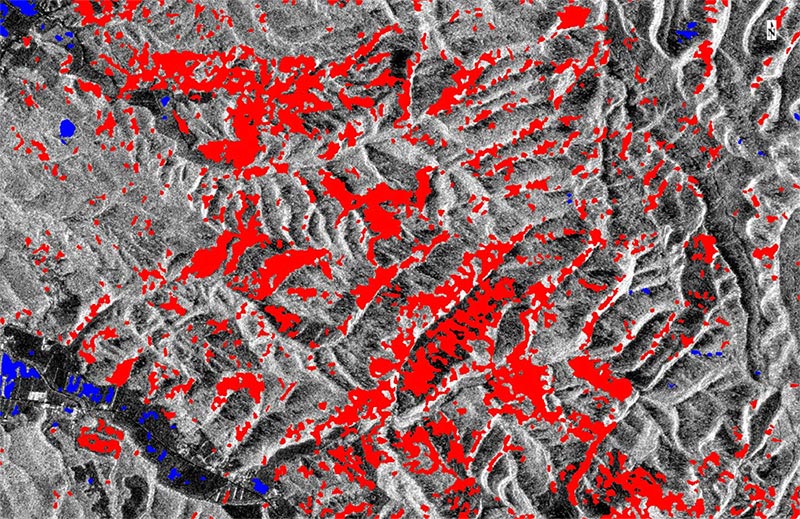
PALSAR-2: Image courtesy of JAXA
If you are interested in learning more about SAR data and processing, watch our on-demand webinar on this topic or take our free, self-paced trainings, Introduction to ENVI SARscape Analytics and ENVI SARscape Analytics for ArcGIS. In addition, we are trying to get some example models built with the ENVI Modeler up on our GitHub page that work well with popular SAR data sources.
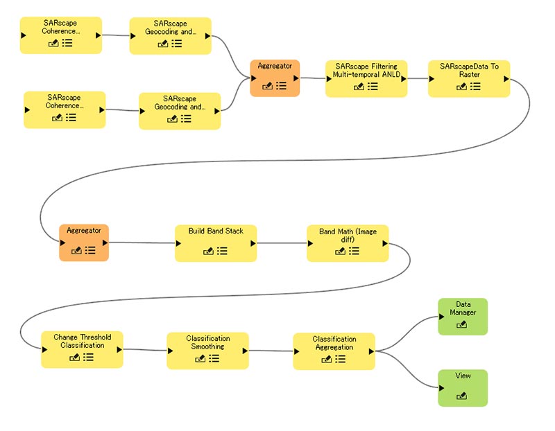
This SAR workflow, quickly created with ENVI Modeler, is used for generating a coherence map and performing change detection to extract the locations where there was change from the earthquake.
In the U.S., the SAR conversation needs to start. For too long SAR has been “around” but not a viable piece of the remote sensing solution because it can be difficult to use. With our new SARscape workflows and upcoming community models, it’s easier than ever for SAR to be a component of your critical decision-making. Get in touch with us and let’s explore how your organization can utilize SAR.