Co-seismic Deformation Quantified Following Greek Earthquake Using ENVI® SARscape®
An earthquake struck Boeotia (an area in central Greece) on December 2, 2020, at 10:54 (GMT). The earthquake had a 4.0 local Magnitude [ML] and a low focal depth (about 6 km). The earthquake was felt in the Greek capital city of Athens located 40km from the epicenter.
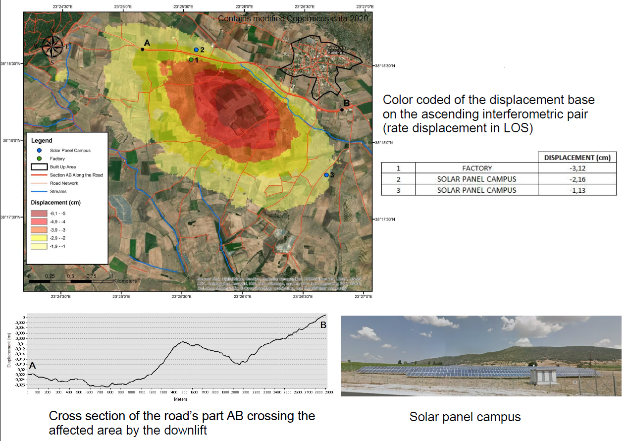
Following the earthquake, a team of scientists led by Professor Issaak Paracharidis from the Harokopio University of Athens set out to research and capture surface deformation caused by the earthquake in the Thiva area. This area contains a solar panel campus, as well as a factory. Professor Paracharidis and his team used sets of dual-polarized SAR satellite data and Differential Synthetic Aperture Radar Interferometry (DInSAR) techniques.
Differential Interferometric Analysis
The team acquired two pairs of Sentinel-1 SAR data on VV polarization in both ascending and descending geometries. The first dataset was captured prior to the earthquake on November 11, 2020, and the second was captured following the earthquake on December 12, 2020. The SAR datasets were analysed with DInSAR methods using the Phase processing toolbox in ENVI® SARscape® to generate line-of-sight (LOS) displacements maps. The vertical and horizontal deformation was calculated through the Displacement Decomposition tool.
The following products were generated:
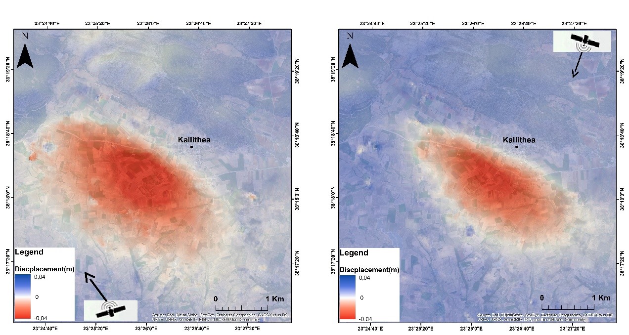
- Two geocoded displacement maps in LOS
- Displacement component along the east-west direction
- Displacement component along the vertical direction
These remote sensing products were then exported and visualized in a GIS environment to provide further context.
Understanding ground deformation
The displacement maps based on two pairs of Sentinel-1 SLC images revealed the following surface deformation over the area of interest.
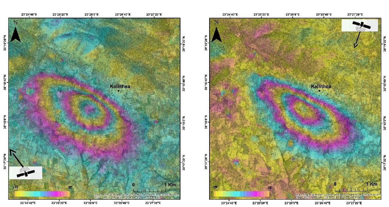
The pattern of deformation is evident in the two wrapped interferograms (in ascending and descending geometry) with two fringes and an interferometric phase that has the same characteristics (positive sign).
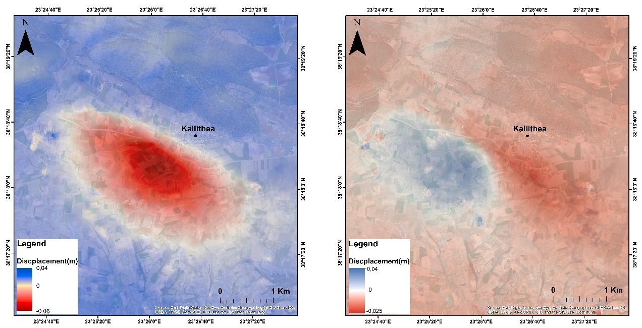
The displacements maps and the displacement decomposition detail reveal that the main component of the displacement was vertical (subsidence) of about 6 cm with a minor east-west component (3.2 cm eastwards and 2.2 cm westwards).
Moreover, the study has detected specific displacement measurements at the factory and solar panel campus locations and has identified subsidence of a road section crossing the area.
ENVI SARscape allows users to easily process and analyze SAR data for applications like surface deformation mapping or time-series monitoring, while providing the option to integrate this information with other geospatial products. Click here for more information on ENVI SARscape.