What’s New in SARscape® 5.4.1
The newest release of SARscape – version 5.4.1 – introduces some algorithmic
improvements and new features. The key features among the new enhancements are:
- Improvement of Sentinel-1 auxiliary downloader
- Sentinel-1 GRD import improvement
- Sentinel-1 Focusing
- DeGrandi filtering improvement
- Improvement of import AIS
- GAOFEN-3 preliminary support
- Automatic ALOS Global Digital Surface Model "ALOS World 3D - 30m" (AW3D30)
extraction and mosaicking
- Decomposition of ascending and descending velocities/displacements/displacement timeseries along the horizontal and vertical directions
- PS cluster product available on request (new license needed)
- Series file generated for some time series products
- Automatic stretch during the loading image
- The SARscapeBatch and SARscape ENVI Task script automatically created from a SARscape Batch file
- New tab on the preferences for user account credential (Scihub Sentinel / AW3D30)
SENTINEL-1
Sentinel-1 GRD import improvement:
- If a geographic polygon shapefile (lat/lon coordinates) is provided in the optional
files tab, only the input files intersecting or included in this polygon will be
imported.
- Automatic mosaic of consecutive acquisitions. If in the input list there are some
consecutive acquisitions (along the same relative orbit), the imported data will be
automatically mosaicked.
Download tool for Sentinel-1 auxiliary files, allowing to populate or update the local
repository, including aux_ins and aux_cal other than orbit files and populate the
repository with these files (used in sentinel-1 focusing).
Focusing of Sentinel-1 raw data (level 0). The focused products can be used for
interferometric analyses only. Users must be aware the products focused using this tool
cannot be combine with focused products coming from different sources.
GENERAL
Series file generated for some time series products:
- If a geographic polygon shapefile (lat/lon coordinates) is provided in the optional
files tab, only the input files intersecting or included in this polygon will be
imported.
- Automatic mosaic of consecutive acquisitions. If in the input list there are some
consecutive acquisitions (along the same relative orbit), the imported data will be
automatically mosaicked.
Automatic stretch of data during the loading of the image to optimise the visualisation.
Some more stretching visualisation options have been added (default stretch in the envi
header file ‘.hdr’).
New tab on the preferences for user account credential (Scihub Sentinel / AW3D30).
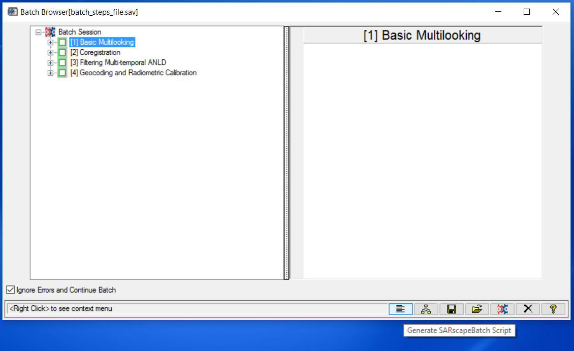
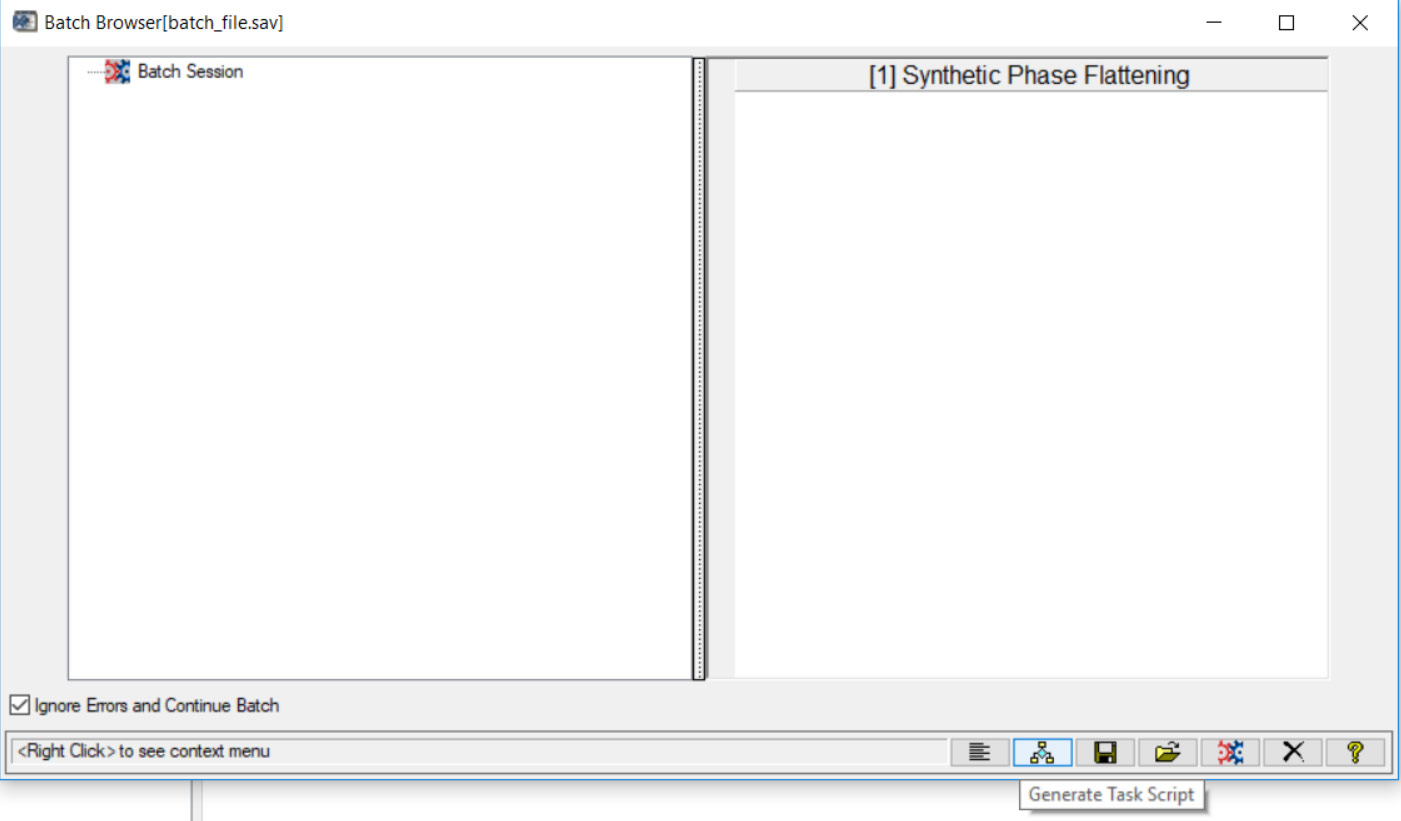
Automatic SARscapeBatch or SARscape Task script generation starting from a SARscape
batch. Batch Browser has two new button: “Generate SARscapeBatch script” and
“Generate Task Script”.
The SARscape ENVI Task documentation has been added with a script example for any
Task object.
IMPORT
GAOFEN-3 preliminary support (only SM Stripmap Slant Range Single and Full
Polarization).
Improvement of import AIS supporting also CSV format.
GENERAL TOOLS
It is now possible to extract ALOS Global Digital Surface Model "ALOS World 3D - 30m"
(AW3D30).Users need to register at the following link:
http://www.eorc.jaxa.jp/ALOS/en/aw3d30/registration.htm
BASIC MODULE
DeGrandi filtering use Frost or Gamma two step filter.
INTERFEROMETRY MODULE - INTERFEROMETRIC TOOLS
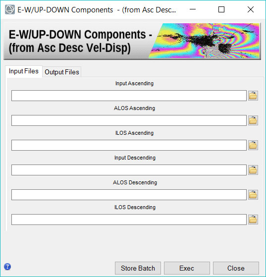
New tool to combine ascending and descending displacement measures to re-project
them along the vertical and east-west directions:
- velocities (SBAS and PS only for raster)
- displacements (DInSAR)
- geocoded time series displacement (SBAS and PS only for raster)
INTERFEROMETRIC STACKING MODULE
PS Cluster (available for SARscape Cluster product).
END OF LIFE (EOL) ANNOUNCEMENT
With SARscape 5.4, the focusing module for ENVISAT WS and ENVISAT AP reached endof-
life. This module will no longer be available starting from the next SARscape
(sub-)release.
KNOWN ISSUES
The following list contains minor issues that are known and will be solved in
forthcoming SARscape versions:
- In some circumstances, a longitudinal shift between a geocoded SLC and a
geocoded GRD in Sentinel-1 data can be seen (in the order of 10 m).
- ScanSAR interferometry with PALSAR2 scanSAR in burst mode is not supported.