Advanced LiDAR Analysis Improves City Infrastructure Management
Anonym

Cities all over the world share an interest in infrastructure management. The rising cost of maintaining ever growing networks of roads, bridges, utility lines, and other infrastructure often results in pieces of it remaining in disrepair due to lack of funding. In the future, municipalities will look to advanced geospatial analytics to reduce the financial and resource costs associated with monitoring and maintaining such a large infrastructure network.
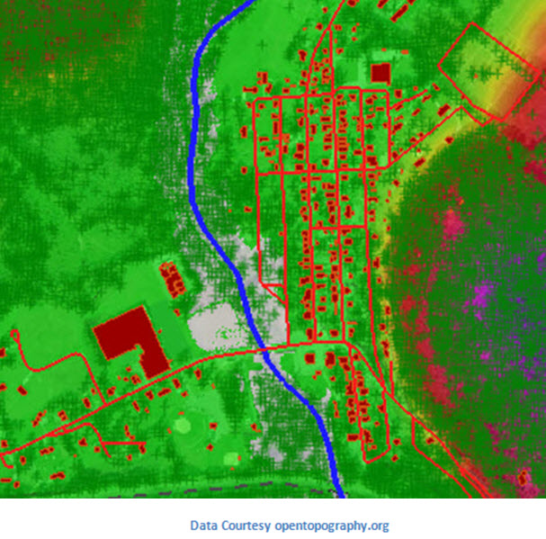
Geographic Information Systems have been used historically to map the extent of city infrastructure, however this practice can be static in nature. While it may capture an accurate representation of the current state of things, it still requires people going out to check assets and manually identify infrastructure in need of repair. Many current GIS practices don’t go far enough to reduce the impact of monitoring and maintenance activities on a monetary level.
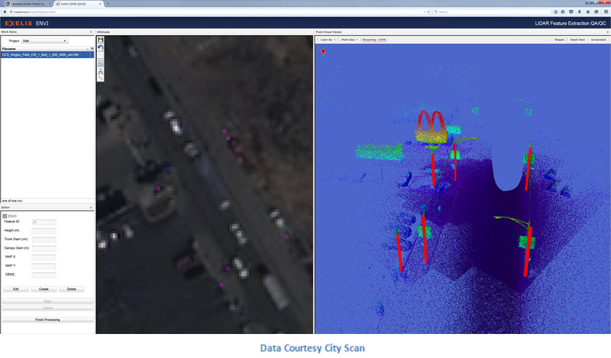
Improved data accuracies and analysis techniques, combined with a reduction in the cost of collection, have made it possible to conduct infrastructure management more efficiently, effectively reducing the time and resources needed to identify pieces of infrastructure that need repair. As an example, ground based LiDAR can now be used to identify power poles and to calculate a number of different important attributes that are helpful for municipalities trying to track their poles.
Automated routines are used to identify power pole features from the point cloud by recognizing certain characteristics that are representative of that feature. A viewer then displays the subsetted point cloud, along with the ability to rotate the pole, zoom into it, or to show only the feature itself and not the ground points. The graph on the right shows the height and width of the feature. The viewer also displays relevant attribute information for the feature, including the pole’s height and the overall tilt of the pole.
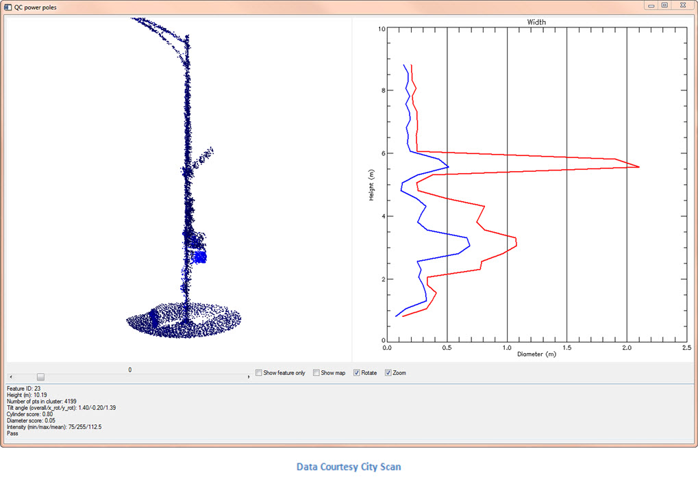
This information is automatically generated by the routine,and provides valuable information to city utility crews that need to assess which poles need repair because they are leaning too far to one side. The user can then click through the identified features and see the resulting metadata. This information can also be used to generate a shapefile of the pole which can be displayed in three dimensions. These shapes can then be plotted to create a heat map of an area with poles identified that might need repair.
This is just one example of how advances in geospatial analysis can decrease the cost of monitoring city infrastructure. Geospatial analytics can also be used to track utility assets, identify potholes, determine bridges that need repair, and more. Contact us for more information on how we can design custom solutions for you or your municipality to better track your city’s infrastructure.