Extending your ENVI Analytic Capabilities for UAV Imagery
Anonym
As 2016 is off to the races, one of the many exciting happenings at NV5 Geospatial is the recent partnership with Icaros Geospatial and the addition of an Icaros OneButton™ Extension in ENVI. With over 1 million hobby drones sold during the holiday season, those capable of flying drones and the presence of UAS/UAV acquired data will only become more prevalent in the upcoming years. What that means for those providing analytic tools to make actionable information from the data is we need to find a way to work with the data and get accurate results. This is where Icaros comes into play.
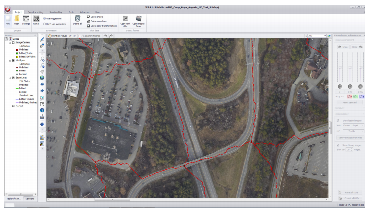
Icaros allows a user to do a variety of processing to their data sets including photogrammetric geocorrection, aerial triangulation, digital terrain modeling, and the key piece — orthomosaic production. They have options that range from "one button" where you simply click and run the processing to "one button pro" where you have more manual options to ensure accuracy and where you can do additional QC like replacing a bad scene from the mosaic. These capabilities bridge the gap between acquiring UAS/UAV data and actually being able to run analytics and provide answers in a timely fashion. On the other end of the spectrum, ENVI is able to bring not only post processing analytics, but tackle one of the huge problems facing UAS/UAV acquired data, data integrity from sensors and the ability to pre process the data and ensure bands are aligned before it is ingested in Icaros.

With the partnering of ENVI, you have an end-to-end solution for working with UAS/UAV acquired data. You have the ability to verify that data lines up and pre process if needed, easily ingest and stitch large swaths of data using Icaros One button, and then ingest the data into ENVI and work with it as you would satellite imagery.