GEOINT means exciting technology
Anonym
Beau Leeger, Manager of US Sales and Services at NV5 (formerly Exelis VIS), is guest blogging today about exciting technology that will be on display next week at GEOINT.
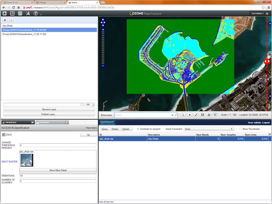
In just five days, GEOINT 2013* begins. The re-scheduling the 2013 edition of my favorite conference allowed for us to extend our cloud based, on-demand geospatial offerings with some potentially game-changing technology. For several years now, I have watched the development and excitement around the Ozone Widget Framework (OWF). To my delight, this technology was released to the general public in early 2013. We immediately went to work on using this flexible "widget" based technology to host components for on-demand geospatial data exploitation. The resulting client stack includes widgets for accessing catalogs and performing advanced geospatial exploitation using ENVI-powered tools. There is even a widget that allows for web-based viewing of point-clouds from LiDAR. Within the framework, a user can interactively build a dashboard that hosts a functional geospatial exploitation application that runs and accesses data within the cloud. The power to for anyone to build web-based, cloud-powered geospatial exploitation tools is now within reach.

I am most excited about the possibilities when these tools are hosted in a flexible, interconnected framework. The design intent of OWF was to bring the source of information from various agencies and contributors together to get a more complete view of a problem or situation. This original goal is now extended into the geospatial realm. The ability to bring all relevant data sources and exploitation together to solve difficult geospatial problems is within reach. Image scientists and researchers will have a framework to develop tools that can interoperate with tools developed by others. Analysts will be able to deploy these tools shortly after development to solve pressing time-critical problems. The future of cloud-powered, web/mobile-based geospatial exploitation is suddenly much brighter.
What do you think about this exciting development? Experience this with us at GEOINT and let us know how it fits into your visions and aspirations for the future of geospatial exploitation.