Position And Navigation Under The Heavens Is All Just A Matter Of Time
From Magellan's voyage to GPS, measuring time and relative distance tells you where you are
Anonym
I just finished re-reading a book about Magellan's historic accomplishments. Almost 500 years ago exactly, Magellan's voyage of discovery effectively illuminated for the first time the gloom that had obscured a valid understanding of world geography. Having spent so much of my life involved in issues of geospatial information technology, I couldn't help but note that many of the challenges that Magellan faced were directly due to the limitations of navigation at the time. The same basic question that confronted the famous explorer must also be answered today when traveling: where am I? Today we know first to ask, what time is it?
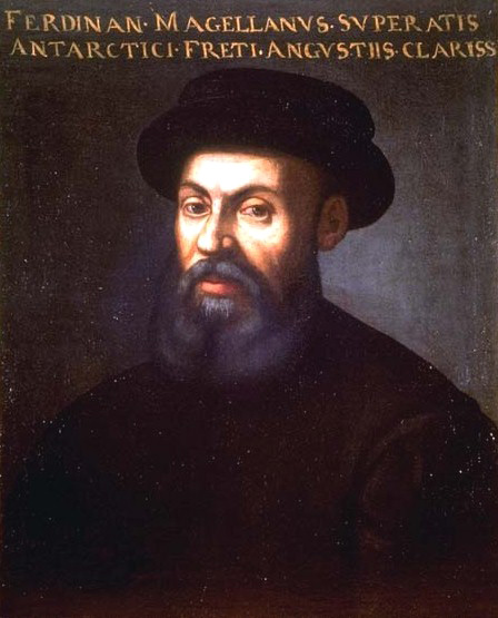
Ferdinand Magellan. The legend reads "Ferdinand Magellan, you overcame the famous, narrow, southern straits." Public Domain
It had long been known that the planet is spherical in shape. The ancient Greek geographer Eratosthenes even calculated the circumference of the Earth with remarkable accuracy around 240 BC. But Europeans at the dawn of the Age of Discovery labored under a staggering assortment of misconceptions and myths as to the geography of the world that they desired to explore. The three continents known to antiquity were seen as being surrounded by water – the Ocean Sea. The southern hemisphere much beyond the equator had only recently begun to be explored. Columbus had studied the writing of Eratosthenes on the size of the globe, but believed that the circumference of the Earth was far smaller than it actually is. In attempting to reach the east by sailing west and circumnavigating the world, Columbus remained forever confused about the actual location of the lands he encountered in what would come to be called the Americas.
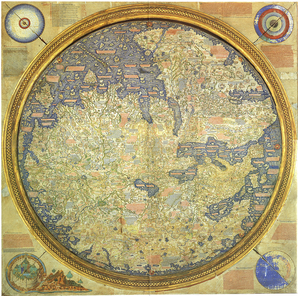
Fra Mauro map, c. 1450. Medieval Europeans lacked knowledge of world geography. Public Domain
Two and a half decades after Columbus sailed to the "Indies", Magellan desired to accomplish what his predecessor had failed to do: reach east Asia (and its rich wealth of spices) by sailing west. In order to do this, he knew he would first have to discover and then successfully navigate through a straight that was assumed to exist at some southern latitude and extend through the South America land mass, connecting the Atlantic with the ocean on its western shores, which we now know as the Pacific. Before he could even encounter this fabled straight, he would be sailing off the edge of any map in existence, truly into the unknown. From that point on, he would be, in effect, writing the map that would describe these portions of the previously unknown world. How could he have known where he was going? How did he even know where he was?
Navigators of that era had reasonably good methods for knowing their latitude, or how far north or south from poles they were, using instruments like an astrolabe to "shoot" the position of some heavenly body as it passes through the line connecting south and north (the meridian). It was common to measure the inclination of the sun at noon each day. The difficulty lay in determining how far east or west of any given meridian they were, termed "the problem of longitude". The only navigational technique available was "dead reckoning", the process of estimating one's position based on known or estimated speeds over elapsed time and course from a previously determined fixed position. Time was kept by religiously monitoring and turning over sand-filled hourglasses, and the speed of a vessel was estimated based on the number of knots in a rope that would pass the stern of the ship after a log that it was tied to had been thrown overboard. Such a method is greatly prone to cumulative error and is inappropriate for transoceanic voyages, but it was the only method available to sailors in Magellan's time.
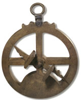
Mariner's astrolabe in Maritime Museum, Lisbon. Public Domain
As we know, Magellan succeeded in finding and navigating the eponymous straight that was the only available sea route between the Atlantic and the Pacific prior to the Panama Canal. The expedition thought that they were sure to be in Asia soon, for the true size of the Earth was still being greatly underestimated, as it had been by Columbus. In fact, if they had realized just how vast the Pacific Ocean is, they never would have attempted to cross it with the vessels and provisions available. They managed to survive the journey (barely), and although Magellan died in the islands that would become known as the Philippines, one of the five ships and some 22 survivors of the crew (out of around 250 that had left) eventually limped back to Spain. After three years and a voyage of some 60,000 miles, these were the first men in history to literally sail around the globe.
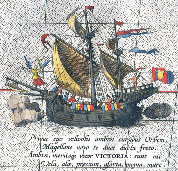
Magellan's flagship Victoria was the only ship to complete the voyage. Public Domain
Having tracked and kept meticulous logs of their voyage, the men were astounding to discover that they had somehow 'lost' a day in the course of their journey. What they thought was a Sunday was actually Monday. They had no concept of an International Date Line, and were the first to experience this temporal effect of circling the planet.
It's that element of time that is fundamental to the answer of navigation and position. Since the Earth rotates at a steady rate of 15 degrees per hour, there is a direct relationship between time and longitude. The problem of longitude was eventually solved by building mechanical timepieces that could be carried on a ship to maintain accurate time at a reference meridian. With that, the relative longitude to that line (say, passing through Greenwich) can be calculated using the measured position of the sun.
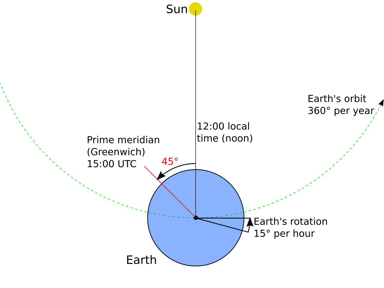
The longitude relative to a position can be determined by the position of the sun - if you know the time! Image by Duff06, CC0 1.0
Today nobody needs to wonder where they are. Like those ancient mariners, we can rely on a constellation of heavenly bodies to fix our position, but those "stars" are satellites that emit radio signals. Like the navigator of one of Magellan's ships, your GPS receiver makes measurements regarding the location of these celestial objects in order to determine your position. But while sixteenth century mariners used sand through an hourglass to measure the passage of time, today every GPS satellite broadcasts its own meticulously kept time signal, based on a very stable atomic clock that it carries on board. Synchronized with each other and to even more accurate master atomic clocks on the ground, GPS satellites keep time accurate to almost 10 nanoseconds. Such precision is astounding to contemplate, but it's what enables GPS positioning to be so accurate. Also worthy of contemplation is that every time we use GPS, we are practicing essentially the same art that Magellan relied on in his quest to sail to the Spice Islands.
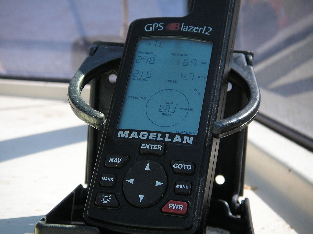
A civilian GPS receiver in a marine application. Photo by Nachoman-au, CC BY-SA 3.0