Situational Awareness from Past to Present
As we celebrated Independence Day last month, the National Day of the United States, and as I reflect on the conflicts from the 18th century to present day, there have been considerable advancements in collecting information providing intelligence and situational awareness, where knowledge of the enemy is critical.
There have been significant technological advances in every conflict starting from the American Revolution to present day. Personally, I find the evolution of tactics, techniques, and technology throughout the centuries fascinating. The following is a very high-level timeline providing a glimpse of methods to collect and analyze meaningful information to weave the story, draw conclusions and take necessary actions with an emphasis on aerial reconnaissance.
During the American Revolution, examining intercepted mail was a means of gaining knowledge of the enemy, disseminating propaganda and misinformation along with spy rings using codes and ciphers to share gathered intelligence.
The Civil War had Union code breakers decoding Confederate messages and simple visual reconnaissance from a tethered balloon gathering tactical intelligence of troop movements and regiment size for both sides. The view from one thousand feet above provided military commanders with a platform to see for miles around and generate maps depicting the battlefield. The first wartime air-to-ground communications took place with electronic transmission of information sent from a balloon linked to the telegraph, directly to President Lincoln on the ground. Two innovations that would continue as tools of intelligence gathering during this period are wiretapping and overhead reconnaissance.
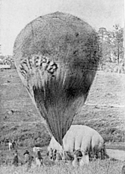
Photo courtesy of Wikipedia Union Army Balloon Corps: Intrepid being cross-inflated from Constitution at Fair Oaks, Virginia. The balloon Intrepid, one of six to eventually be constructed by Thaddeus Lowe and the Union Army Balloon Corps.
During World War I, there was the interception of telegrams, aerial reconnaissance and photography from airplanes. Versions of standard fighters and bombers were equipped with cameras for aerial reconnaissance. It was during WWI when air photo interpretation was first developed, and the support of ground forces was nearly the only role of reconnaissance. It was during this period that the demonstration of increasing sophistication of imagery interpretation and exploitation techniques aimed at intelligence and cartography, such as the production of mosaic maps creating a broad view of the enemy’s trench network. Interpreters used stereoscopes looking for visual clues that might denote changes in the enemy’s position such as soil displacement or shadows identifying trenches, embankments, artillery batteries and troop movements.
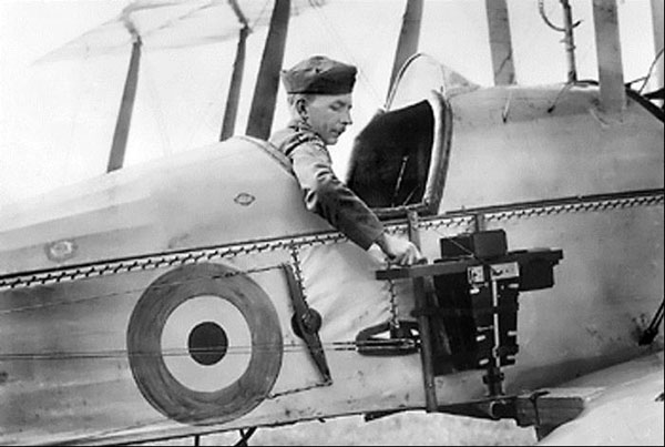
Photo courtesy of Wikipedia Aerial_reconnaissance: An aerial reconnaissance camera of 1916 as operated by a British pilot of a B.E.2c
During World War II, aerial reconnaissance matured with collection and air photo interpretation becoming a considerable enterprise and playing a significant role for Allied victories. British and American reconnaissance aircraft were adapted combat aircraft having long range and high speed combined with the ability to fly at high altitude. They were unarmed to maximize performance while emphasizing the purpose of bringing back pictures without engaging the enemy. Analysis of photos took place at the Allied Central Interpretation Unit (ACIU) at Medmenham, with over 1,700 personnel. Photographs provided solid evidence quickly. Film could be developed, printed and interpreted within hours of a reconnaissance sortie. Photo interpreters used a stereoscope, enabling them to see in three dimensions to expose details they would not have seen otherwise. This allowed them to accurately select their targets and assess damage after bombing raids. Aerial photography and analysis played a crucial role in Allied bombing raids of the German rocket program helping to ensure the success of the D-Day landings and its eventual victory. Nighttime photo reconnaissance utilizing a high-powered flash was a significant American contribution to air intelligence providing critical intelligence about enemy strengths and troop movements.
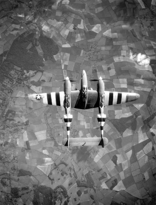
Photo courtesy of Wikipedia Aerial reconnaissance: A photo-reconnaissance Lockheed F-5 (P-38) Lightning, circa June 1944, shown marked with invasion stripes to help Allied troops identify it as an Allied plane.
During the period of the Cold War, there was the development of highly specialized and strategic high-flying reconnaissance aircraft to operate at altitudes well above air defenses (for the era), such as Lockheed’s U-2 and its successor, the SR-71 Blackbird. It is still going strong, outlasting its successor and has been in operation since 1955. The U-2 provided the evidence of Soviet missiles in Cuba in 1962, helping to avert a nuclear confrontation.
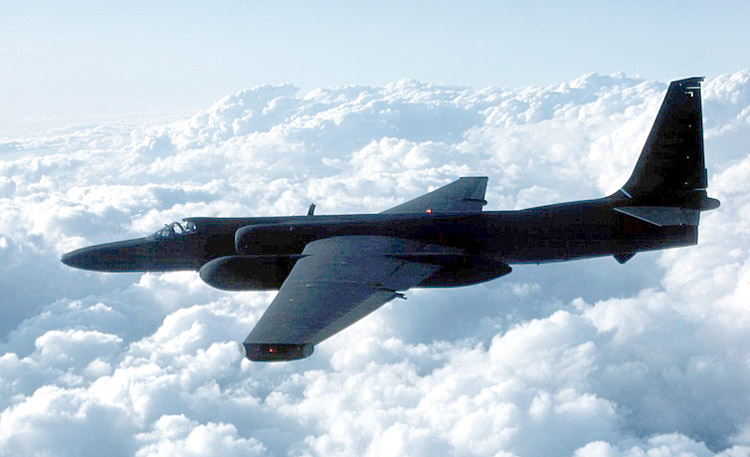
Photo courtesy of Wikipedia Lockheed_U-2: TR-1 in-flight (A third production batch of U-2R aircraft built for high-altitude tactical reconnaissance missions)
Today, the U-2, upgraded given it greater reconnaissance and threat-detection, continues to gather and provide intelligence supporting a number of operations with its ability to direct flights to missions at short notice.
During the Cold War, there was the production and operation of strategic reconnaissance satellites. Advantages of satellite photographs is that they are available 365 days of the year with frequent revisit times, can capture large area footprints decreasing the need for creation of image mosaics, they can easily access remote or restricted areas, including hostile territory without putting pilots at risk of being shot down. The cons of satellite surveillance compared to aircraft are cost, the inability of quick placement over the target and lower resolution photographs.
These days we hear a lot about unmanned intelligence, surveillance and reconnaissance (ISR) platforms, providing situational awareness and information. Technological advances in communications allow for remote control of the vehicle and relaying data back over high-bandwidth data links in real time. An advantage of the unmanned aerial vehicle (UAV) is longer endurance flights at both high and low altitudes. Advanced sensors and full motion video have increased awareness and the information provided in near real-time; unlike the aerial information gathered in previous decades requiring development and analysis once the platform has landed.
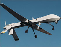
Photo Courtesy of PBS.org: General Atomics Aeronautical Systems RQ-1 Predator.
Unmanned aerial systems have played a significant role in aerial ISR this past decade. Rapid advances in geospatial intelligence software and technology will continue, as they always do, and this leads me to believe that we will hear much more about activity-based intelligence (ABI) and automated processing to handle greater data volumes.