Where in the World Am I?
Anonym
When analyzing satellite or airborne imagery, we often know the general location of our study area. But we may not know exactly where a particular image is located, relative to nearby cities or geographic features (oceans, mountain ranges, etc.) This article will provide some tips for finding your way around in ENVI that you may not have been aware of.
Here is an example. At first glance, you probably wouldn't know where this image was located:
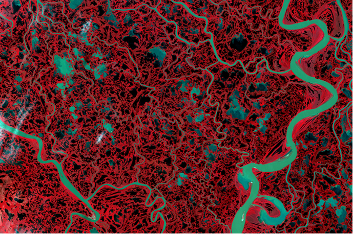
Landsat 8 color-infrared composite, acquired from USGS EarthExplorer. Data available from the U.S. Geological Survey.
Landsat images are georeferenced to a standard map projection, so you can display geographic coordinates in the ENVI status bar as you explore the image. The status bar is located along the bottom of the ENVI application. Right-click in any segment of the Status bar and select Lat/Lon Decimal Degrees.
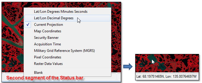
The Cursor Value tool offers a similar method. From the geographic coordinates, you can see that the image is at a high latitude (68ºN). The image reveals geomorphic features that are common in coastal floodplains such as braided river networks and thousands of melt ponds and lakes.
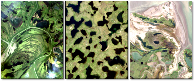
True-color snapshots of various floodplain features from the Landsat 8 image
Still, this is not enough information to tell where the image is located. Enter the Reference Map Link tool.
This handy feature is located under the Views menu, or you can use the Alt+M keyboard shortcut to start it. The underlying technology and base maps were developed by Esri® via their ArcGIS API for Javascript. The Reference Map Link dialog displays a base map with a blue dot that corresponds to the location of the scene center:
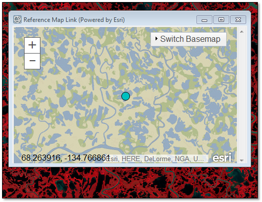
The lower-left corner of the map displays the updated coordinates as you move around the map. Here are some tips for using the Reference Map Link:
- Click the + and - buttons, or use the mouse wheel, to zoom in or out.
- Click and drag to pan around the map.
- Click and drag the lower-right corner of the window to resize it.
- Click the Switch Basemap menu to select a different base map.
- The Reference Map Link is actively linked to the ENVI view. If you change the location in the view, or if you zoom or rotate the image, the map will update to reflect that change.
As you zoom out, a blue border shows the view extent:
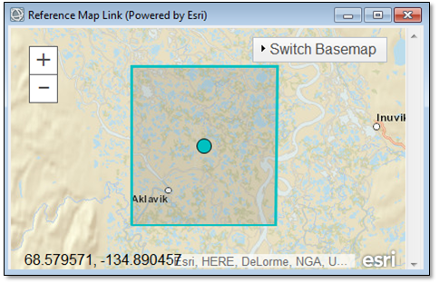
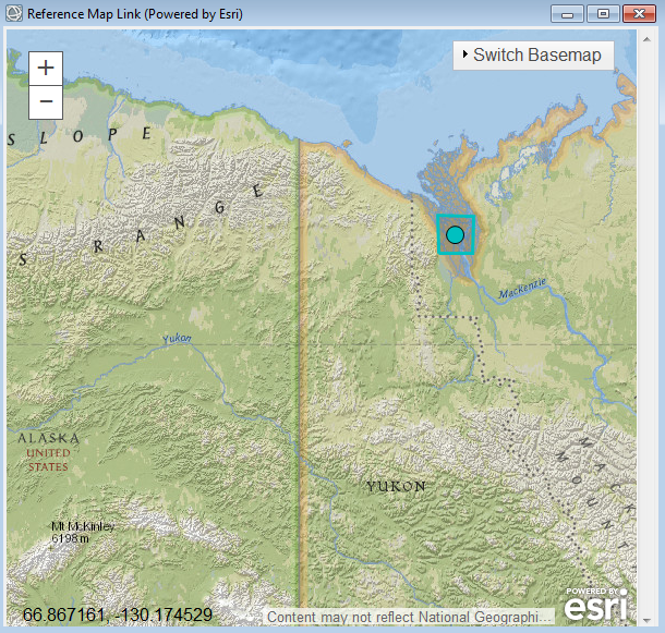
This particular image is located in the Mackenzie River drainage basin, Northwest Territories, Canada. The view extent and scene center are shown in the following figure that uses a National Geographic base map:
The Reference Map Link is the simplest way to determine the geographic location of your imagery. You can also overlay vector coastlines, countries, and provinces on an image using the File > Open World Data menu options. Or, use the menu option File > Chip View to > Google Earth to open the extents of the current image view in Google Earth.
Have fun exploring!