X

NV5 Geospatial Blog

Each month, NV5 Geospatial posts new blog content across a variety of categories. Browse our latest posts below to learn about important geospatial information or use the search bar to find a specific topic or author. Stay informed of the latest blog posts, events, and technologies by joining our email list!


Comparing Amplitude and Coherence Time Series With ICEYE US GTR Data and ENVI SARscape

Comparing Amplitude and Coherence Time Series With ICEYE US GTR Data and ENVI SARscape

12/3/2025

Large commercial SAR satellite constellations have opened a new era for persistent Earth monitoring, giving analysts the ability to move beyond simple two-image comparisons into robust time series analysis. By acquiring SAR data with near-identical geometry every 24 hours, Ground Track Repeat (GTR) missions minimize geometric decorrelation,... Read More >

Empowering D&I Analysts to Maximize the Value of SAR

Empowering D&I Analysts to Maximize the Value of SAR

12/1/2025

Defense and intelligence (D&I) analysts rely on high-resolution imagery with frequent revisit times to effectively monitor operational areas. While optical imagery is valuable, it faces limitations from cloud cover, smoke, and in some cases, infrequent revisit times. These challenges can hinder timely and accurate data collection and... Read More >

Easily Share Workflows With the Analytics Repository

Easily Share Workflows With the Analytics Repository

10/27/2025

With the recent release of ENVI® 6.2 and the Analytics Repository, it’s now easier than ever to create and share image processing workflows across your organization. With that in mind, we wrote this blog to: Introduce the Analytics Repository Describe how you can use ENVI’s interactive workflows to... Read More >

Deploy, Share, Repeat: AI Meets the Analytics Repository

Deploy, Share, Repeat: AI Meets the Analytics Repository

10/13/2025

The upcoming release of ENVI® Deep Learning 4.0 makes it easier than ever to import, deploy, and share AI models, including industry-standard ONNX models, using the integrated Analytics Repository. Whether you're building deep learning models in PyTorch, TensorFlow, or using ENVI’s native model creation tools, ENVI... Read More >

Blazing a trail: SaraniaSat-led Team Shapes the Future of Space-Based Analytics

Blazing a trail: SaraniaSat-led Team Shapes the Future of Space-Based Analytics

10/13/2025

On July 24, 2025, a unique international partnership of SaraniaSat, NV5 Geospatial Software, BruhnBruhn Innovation (BBI), Netnod, and Hewlett Packard Enterprise (HPE) achieved something unprecedented: a true demonstration of cloud-native computing onboard the International Space Station (ISS) (Fig. 1). Figure 1. Hewlett... Read More >

1345678910Last
7029 Rate this article:
5.0

ENVI Server in (Almost) 60 Seconds

Abby Lehman


ENVI Server lets you run processing in parallel or in the background and allows you to take advantage of modern hardware. With ENVI Server, you no longer need to wait for ENVI's progress bars to finish before getting to the next step of your workflows. One of the best features about ENVI Server is that it is free to anyone that has access to ENVI 5.6 or newer. There is no additional fee, license, or module that you need to purchase to use ENVI Server.

You can also use ENVI as a client to ENVI Server. Meaning that, any machine with ENVI Server and access to the same data as your local ENVI Session, can accept processing from ENVI. You can use the ENVI Modeler or ENVI dialogs to send processing to ENVI Server. This allows you to keep using ENVI the same way that you always have to easily take advantage of the power of ENVI Server.

Contact Us Today

DISCOVER MORE

The benefits of running analytics at scale

Situational Awareness Webinar

ENTERPRISE SOLUTIONS

On-premises, cloud-based and full-scale enterprise applications
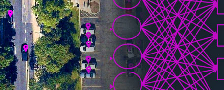
ENVI DEEP LEARNING MODULE

AUTOMATE ANALYTICS

Automate analytics with deep learning for fast, accurate results.

Solve Geospatial Problems with Deep Learning

RECORDED WEBINAR

See how ENVI Deep Learning is used for environmental, natural resource, and disaster response.


Please login or register to post comments.