Looking Back on Mount St. Helens Through the Lens of Landsat Imagery
Anonym
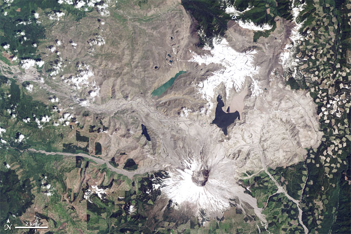
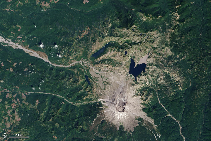
It was with a bit of a thrill that I recently stumbled across these images of Mount St. Helens from 1984 and 2013 at NASA's Earth Observatory site. I grew up in southeastern Washington state, and was 15 years old when Mount St. Helens blew in 1980. I remember noticing the unusual clouds while leaving church with my family that Sunday morning. As we chatted with friends,we eventually realized that something odd was falling from those clouds, and we'd better turn on the news and figure out what was going on. My town didn't get the worst of the ash fall, but schools and businesses closed for days as the ash gently accumulated. A few days after the eruption, I remember sitting on a park bench with my best friend, astonished by how the red of the strawberries we shared seemed to glow in contrast to the ash-gray landscape.
 True color Landsat 5 Thematic Mapper image of Mount St. Helens acquired June 17, 1984. Image courtesy of NASA.
Not much life in the area immediately surrounding the mountain survived that eruption. But it didn't take long for it to return. I hiked Mount St. Helens in 1985, five years later. The abundant pink fireweed was eerily beautiful against the ash that surrounded the visitor center.
I visited Mount St. Helens again about 15 years later, and I could barely recognize the landscape. Our wooded campground was in an area that had been devoid of trees in my earlier visit. The visitor center - while still providing an impressive view of the crater - was now surrounded by vegetation and wildlife. It was hard to fully appreciate the devastation that I'd witnessed myself in 1985.
 True color Landsat 8 OLI image of Mount St. Helens acquired August 21, 2013. Image courtesy of NASA.
If you ever get the chance, I highly recommend a visit to Mount St. Helens National Monument. It has one of the best visitors' centers I've ever seen. I don't know if they have an exhibit with these Landsat images,but I hope they do. As all of us who work with remotely sensed imagery know, the satellite perspective is always one of the most informative and awe-inspiring.