Guardians of the Coast: Ship Monitoring and Coastal Mapping
Authors: Dr. Emilyn Hagen, Rene Gunzkofer: Session A.08.02 Advances in the theory and methodology of SAR Oceanography
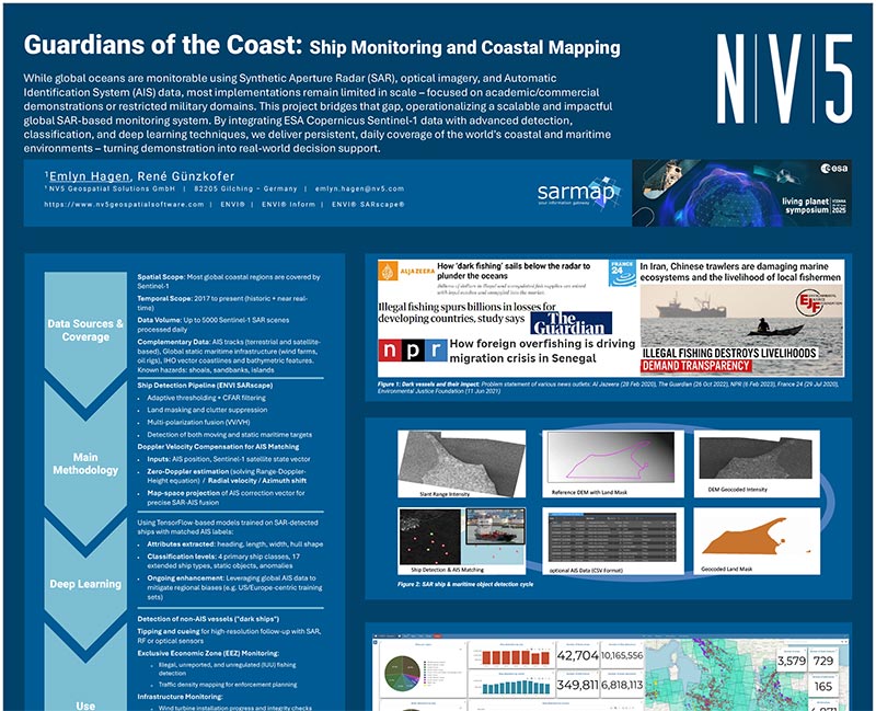
This poster highlights a global SAR-based monitoring system that leverages Copernicus Sentinel-1, advanced detection methods, and deep learning to track vessels, identify “dark fleets”, and map coastal changes for maritime security and environmental management.
View Poster
Unlocking Hidden Treasures from Above by Hyperspectral Imaging Across Scales
Authors: Dr. Thomas Bahr, Dr. Friederike Koerting, Dennis Adamek, Dr. Daniel Schlapfer: Session A.10.01 EO for Mineralogy Geology and Geomorphology
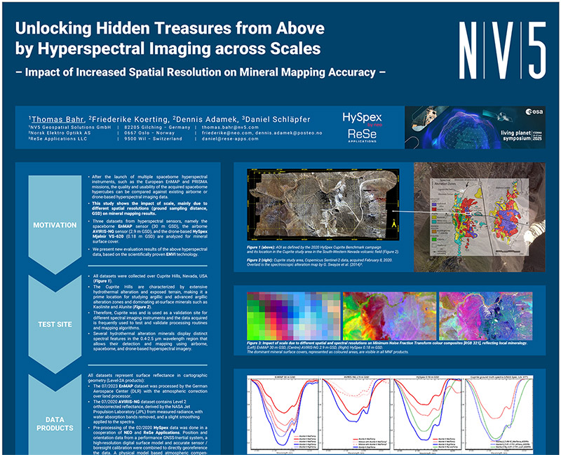
This study explores how spatial resolution, (from satellite to airborne to drone platforms), affect mineral mapping and accuracy. Using ENVI-based workflows, researchers compared EnMAP, AVIRIS-NG, and HySpex data to demonstrate the strengths of hyperspectral imagery for mineral exploration.
View Poster
Precision In Peril: SAR Strategies for Disaster and Emergency Operations
Authors: Nicolai Holzer, James Slater: Session F.05.04 Earth Observation in Governance: Bridging Data and Decision Making
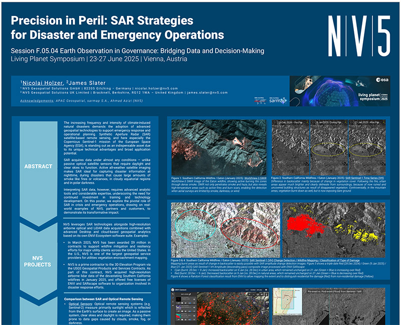
This poster showcases the role of SAR in disaster management, from wildfire damage assessments in California to flood mapping in Spain and cyclone monitoring in Australia. Using ENVI SARscape and ENVI Connect, NV5 demonstrates how SAR delivers situational awareness in all weather and lighting conditions.
View Poster