X

NV5 Geospatial Blog

Each month, NV5 Geospatial posts new blog content across a variety of categories. Browse our latest posts below to learn about important geospatial information or use the search bar to find a specific topic or author. Stay informed of the latest blog posts, events, and technologies by joining our email list!


NV5 at ESA’s Living Planet Symposium 2025

NV5 at ESA’s Living Planet Symposium 2025

9/16/2025

We recently presented three cutting-edge research posters at the ESA Living Planet Symposium 2025 in Vienna, showcasing how NV5 technology and the ENVI® Ecosystem support innovation across ocean monitoring, mineral exploration, and disaster management. Explore each topic below and access the full posters to learn... Read More >

Monitor, Measure & Mitigate: Integrated Solutions for Geohazard Risk

Monitor, Measure & Mitigate: Integrated Solutions for Geohazard Risk

9/8/2025

Geohazards such as slope instability, erosion, settlement, or seepage pose ongoing risks to critical infrastructure. Roads, railways, pipelines, and utility corridors are especially vulnerable to these natural and human-influenced processes, which can evolve silently until sudden failure occurs. Traditional ground surveys provide only periodic... Read More >

Geo Sessions 2025: Geospatial Vision Beyond the Map

Geo Sessions 2025: Geospatial Vision Beyond the Map

8/5/2025

Lidar, SAR, and Spectral: Geospatial Innovation on the Horizon Last year, Geo Sessions brought together over 5,300 registrants from 159 countries, with attendees representing education, government agencies, consulting, and top geospatial companies like Esri, NOAA, Airbus, Planet, and USGS. At this year's Geo Sessions, NV5 is... Read More >

Not All Supernovae Are Created Equal: Rethinking the Universe’s Measuring Tools

Not All Supernovae Are Created Equal: Rethinking the Universe’s Measuring Tools

6/3/2025

Rethinking the Reliability of Type 1a Supernovae   How do astronomers measure the universe? It all starts with distance. From gauging the size of a galaxy to calculating how fast the universe is expanding, measuring cosmic distances is essential to understanding everything in the sky. For nearby stars, astronomers use... Read More >

Using LLMs To Research Remote Sensing Software: Helpful, but Incomplete

Using LLMs To Research Remote Sensing Software: Helpful, but Incomplete

5/26/2025

Whether you’re new to remote sensing or a seasoned expert, there is no doubt that large language models (LLMs) like OpenAI’s ChatGPT or Google’s Gemini can be incredibly useful in many aspects of research. From exploring the electromagnetic spectrum to creating object detection models using the latest deep learning... Read More >

1345678910Last
«September 2025»
SunMonTueWedThuFriSat
31123456
78910111213
14151617181920
21222324252627
2829301234
567891011
20579 Rate this article:
5.0

Change Detection using Airbus WorldDEM™ and Elevation from Optical Imagery

Anonym

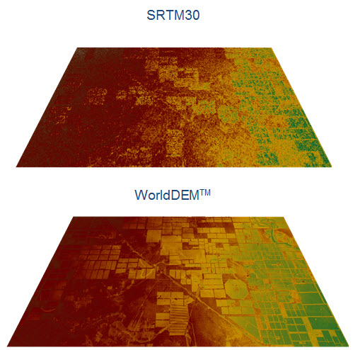
Airbus has recently released their WorldDEM™ product, which is a worldwide elevation product that has a better resolution than freely available elevation sources such as SRTM and GMTED. Accurate elevation information is important to conducting accurate analysis, because low resolution data can cause noise to appear especially when comparing datasets from two different time periods.

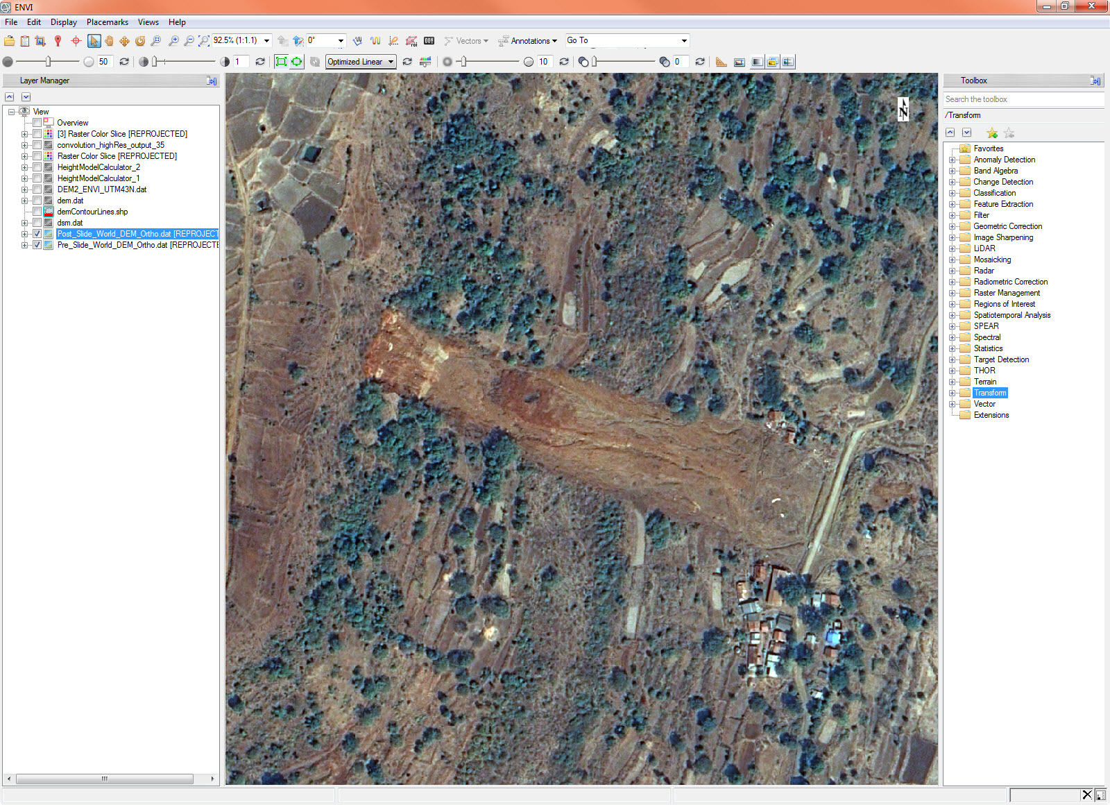
Below is an Airbus image taken after a landslide that occurred in Malin, India in 2014. I was able to retrieve a WorldDEM dataset over the area taken not too long before this landslide occurred.

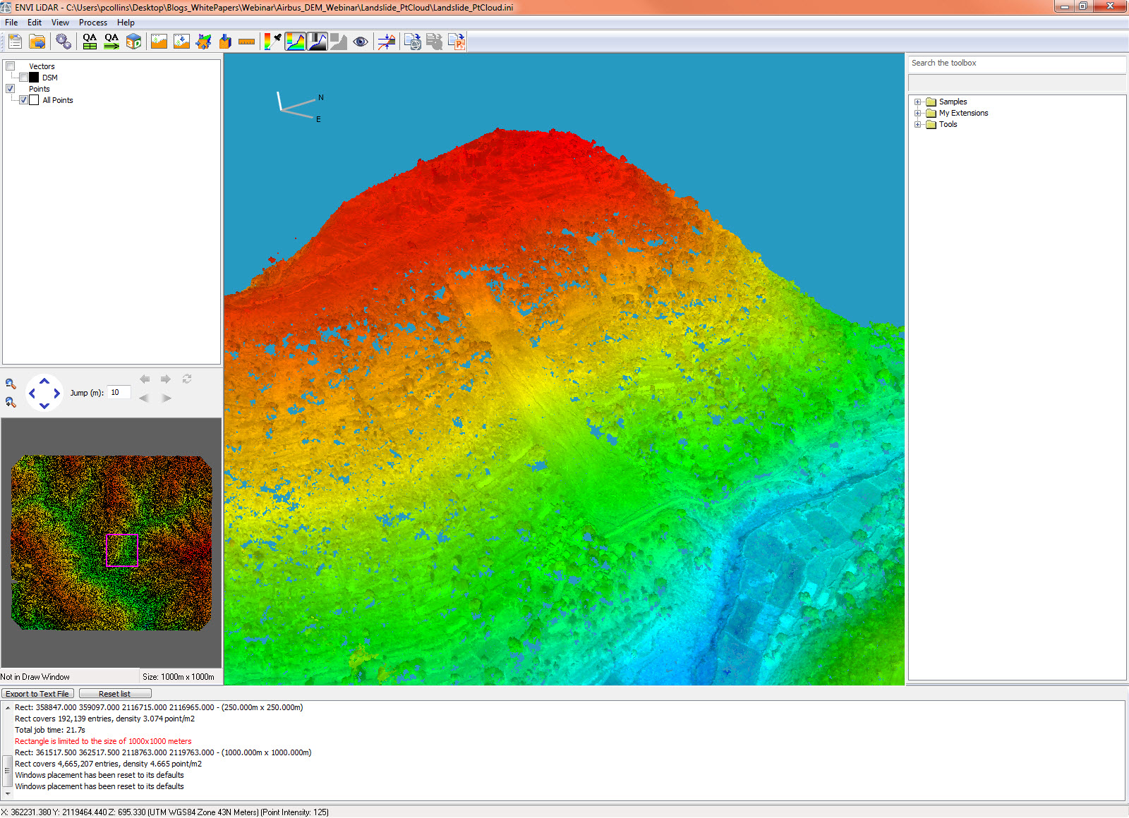
I also ordered two of the post-event images in order to extract a passive point cloud from the two datasets, which would allow me to extract extremely detailed elevation information over the area. This is important because it can be difficult to get information over a remote area that has experienced a disaster or inclement weather. Being able to extract one-to-one elevation information from a high resolution imaging satellite such as Pleiades makes it easy to get accurate information in this type of scenario. Here you can see the extracted point cloud.

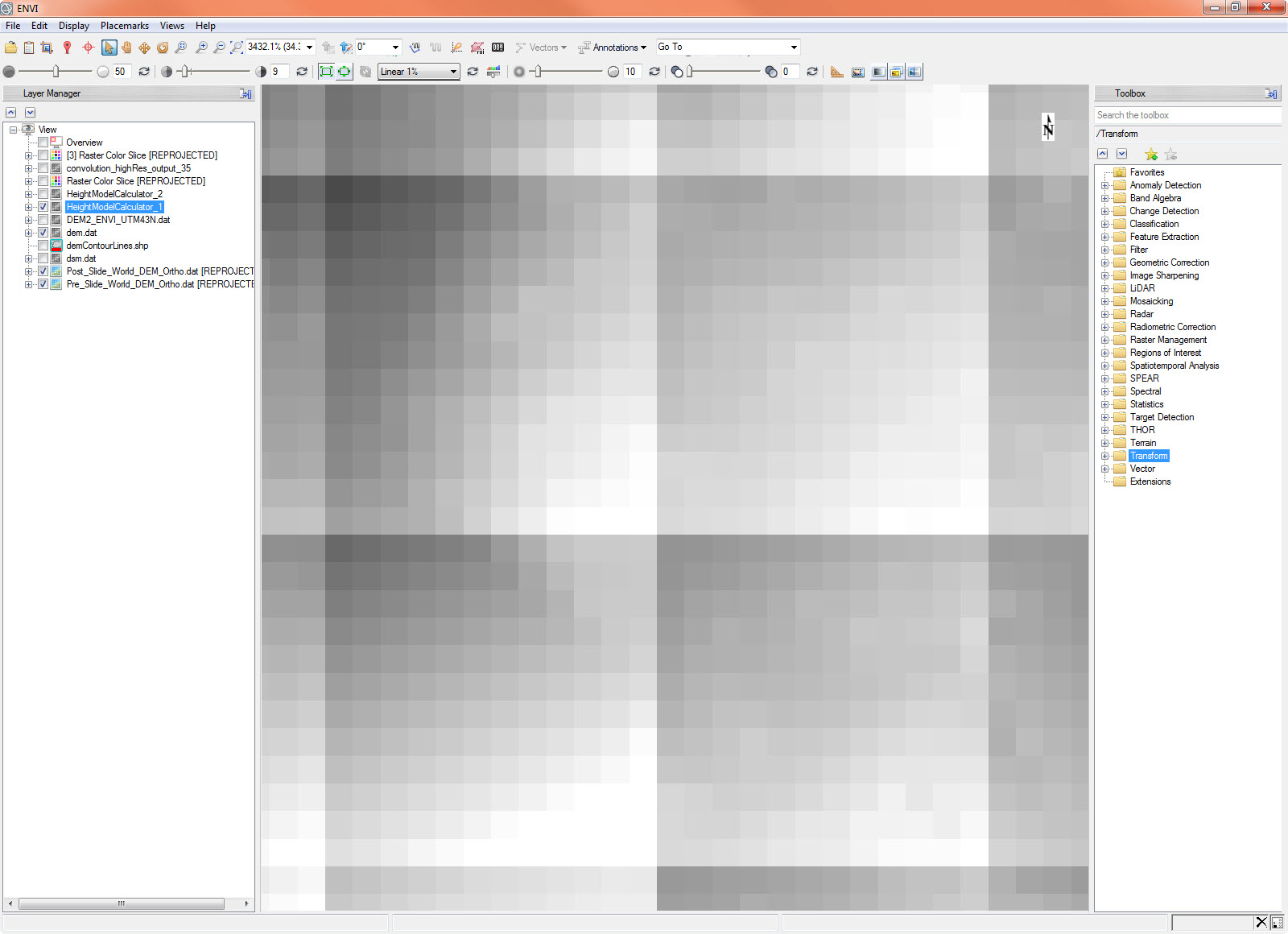
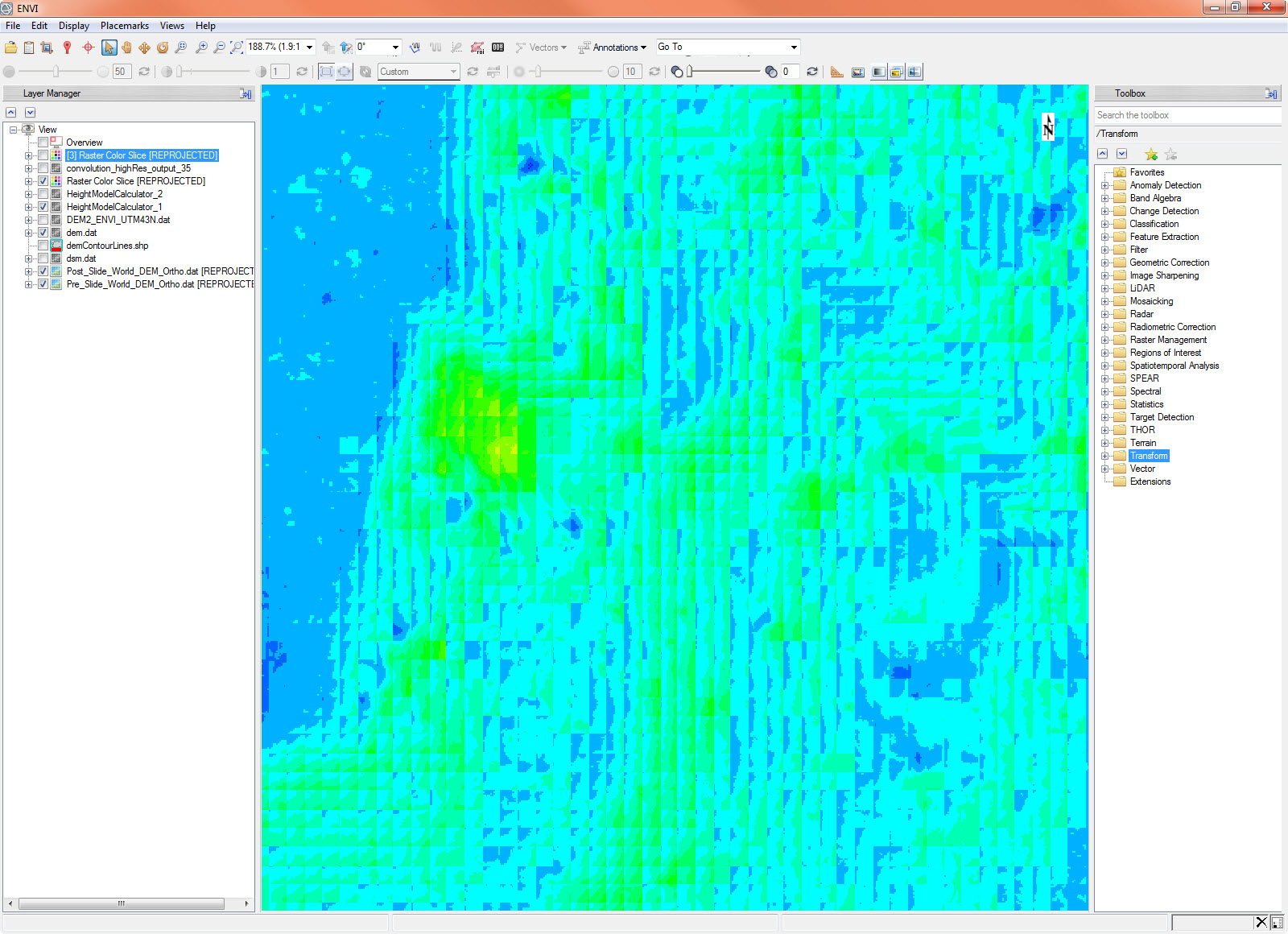
After extracting the Digital Elevation Model from the point cloud, I then subtracted the point-cloud generated DEM from the WorldDEM product to get an elevation change difference over the area. You can see from the image below that the resolution difference between the two elevation datasets has caused some anomalies to appear between the pixel sizes of the lower resolution dataset.

When we look at a color slice of this data we get the following.

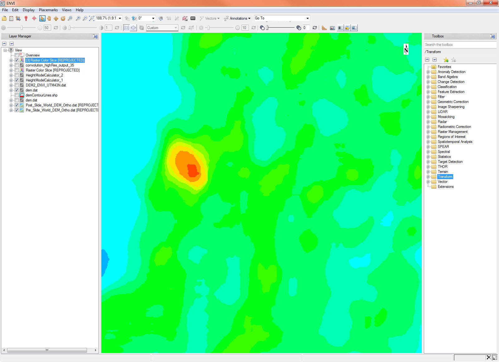
This doesn’t quite give us the accuracy we are looking for with our data, however we can use convolution filtering within ENVI to smooth this dataset into something a little more readable. After running a convolution filter with a thirty-five pixel size we are left with the following image.

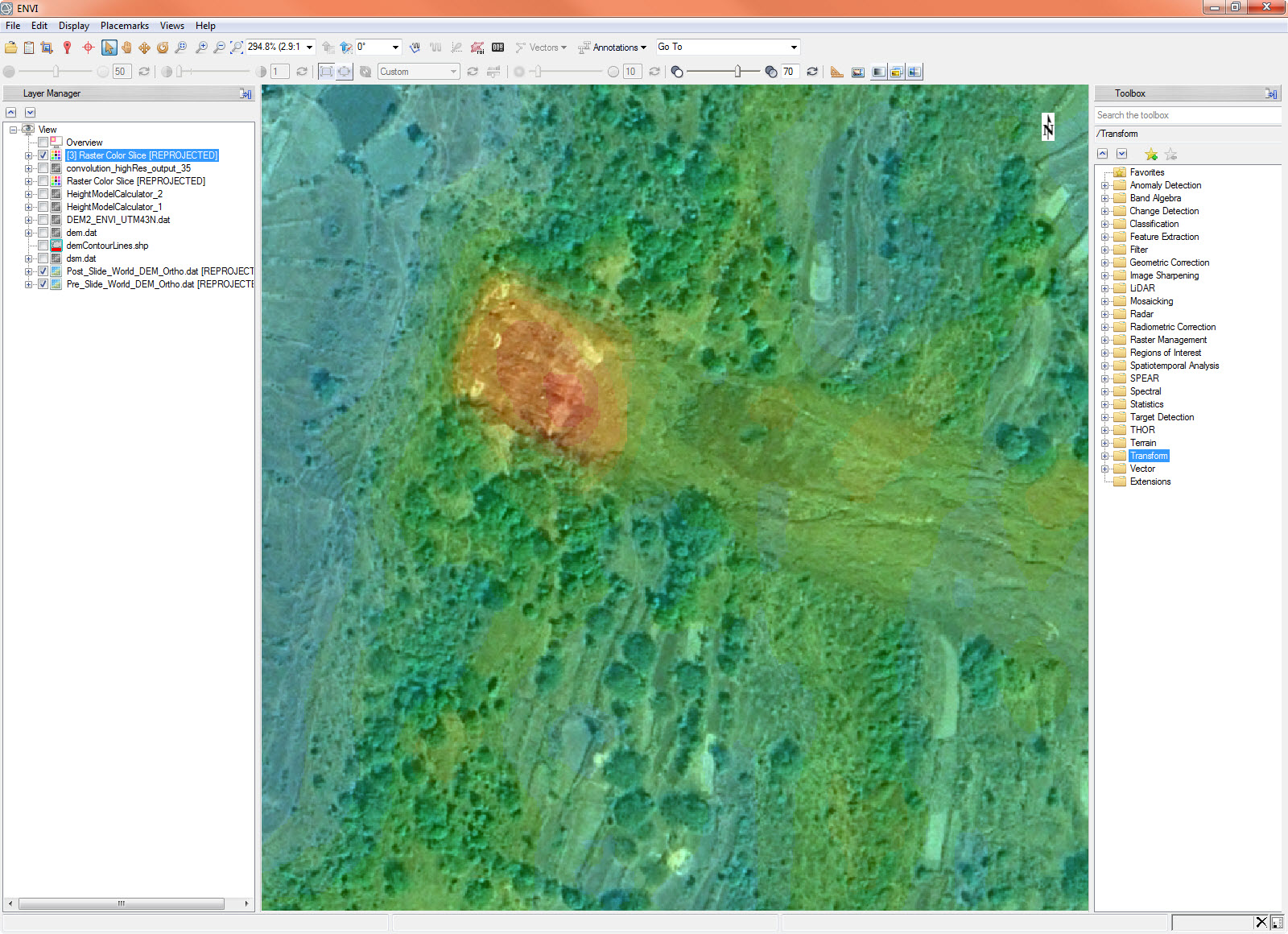
This final image shows how our elevation analysis has clearly captured the location of the landslide within this region. As mentioned before, the ability to capture and analyze extremely accurate elevation data from space allows government and other first responders the ability to quickly get important information about an area, even one that is remote or inaccessible.

For more information on WorldDEM and how high resolution elevation information can increase the accuracy of your analysis results, check out the joint Airbus / NV5 (formerly Harris) webinar, Make Better Geospatial Decisions with Accurate Elevation Information.

Please login or register to post comments.