Detecting Fog to Prevent Delays, Accidents and Injuries on Roads, Ports and Airports
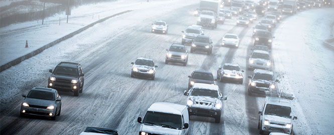
With all the news coverage of extreme weather events like tornadoes, hurricanes and flash flooding, it’s easy to assume that those are the deadliest weather events. However, a deadlier weather event lurks, and that is fog. On average, fog causes more deaths (from traffic accidents) than heat, tornadoes, floods and lightning.
Fog and heavy precipitation create low visibility conditions, which in the case of vehicle traffic, lead to increased speed variance and a greater crash risk. According to the Federal Highway Administration (FHWA), every year, over 38,700 vehicle crashes occur in fog, killing more than 600 people and injuring more than 16,300 people annually. And vehicles aren’t the only mode of transportation affected by fog; there can be significant impact to aviation and marine operations as well.
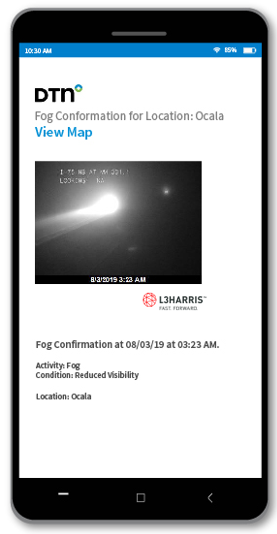
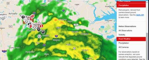
Today, there are many tools for identifying and predicting severe and high-impact meteorological events. However, short-lived weather-phenomena like fog does not lend itself as easily to identification and prediction. EnvisiCast™, a new technology from DTN, enables accurate fog prediction and can be easily implemented to reduce delays and accidents on roadways, ports and on airport runways. EnvisiCast™ produces actionable information using innovative sensor nodes, numerical weather modeling and site-adaptable software algorithms. Furthermore, DTN partnered with NV5 (formerly L3Harris) to bring its Helios® into EnvisiCast™ to produce alerts confirming the occurrence of reduced visibility. This partnership ensures that DTN customers not only get notified of an increased potential for reduced visibility, but will also get confirmation when the event occurs, ensuring they can continue to make decisions based upon the most accurate information available.
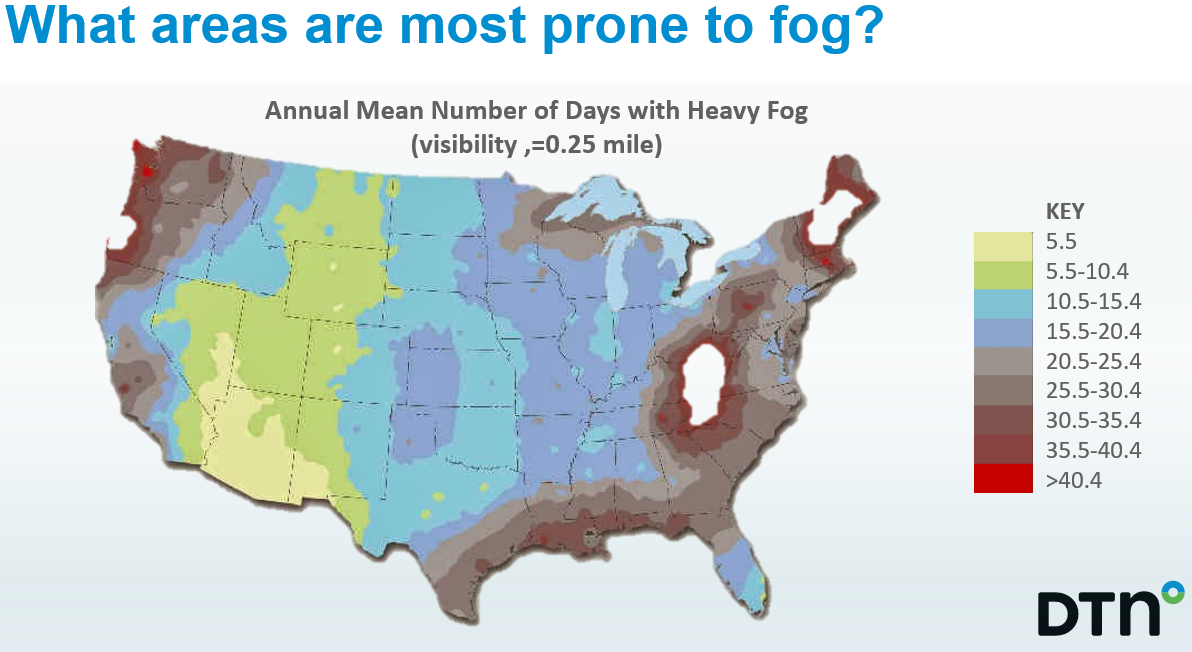
Since fog is essentially a cloud that has formed close to the ground, people assume radar can detect it like other cloud formations. Unfortunately, fog’s location generally makes it difficult for most traditional radars to detect. This is mainly due to the elevation angle of radar beams and the curvature of the earth. At this low altitude, temperature inversions that cause the fog can bend the radar beam back towards the ground, resulting in significant ground clutter. Furthermore, fog can appear and disappear very quickly depending on the humidity and temperature near where it forms.
Fog is also dangerous for aviation operations. Because fog tends to be very localized, it is possible that it can affect one portion of the airfield when another portion can be clear. Fog can move in and out of areas in minutes and reduce visibility significantly. This results in costly flight and schedule delays for both arrivals and departures and can lead to even more costly re-routing during unanticipated events. This same problem is also true for mariners in the open sea as well as it can disrupt port operations.
To find out more about fog detection and the new EnvisiCast™ product, view this informative video or please visit: https://www.dtn.com/weather/transportation/city-and-county-roadways/envisicast/
HELIOS®
Fast and accurate local ground weather intelligence to enable real-time decision making.
BLOG ARTICLE
Helios was used by multiple agencies and businesses during hurricane florence.
RECORDED WEBINAR
Learn how Helios® solves weather challenges.