Integrating LiDAR Analysis into your GIS
Anonym
With the International LiDAR Mapping Forum (ILMF) coming to Denver, I think it’s important to revisit the value that LiDAR brings to the GIS user. According to Wikipedia, Light Detection and Ranging (LiDAR) is an optical remote sensing technology that can measure the distance to, or other properties of, targets by illuminating the target with laser light and analyzing the backscattered light. In the GIS industry, LiDAR can be deployed from ground, airborne, or space-based resources to very accurately measure location and height information of various targets. Although costly, LiDAR has gained ground over the years as a go-to technology for GIS analysts who are in need of extremely accurate height measurements, and can be used for everything from developing elevation models, mapping rooftops, assessing utility right of way, and more.
LiDAR Provides Meaningful Information to your GIS
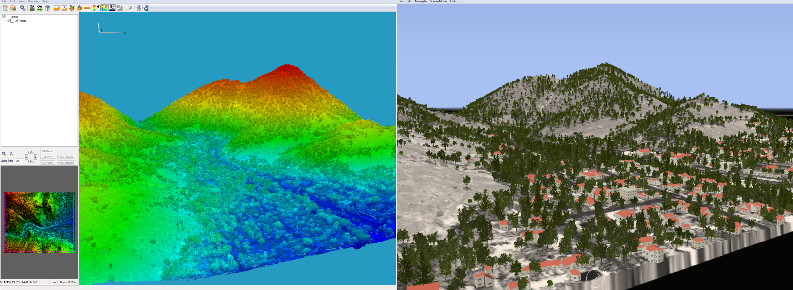
As LiDAR becomes more widely used in the GIS industry, the integration of the information gleaned from LiDAR data into more robust GIS databases is of increasing importance. Many software packages such as ArcGIS® and ENVI have robust LiDAR analysis capabilities to assist in the LiDAR/GIS integration. With its release in Q1 of 2013, ENVI LiDAR allows for automatic extraction of tree, building, building perimeter, power line, and power pole features along with an orthophoto, Digital Elevation Model (DEM), DEM Contours, Digital Surface Model (DSM), and a terrain triangulated irregular network (TIN) directly from your point clouds while providing one-click export of those features and data directly into ENVI or ArcGIS. This is important as it allows the end-user to enhance their two dimensional data and vector layers with three-dimensional information. With ENVI LiDAR, two clicks of a mouse can literally extract all of the above mentioned data and export it directly into your ArcGIS desktop instance for further analysis.

ENVI LiDAR Features in ArcGIS
With the upcoming release of ENVI LiDAR and its enhanced Application Programming Interface (API), LiDAR analysis has also been web-enabled. This means that the extraction capabilities of the product are now extendable by web technologies via the API. Batch jobs can be run remotely and the processed data can be placed in shared locations for further analysis or dissemination on the web. The API also allows for consumption of online content within the ENVI LiDAR interface such as the Google Maps API and the Esri Web API’s. This means that you can leverage the benefit of non-LiDAR data directly in your LiDAR mapping interface.
LiDAR has been around for quite some time, however the availability of free or low cost data is increasing, making the benefits of LiDAR analysis accessible to more and more GIS users. As this technology becomes more prominent in the industry, it will be important for GIS software to continue to stay up to date on new developments in the analysis and dissemination of information from LiDAR. What are your thoughts? Do you think LiDAR is still too costly to be used by the majority of GIS analysts? What do you use LiDAR for? Come see me present on our new LiDAR technologies at ILMF on Tuesday, February 12th in Denver!

LiDAR Point Cloud in ENVI LiDAR