Making Image-to-Image Alignment Simpler
Anonym
A very common geospatial processing task is to receive a new image product that needs to be orthorectified and coregistered to an existing controlled base orthoimagery reference that overlaps the geographic extent of the new dataset. This process can be accomplished through a variety of multi-step workflows such as RPC orthorectification with manual ground control point (GCP) definition potentially followed by image-to-image coregistration with interactive tie-point refinement. Furthermore, the process can become even more laborious if there is significant temporal difference between the datasets where over the period of time between image acquisitions there has been a substantial amount of change. Consequently, the primary issue with this approach is it involves a decent amount of human-in-the-loop software interaction that does not lend itself to headless automation or scalable big data processing deployments.
Since a lot of the components of the processing puzzle already exist in our ENVI software one of our engineers (Dr. Xiaoying Jin) developed a much simpler and more automated solution that will be introduced in our upcoming ENVI 5.3 SP1 release as two new tools (with corresponding programmatic API tasks):
RPC Orthorectification Using Reference Image – performs a refined RPC orthorectification by automatically generating ground control points (GCPs) from an orthorectified reference image with elevation derived from an auxiliary DEM raster dataset
Generate GCPs From Reference Image – generates and exports the ground control points (GCPs) in a format that can be used with other processing tools such as Image-to-Map Registration, Rigorous Orthorectification, DEM Extraction, and RPC Orthorectification workflows (e.g. edit the GCPs or review error statistics in an interactive environment)
Consider the following scenario for Castle Rock, CO where we have a historical QuickBird scene acquired in 2002 (data provided courtesy of DigitalGlobe) and a more recent High Resolution Orthoimagery acquired in 2012 (data downloaded from USGS National Map). In order to perform an accurate change detection analysis over this ten year period the two image datasets must be properly aligned. However, the georeferencing for the original raw datasets clearly shows significant spatial offset between the two images:

Image data provided courtesy of DigitalGlobe and USGS
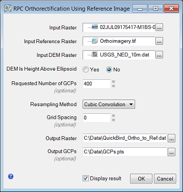
Even after performing a RPC orthorectification of the QuickBird Level 1B product (without ground control) there are still several pixel offsets in comparison to the reference image we are trying to match. Fortunately in ENVI 5.3 SP1 a user can now input these two image datasets and DEM elevation source into a single tool where the QuickBird dataset can be orthorectified and coregistered to the High Resolution Orthoimagery in one quick-n-easy processing step:
Another benefit of this new ENVI software functionality is the user does not need to be concerned with the spatial extent of image overlap or different coordinate system & pixel size – the software handles these processing complexities for the user automatically. Here is a screenshot of processing output result which shows nearly perfect pixel alignment between the two image datasets:
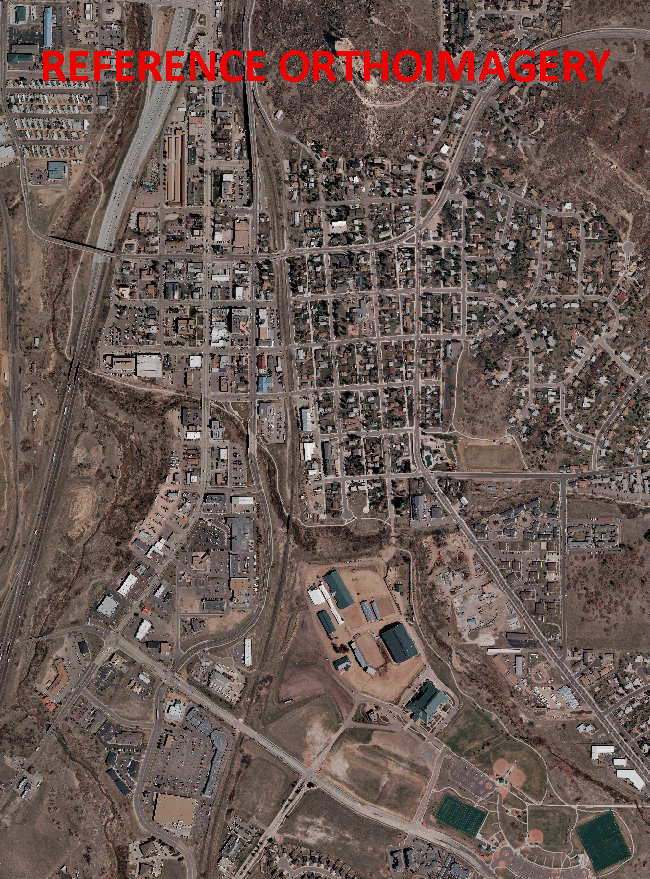
Image data provided courtesy of DigitalGlobe and USGS