X

NV5 Geospatial Blog

Each month, NV5 Geospatial posts new blog content across a variety of categories. Browse our latest posts below to learn about important geospatial information or use the search bar to find a specific topic or author. Stay informed of the latest blog posts, events, and technologies by joining our email list!


New ENVI Agent, IDL Agent, and GeoAgent Quick Guides

New ENVI Agent, IDL Agent, and GeoAgent Quick Guides

6/9/2026

The recent release of ENVI® Agent, IDL® Agent, and GeoAgent™ revolutionize how users interact with geospatial software. These agentic AI applications act as partners to plan, simplify, and execute complex workflows. Knowing where to start can be challenging for new users. To this end, we developed three new quick guides to... Read More >

Introducing NISAR Data Support

Introducing NISAR Data Support

6/5/2026

The release of ENVI® SARscape 6.3 in April 2026 includes preliminary support for NASA-ISRO SAR (NISAR) data. The NISAR mission is a joint Earth-observing satellite project between NASA and the Indian Space Research Organization designed to monitor changes in the planet’s land and ice surfaces using advanced radar imaging. It... Read More >

Monitoring Illegal Mining in the Amazon: Turning Persistent Data Into Actionable Insight

Monitoring Illegal Mining in the Amazon: Turning Persistent Data Into Actionable Insight

5/28/2026

Illegal mining over decades has constituted one of the most persistent and complex socio-environmental problems in the Brazilian Amazon. In recent years, with the increasingly intensive use of mechanized extraction, the associated environmental impacts—such as deforestation, intense soil disturbance, river siltation, and mercury... Read More >

From Answers to Action: Why ENVI and IDL Agents Go Beyond General AI

From Answers to Action: Why ENVI and IDL Agents Go Beyond General AI

4/20/2026

As generative AI tools like Claude and Gemini continue to gain traction, many organizations are asking the same question: Can general purpose AI actually support real geospatial workflows, or does it stop at surface-level answers? That question was front and center in our recent webinar, Meet Your New Partners in Science: ENVI... Read More >

Mapping Earthquake Deformation in Taiwan With ENVI

Mapping Earthquake Deformation in Taiwan With ENVI

12/15/2025

Unlocking Critical Insights With ENVI® Tools Taiwan sits at the junction of major tectonic plates and regularly experiences powerful earthquakes. Understanding how the ground moves during these events is essential for disaster preparedness, public safety, and building community resilience. But traditional approaches like field... Read More >

1345678910Last
«June 2026»
SunMonTueWedThuFriSat
31123456
78910111213
14151617181920
21222324252627
2829301234
567891011
21802 Rate this article:
5.0

UAS: A lot of buzz, but still working on the take off

Anonym

No matter what industry you are in right now, you've probably heard the hype around UAS and what that could mean in terms of productivity, savings, and real-time analytics. The possibilities that UAS acquired data offer are incredibly exciting, whether it's no longer needing to charter a helicopter for corridor mapping, being able to tell a farmer in real time where his crops are struggling, or quickly deploying thermal cameras for search and rescue operations.

For more than a year or so now, the buzz has been building. But in reality, things have been slow to get off the ground. This is in large part due to the FAA’s restrictions in this space that limit Commercial/Government operators. The good news is the FAA is learning and adapting and as it gets more information it is starting to make it easier on UAS section 333 exemption holders.


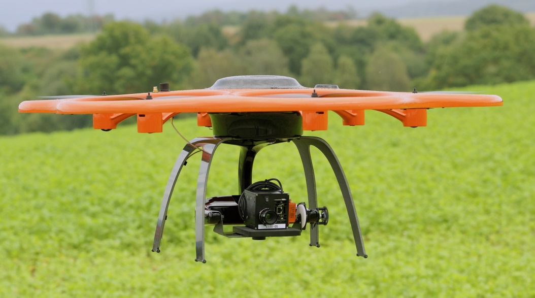
(Hyperspectral Imager from AIBOTIX)

As the FAA continues to make progress in accessing the situation, there was a promising announcement made on March 29th:

After a comprehensive risk analysis, the Federal Aviation Administration (FAA) has raised the unmanned aircraft (UAS)“blanket” altitude authorization for Section 333 exemption holders and government aircraft operators to 400 feet. Previously, the agency had put in place a nationwide Certificate of Waiver or Authorization (COA) for such flights up to 200 feet. The new COA policy allows small unmanned aircraft—operated as other than model aircraft (i.e. commercial use)—to fly up to 400 feet anywhere in the country except restricted airspace and other areas, such as major cities, where the agency prohibits UAS operations. “This is another milestone in our effort to change the traditional speed of government,” said FAA Administrator Michael Huerta. “Expanding the authorized airspace for these operations means government and industry can carry out unmanned aircraft missions more quickly and with less red tape.”


While 400 feet might not sound significant, what the FAA did was actually double the flight ceiling height. This means that UAS operators can potentially capture twice the data they could previously. That's a big deal! For a large area of interest, flying a UAS at the 200 feet ceiling might not have made sense because it would have been too time-intensive to cover the full area, especially when a lot of UAS have limited flight times. As the FAA restrictions continue to loosen on commercial UAS operators, 2016 could very well  be the year we start to see more UAS projects taking off. It will be exciting to see how this type of data collection transforms our industry.

Please login or register to post comments.