X

NV5 Geospatial Blog

Each month, NV5 Geospatial posts new blog content across a variety of categories. Browse our latest posts below to learn about important geospatial information or use the search bar to find a specific topic or author. Stay informed of the latest blog posts, events, and technologies by joining our email list!


NV5 at ESA’s Living Planet Symposium 2025

NV5 at ESA’s Living Planet Symposium 2025

9/16/2025

We recently presented three cutting-edge research posters at the ESA Living Planet Symposium 2025 in Vienna, showcasing how NV5 technology and the ENVI® Ecosystem support innovation across ocean monitoring, mineral exploration, and disaster management. Explore each topic below and access the full posters to learn... Read More >

Monitor, Measure & Mitigate: Integrated Solutions for Geohazard Risk

Monitor, Measure & Mitigate: Integrated Solutions for Geohazard Risk

9/8/2025

Geohazards such as slope instability, erosion, settlement, or seepage pose ongoing risks to critical infrastructure. Roads, railways, pipelines, and utility corridors are especially vulnerable to these natural and human-influenced processes, which can evolve silently until sudden failure occurs. Traditional ground surveys provide only periodic... Read More >

Geo Sessions 2025: Geospatial Vision Beyond the Map

Geo Sessions 2025: Geospatial Vision Beyond the Map

8/5/2025

Lidar, SAR, and Spectral: Geospatial Innovation on the Horizon Last year, Geo Sessions brought together over 5,300 registrants from 159 countries, with attendees representing education, government agencies, consulting, and top geospatial companies like Esri, NOAA, Airbus, Planet, and USGS. At this year's Geo Sessions, NV5 is... Read More >

Not All Supernovae Are Created Equal: Rethinking the Universe’s Measuring Tools

Not All Supernovae Are Created Equal: Rethinking the Universe’s Measuring Tools

6/3/2025

Rethinking the Reliability of Type 1a Supernovae   How do astronomers measure the universe? It all starts with distance. From gauging the size of a galaxy to calculating how fast the universe is expanding, measuring cosmic distances is essential to understanding everything in the sky. For nearby stars, astronomers use... Read More >

Using LLMs To Research Remote Sensing Software: Helpful, but Incomplete

Using LLMs To Research Remote Sensing Software: Helpful, but Incomplete

5/26/2025

Whether you’re new to remote sensing or a seasoned expert, there is no doubt that large language models (LLMs) like OpenAI’s ChatGPT or Google’s Gemini can be incredibly useful in many aspects of research. From exploring the electromagnetic spectrum to creating object detection models using the latest deep learning... Read More >

1345678910Last
«September 2025»
SunMonTueWedThuFriSat
31123456
78910111213
14151617181920
21222324252627
2829301234
567891011
5004 Rate this article:
5.0

Unlocking the Potential: Exploring ENVI 6.0's Advanced Spectral Analysis Capabilities

Trey Scroggins

In the dynamic realm of remote sensing and spectral analysis, achieving precision and efficiency is paramount. Step into the world of ENVI 6.0, a powerhouse of cutting-edge technologies meticulously designed to unveil the mysteries hidden within spectral data. Let's embark on a journey through its multifaceted arsenal, delving into its transformative capabilities in Target Detection, Endmember Extraction, Spectral Hourglass, and Material Identification, each wielding the power to revolutionize diverse applications.

Precision Target Detection in ENVI

From military and surveillance applications to environmental monitoring and geological exploration, the Target Detection tool provides precise and efficient detection capabilities for identifying specific features of interest within your imagery.

Spotlight on Precision: Unveiling ENVI's Target Detection Tool

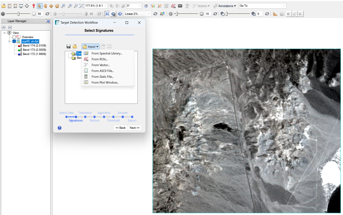
At the forefront of ENVI 6.0's prowess lies its Target Detection tool, empowering users to discern elusive signatures amidst spectral clutter. Harnessing sophisticated algorithms and machine learning techniques, ENVI identifies anomalous pixels, shedding light on concealed targets against complex backgrounds. From detecting environmental hazards in satellite imagery to uncovering archaeological relics buried beneath layers of earth, its applications span the spectrum of scientific inquiry and security domains.

The Power of Enhanced Algorithms: ENVI 6.0's target detection capabilities are driven by enhanced algorithms, leveraging the latest advancements in machine learning and deep learning to discern subtle patterns and anomalies within complex imagery.

Real-World Applications: From Urban planning to environmental monitoring and defense, ENVI’s target detection capabilities can be applied to facilitate infrastructure analysis, precisely detect changes in land cover and vegetation health, and aid in reconnaissance missions and surveillance activities to identify potential threats and anomalies.

Adaptive Thresholding: ENVI 6.0's adaptive thresholding algorithm intelligently adjusts detection thresholds based on local image characteristics, ensuring robust performance across diverse environmental conditions, from densely populated urban areas to remote wilderness regions.

Endmember Extraction: Unraveling Nature's Palette

At the core of hyperspectral analysis lies the quest to uncover nature's palette—the endmembers defining the spectral fingerprint of each material. Like a skilled artist mixing colors on a canvas, ENVI's algorithms adeptly extract these endmembers, unraveling the spectral cocktail with mathematical precision. From rocky terrains to lush vegetation, each endmember tells a story, offering insights into the hidden treasures of our Earth. Geological Exploration: Identifying mineral compositions and mapping geological formations.

Environmental Monitoring: Tracking changes in land cover, vegetation health, and soil composition.

Precision Agriculture: Assessing crop health, detecting nutrient deficiencies, and monitoring soil properties.

Urban Planning: Analyzing urban sprawl, identifying land use patterns, and assessing environmental impacts.

Forestry Management: Mapping forest types, monitoring deforestation, and estimating biomass.

Endmember Extraction in ENVI

Whether you're exploring mineral compositions, mapping land cover types, or detecting environmental contaminants, the Endmember Extraction tool provides unparalleled accuracy and flexibility.

Seeing Beyond: Delving into ENVI's Spectral Hourglass Tool

Spectral Hourglass transcends conventional paradigms, empowering users to traverse the temporal and spatial dimensions of spectral data. Through spatial analysis techniques, ENVI constructs a narrative of change and evolution, unveiling patterns hidden within the spectral continuum. From tracking vegetation dynamics to monitoring urban sprawl, its spatial insights offer a window into dynamic processes shaping our world.

The following use cases illustrate the diverse range of applications for ENVI's Spectral Hourglass tool in environmental science, geology, agriculture, urban planning, disaster management, ecology, education, and climate research.

  • Analyzing spectral signatures to identify and differentiate materials on the Earth's surface, such as minerals, vegetation types, and man-made structures.
  • Mapping geological formations, identifying mineral deposits, and assessing the composition of rocks and soil to support mineral exploration and resource management efforts.
  • Monitoring water bodies for pollution, identifying harmful algal blooms, and assessing water quality parameters such as turbidity, chlorophyll content, and dissolved organic matter.
  • Assessing the impact of natural disasters such as floods, wildfires, and landslides by analyzing changes in spectral signatures before and after the event to aid in emergency response and recovery efforts.
  • Using spectral data and ENVI's Spectral Hourglass tool to teach students about remote sensing principles, image analysis techniques, and applications in various fields.


Spectral Hourglass Workflow

With advanced spectral analysis capabilities, this cutting-edge tool allows you to identify and classify materials with precision and efficiency.

Watch a tutorial on ENVI Spectral Hourglass

Endmember Extraction in ENVI

With advanced spectral analysis capabilities, this cutting-edge tool allows you to identify and classify materials with precision and efficiency.

Unveiling the Power of ENVI's Material Identification Tool: A Comprehensive Guide

Material Identification serves as the crowning jewel in ENVI 6.0's repertoire, bestowing the gift of knowledge upon the spectral explorer. Armed with an extensive spectral library and advanced classification algorithms, ENVI deciphers the enigmatic language of spectra with unparalleled accuracy, offering actionable intelligence for diverse stakeholders.

Understanding ENVI's Material Identification Tool: Leverage advanced algorithms and spectral analysis techniques to identify and classify materials within imagery. Whether working with multispectral or hyperspectral, this tool provides the means to extract valuable insights from complex datasets. From identifying land cover types to characterizing geological formations and man-made structures, ENVI's Material Identification Tool offers unparalleled capabilities for material identification and analysis.

Key Features and Functionality: The heart of ENVI's Material Identification Tool is a suite of advanced algorithms tailored for material classification tasks. Users can utilize spectral libraries, spectral angle mapping, and machine learning techniques to accurately identify and classify materials based on their spectral signatures.

The tool also offers interactive visualization capabilities to explore spectral signatures and fine-tune classification parameters to achieve optimal results. Moreover, its seamless integration with other ENVI modules and third-party data sources lets users augment their analysis with additional information, such as terrain data or ancillary datasets, to enhance classification accuracy and robustness.

Real World Applications:

  • For environmental monitoring, it can aid in land cover classification, vegetation mapping, and habitat assessment, providing valuable insights for conservation efforts and ecosystem management.
  • In agriculture, it can support precision farming practices by identifying crop types, monitoring crop health, and detecting nutrient deficiencies.
  • For geology and mineral exploration, it can assist in identifying geological formations, mapping mineral deposits, and characterizing terrain features, facilitating resource exploration and extraction activities.


In the ever-expanding universe of remote sensing, ENVI 6.0 stands as a beacon of innovation, illuminating the path towards new frontiers of knowledge and discovery. With its transformative capabilities, ENVI emboldens researchers, analysts, and decision-makers to unravel the complexities of our world with clarity and precision, forging new horizons in our quest for understanding.

If you want to try ENVI’s spectral capabilities for yourself or have questions, reach out to me and our other spectral experts at GeospatialInfo@NV5.com.

Please login or register to post comments.