X

NV5 Geospatial Blog

Each month, NV5 Geospatial posts new blog content across a variety of categories. Browse our latest posts below to learn about important geospatial information or use the search bar to find a specific topic or author. Stay informed of the latest blog posts, events, and technologies by joining our email list!


Mapping Earthquake Deformation in Taiwan With ENVI

Mapping Earthquake Deformation in Taiwan With ENVI

12/15/2025

Unlocking Critical Insights With ENVI® Tools Taiwan sits at the junction of major tectonic plates and regularly experiences powerful earthquakes. Understanding how the ground moves during these events is essential for disaster preparedness, public safety, and building community resilience. But traditional approaches like field... Read More >

Comparing Amplitude and Coherence Time Series With ICEYE US GTR Data and ENVI SARscape

Comparing Amplitude and Coherence Time Series With ICEYE US GTR Data and ENVI SARscape

12/3/2025

Large commercial SAR satellite constellations have opened a new era for persistent Earth monitoring, giving analysts the ability to move beyond simple two-image comparisons into robust time series analysis. By acquiring SAR data with near-identical geometry every 24 hours, Ground Track Repeat (GTR) missions minimize geometric decorrelation,... Read More >

Empowering D&I Analysts to Maximize the Value of SAR

Empowering D&I Analysts to Maximize the Value of SAR

12/1/2025

Defense and intelligence (D&I) analysts rely on high-resolution imagery with frequent revisit times to effectively monitor operational areas. While optical imagery is valuable, it faces limitations from cloud cover, smoke, and in some cases, infrequent revisit times. These challenges can hinder timely and accurate data collection and... Read More >

Easily Share Workflows With the Analytics Repository

Easily Share Workflows With the Analytics Repository

10/27/2025

With the recent release of ENVI® 6.2 and the Analytics Repository, it’s now easier than ever to create and share image processing workflows across your organization. With that in mind, we wrote this blog to: Introduce the Analytics Repository Describe how you can use ENVI’s interactive workflows to... Read More >

Deploy, Share, Repeat: AI Meets the Analytics Repository

Deploy, Share, Repeat: AI Meets the Analytics Repository

10/13/2025

The upcoming release of ENVI® Deep Learning 4.0 makes it easier than ever to import, deploy, and share AI models, including industry-standard ONNX models, using the integrated Analytics Repository. Whether you're building deep learning models in PyTorch, TensorFlow, or using ENVI’s native model creation tools, ENVI... Read More >

1345678910Last
11706 Rate this article:
.1

Using Thematic Change Detection to Determine Trail Conditions: Part 1

Anonym

There is nothing more frustrating than getting up to an off-road trail and figuring out the last rain caused a rockslide, or caused part of the trail to wash away. Meaning that hour and a half drive to the trail head was for nothing!

Generally the Forest Service is on top of trail closures, but there are quite a few 4 wheeling groups across Colorado who adopt trails and are responsible for opening them at the end of spring when the mud is hardening and the snow has melted off. When these groups adopt trails they are responsible for removing downed trees, repairing wash outs on shelf roads, and closing off areas that are still too wet to be driving on.

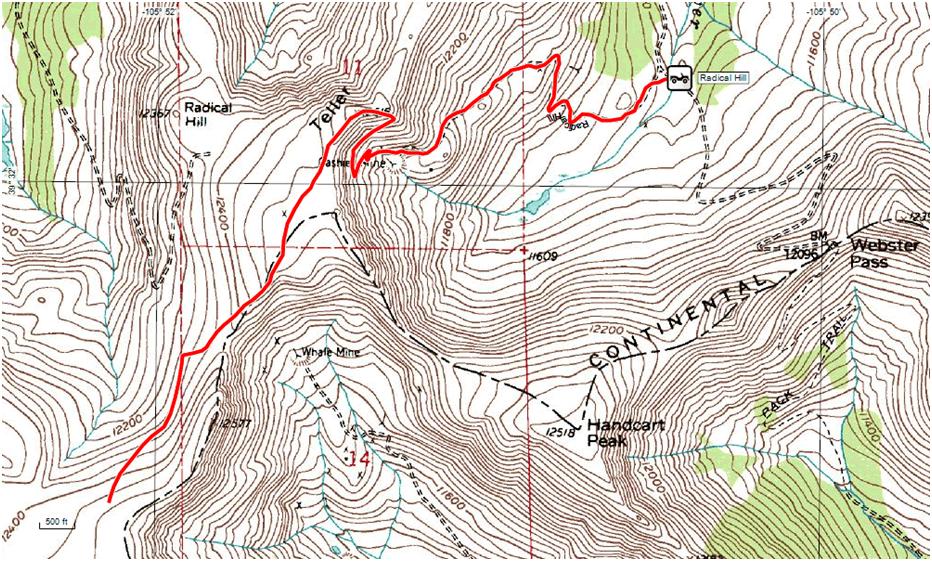
During a trip this past weekend I got to thinking that with the amount of free data there is (including topographic maps that cover trail routes), it would be fairly easy to establish the trail area and a “norm” for trail conditions that will serve as your base dataset.

Every spring the trick would be tracking down recently flown data, or possibly getting setup with access to a service like DigitalGlobes Global Big Data. Once you have new data then you can utilize a workflow like thematic change detection to determine what obstacles you will be facing. The beauty of a workflow like Thematic Change Detection is you are not manually scrolling through the trail trying to pick possible changes, but can instead select “only include areas that have changed”.

I know this doesn’t sound like ground-breaking material, but the Colorado seasons can be wild and it’s common for spring wind storms to knock large old trees across trails or the snow melt to create new ruts that won’t be safe to pass over. The key advantage to putting a practice like this in place is when these groups go up to open the trail for the summer, they can take all necessary equipment like a large chain saw or T post and lumber to reinforce a trail edge. Though I am not part of a 4 wheeling club, I think this idea is worth proposing to them.

In Part 2 of this Blog I will putting the practice to test and seeing where Popular 4 wheeling trails in Park County have changed from 2014 to 2015.

Please login or register to post comments.