Utilizing ENVI and the Airbus Defense and Space Constellation for Precision Agriculture
Anonym
Editor's note: Sky Rubin, our guest blogger from Airbus Defense and Space, talks about how Airbus DS data and imagery works with ENVI image analysis software. Check out this webinar for more information on the partnership between the two companies and how you can benefit.
In the past two years, I have seen a dramatic increase in the demand for in-season crop monitoring using Earth observation satellites. Driving the growth of the agriculture industry is the need to increase crop yield and reduce its inputs. For this reason, agri-businesses are now working with Airbus Defense and Space to setup custom monitoring programs for their areas of interest. The programs vary from intensive monitoring on a daily/weekly basis to monthly/bi-monthly monitoring. Airbus Defense and Space’s new constellation of satellites (Pléiades 1A, Pléiades 1B, SPOT 6, and SPOT 7 and UK-DMC2 is a perfect tool to satisfy their needs. It guarantees fast, fresh and frequent coverage of agricultural areas with an unmatched reliability and range of resolutions, allowing intra-parcel insight.
Clients often mention that the most important factor when choosing imagery for Precision Agriculture is the actual availability of the data at the right point in time during the crop growth cycle. Airbus Defense and Space excels at this with an impressive rate of new collections. Our success rate is almost 9 out of 10, which means that 9 new imagery requests out of 10 are collected on-time and according to specification on a global basis. Our experience in satellite tasking dates back to 1982. Ever since then, a team of world-class tasking experts gets up every morning to ensure that your area is covered on-time and on-spec. They carefully conduct feasibility studies and closely follow up on open tasking requests. They constantly adjust priorities and do not hesitate to use satellite capacity even in difficult areas whenever there is a chance to capture the desired target. All of that fine-tuning is in our DNA, and more than any technical feature, this is the secret of our reliability.
Using the right satellite resource is essential to reduce satellite data input costs and to maximize return on investment. Depending on the application, imagery with of range of resolutions up to 22m may be sufficient. Very high resolution, 50cm imagery is always available, but may not be necessary depending on the final application. Teaming with our customers, understanding precisely what their needs are, allows for Airbus Defense and Space to come back with the right imagery source for their application- the one that will be the best match between collection time, budget and information depth required.
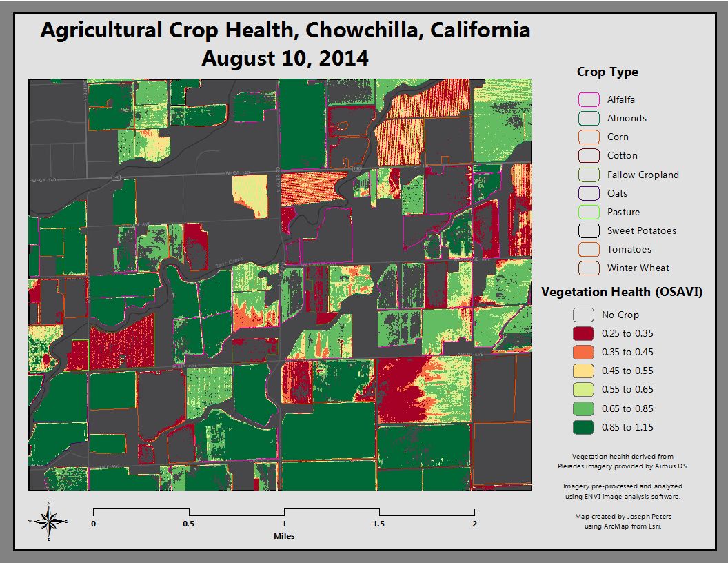
The majority of companies I have worked with in the agricultural vertical are using ENVI. ENVI Processing Modules like QUAC (surface reflectance model) can be used to process imagery and create derivative works such as crop yield maps, fertilizer recommendation, water needs maps, etc. Airbus Defense and Space data is very robust as our new sensors are 12 bit. This means we have 4,096 values per pixel, twice as many values per pixel as our competition. The increased spectral range is ideal for multispectral analysis with ENVI. Airbus Defense and Space also has worked with us to educate the market on our JPG2000 Lossless imagery format, which can save up to 50% in terms of file size, speeding up processing and delivery times without information loss.
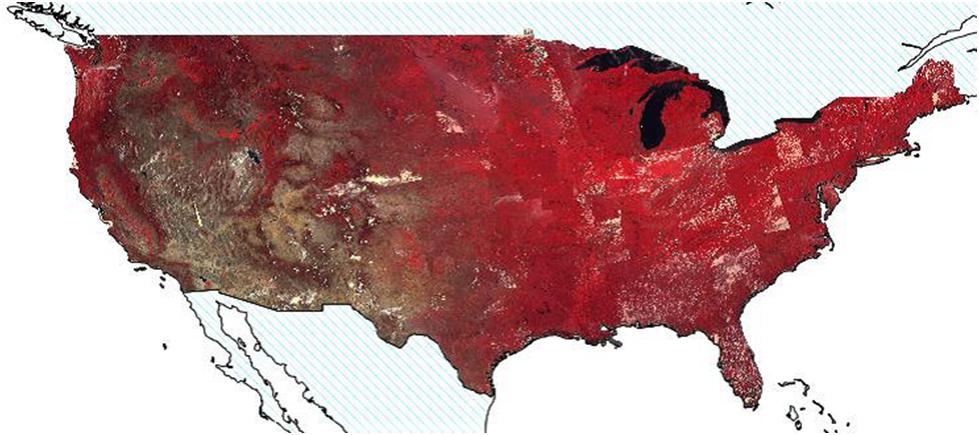
With DMCii, Airbus Defense and Space is also able to provide large area coverage of the Continental U.S. during the growing season for a U.S. Government client. This data is available for commercial purchase. As the 22m DCMii imagery is some of the least expensive satellite imagery in the commercial market, clients often purchase DMCii data to be used in conjunction with free Landsat data. The 600km swathand ease of use with Landsat data makes DMC data very attractive to those who need large area coverage at 22m.
We work with partners to provide 22m images collected every three days, which are then used for irrigation management. Without utilizing DMCii, such an imagery program would be not be possible due to the size of the areas of interest and the limited revisit provided by Landsat Satellites. A sensor with a very large swath width and a high temporal revisit is required to collect large regions every 3 days. The DMCii satellite swath width is 600km. For comparison, the State of Colorado is 605km in width. The large 600km swath combined with the high temporal revisit makes DMCii the ideal choice for large area monitoring.
Within the agriculture vertical, the goal of Airbus Defense and Space is to help our clients meet the needs of a growing planet by helping increase global food production via the use of precision agriculture and remote sensing.