Light, Wavelength, and the Electromagnetic Spectrum
Physics tells us that light can be understood as a particle or wave. Photons are light particles or "packets" of electromagnetic energy. Waves are the wave form of electromagnetic energy.
In Remote Sensing, we will most often refer to light as consisting of waves of different frequencies.
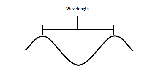
Wavelength - distance between two consecutive crests of waves
Frequency - number of waves that pass a point in space in a given period of time
In optical remote sensing, wavelength is usually expressed in units of micrometers (µm) or nanometers (nm).
The Electromagnetic Spectrum
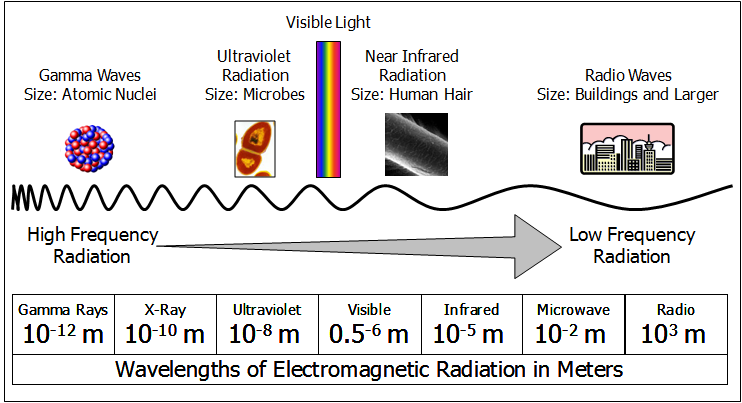
The above diagram shows high to low frequency wavelengths of the EM spectrum. Each region of the electromagnetic spectrum has properties suitable for specific uses.
For example, high-energy x-rays can penetrate soft tissue but are stopped by bone allowing for medical imaging.
Portions of the visible and near-infrared spectrum have sufficient energy, and are of the correct wavelength to interact with the molecular structures of materials on the Earth’s surface. These wavelengths are reflected, absorbed, or transmitted and can be detected using sensors that are calibrated to detect these wavelengths.
The longer the wavelength, the lower its energy content which makes it more difficult to passively sense materials on the earth surface. Thermal sensors can detect emitted (heated) electromagnetic radiation from a material but because of the low energy content cannot achieve the same spatial resolution as a visible and near-infrared sensor. Microwaves (Radar) require an active sensor that provides the energy source for detection of materials.
Reviewed 8/25/2014 MM