LiDAR Uses in Disaster Response
Anonym
The increased availability of LiDAR data is changing the way that agencies prepare for, and respond to, disasters. The ability to automatically extract high-quality elevation models and other features from LiDAR point clouds decreases the amount of time it takes to get reliable information about on-the-ground conditions during an emergency.
Here are some of the types of information that can be extracted from LiDAR and how it can be used in different disaster scenarios.
Visualization
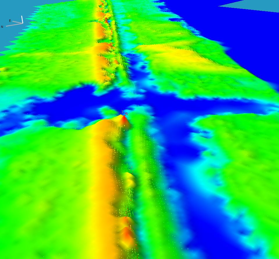
In the aftermath of hurricane Katrina, LiDAR was flown over the city of New Orleans to map the failing levy system. Visualization of the LiDAR point cloud allowed responders to easily identify areas where the levies had failed. Many times simply having a three dimensional view of a situation can provide unique information to help responders. Below we can see an image of a breached LiDAR as shown by the point cloud. (Data courtesy NOAA)
Elevation
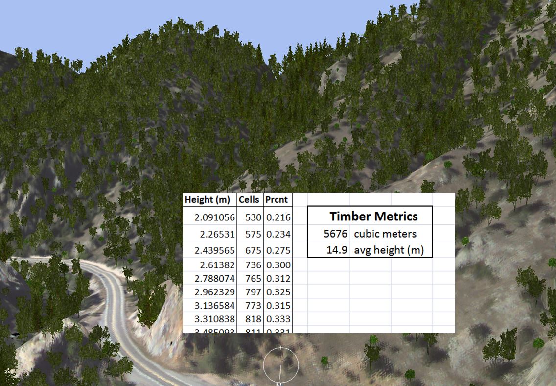
One of the biggest benefits from LiDAR is the ability to extract high quality elevation information from the point cloud. Elevation data can be used to build three-dimensional models, assess ideal locations for staging aid, better understand terrain mobility, evaluate displacement of soil, map debris blockage, and more. As a preparedness measure for wildfires, elevation data derived from LiDAR can be used to model biomass and slope to help build fire prediction maps and better understand how a fire might move across a landscape. This information can also be useful for homeowners who are implementing fire mitigation strategies around their homes. Below we can see an example of biomass calculation from LiDAR. (Data courtesy Boulder Critical Zone Observatory)
Building Features
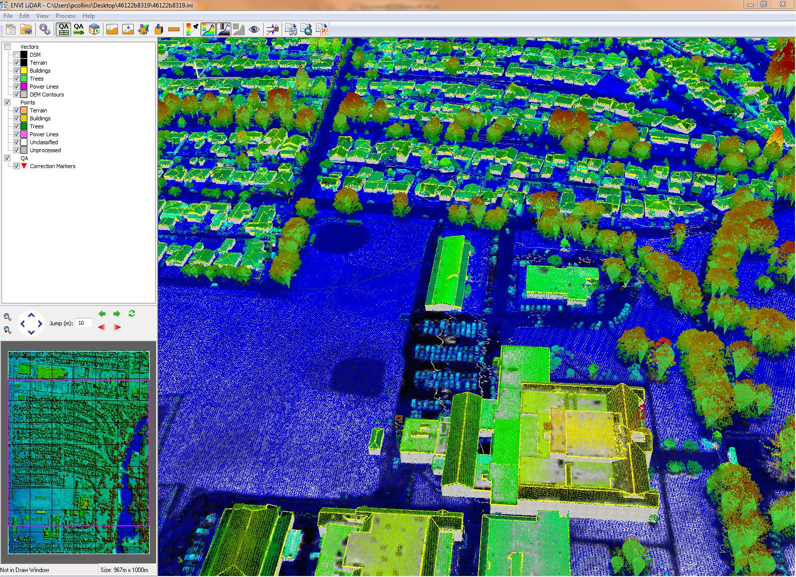
The ability to extract building features automatically from the point cloud is something that can be extremely useful in pre, during, and post-disaster response. Having a quick method to inventory structures can save valuable amounts of time for responders attempting to assess damage to houses and secure the safety of affected residents. Combining building footprints with flood zone maps can make it easy to identify those areas that are most likely to be affected by an event, or help identify those that are in critical need during an event. Below we can see a suburban landscape with all of the building features extracted, which could be used in flood planning or modeling. (Data courtesy NOAA)
Power Lines
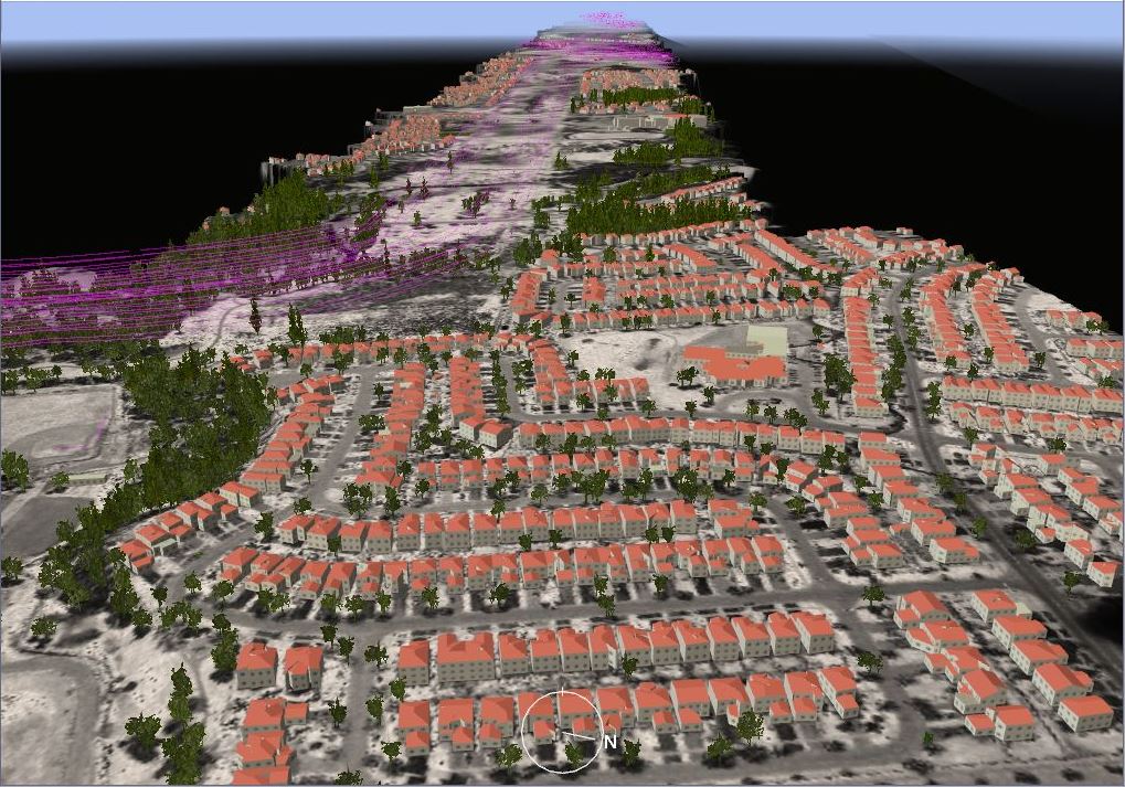
Power lines are of particular interest during a disaster. Not only are they needed to provide energy and heat to affected areas, downed power lines can be extremely dangerous. The ability to quickly extract power line vectors from the point cloud decreases the amount of time it takes crews to identify issues with the power grid, restore power to residents, and identify hazards along the lines. Below you can see an image where a large series of power lines have been extracted from the dataset. (Data courtesy NOAA).
These are just some of the possible use cases for leveraging LiDAR to assist in disaster situations. What are your thoughts? Do you think LiDAR is becoming more available as a data type to assist in these types of scenarios? What other types of use cases to do you see for LiDAR in disaster or other situations?