Industry embed: An Army Chief Warrant Officer trains at Harris
Anonym

Hello. My name is Chief Warrant Officer 3 Augustus Wright. I’ve been working with Harris since August as part of the U.S. Army’s Training with Industry program. Now why on earth would the Army send one of its warrant officers to live what many soldiers would call “The Good Life”? That entails working with and training alongside civilians -- not to mention living as one -- for a year!
The answer is actually quite simple. The Training with Industry program recognizes that it is necessary for selected individuals to actually leave the Army for a while to get hands-on training with the tools needed to do their jobs. Afterward, these industry trainees return with refined and improved skills, as well as knowledge about leading trade practices to move the Army forward. Given my background, I was a good candidate. I’m a 125D Geospatial Engineering Technician and I’ve been serving on active duty for 17 years. Prior to being selected to train with Harris on its geospatial software ENVI, I served as the direct support officer-in-charge for the U.S. Army Europe’s 60th Geospatial Planning Cell.

Over the years, I’ve completed three separate combat deployments to Iraq in support of Operation Iraqi Freedom and Operation New Dawn totaling 38 months. In 2003, as a Topographic Sergeant with the 4th Infantry Division I provided situational awareness and geospatial tactical decision aids to ground force commanders in Iraq and was awarded a Bronze Star Medal. As the Sr. Topographic Sergeant for the 25th Infantry Division in 2005, I used ENVI and ArcGIS to perform predictive analysis on IED trends. ENVI was primarily used to detect disturbed earth and spectral differences in road materials. In 2009, as the GEOINT Officer in Charge for the3rd Infantry Division, I used ENVI and ArcGIS to detect IED making materials and disturbed ground. I also used ENVI and ArcGIS to plan the emplacement of strategic checkpoints that were a part of the strategy to end operations in Iraq. During this tour I was awarded a second Bronze Star Medal.
Since I started with Harris three months ago, I’ve worked side by side with expert software engineers. Not only am I learning a ton, but I’m also in the unique position to provide user feedback from the Army geospatial community about what additions to the software would be helpful. One intuitive add-on that I’m extremely excited about is the dynamic symbolization of the electromagnetic spectrum in the ENVI DataManger, Layer Manager, Metadata and Spectral profile. Another is Supplementary Color Band Symbology that takes into account the wide range of remote sensing and imagery exploitation experience of users within the Defense & Intelligence Community. This new feature, which is applicable in both academia and day-to-day tradecraft, will help more experienced soldiers teach novice soldiers while ensuring product quality and integrity in practical use cases. Keep an eye out for these enhancements in future releases of ENVI.
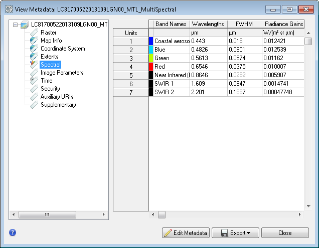
Supplementary Color Band Symbology
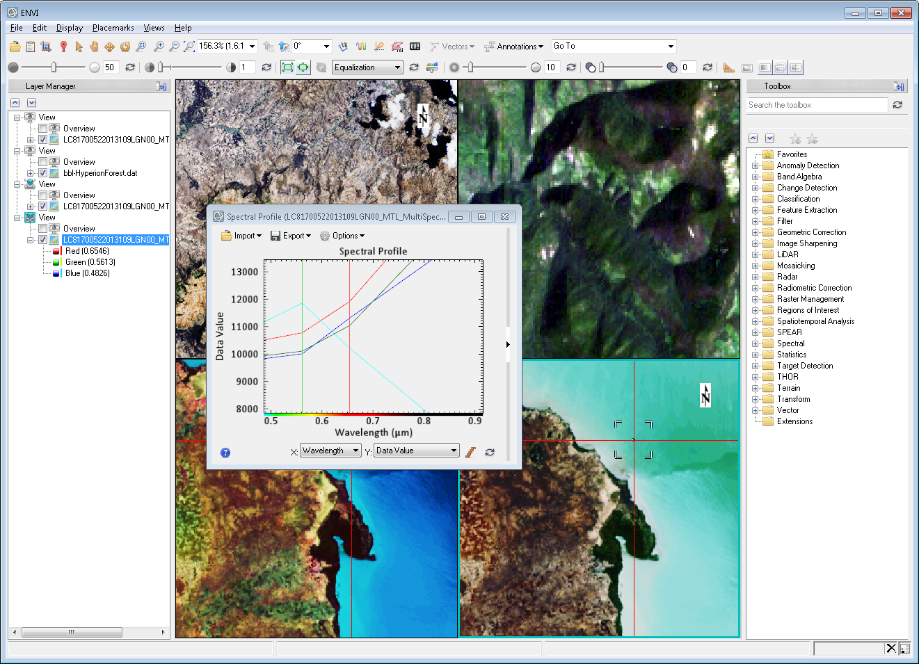
Dynamic symbolization of the electromagnetic spectrum in the ENVI Data Manger, Layer Manager, Metadata and Spectral profile.
I’ll be posting blogs on a regular basis to keep you up to date on what I’m learning and let you know how this new “deployment” as an Industry Trainee with Harris is going.