After going to college on a football scholarship, Tim Mack had a short career in the NFL, playing defensive back in training camps and on practice squads for the Chicago Bears and New Orleans Saints. Once his time in the NFL was up, he followed his sense of duty and joined the U.S. Army. After a distinguished 19-year career in the Army, Mack joined the Defense and Intelligence team within L3Harris Geospatial.
“There weren’t too many companies that I wanted to work for,” Mack explains. “L3Harris has a good reputation as an honest broker. Their products like ENVI, do what the company says they do both on the website, and in the documentation. Actually, the products do even more!”
Mack was first introduced to ENVI through Distributed Common Ground System-Army (DCGS-A), the Army’s cornerstone intelligence system for sensor tasking, Processing, Exploitation and Dissemination (PED). But it wasn’t until later that he got a real appreciation for ENVI.
“In 2017, I was deployed with a special forces group providing situational awareness to my commander and to General Schwartz, who was the European special operations commander. I had to wrangle and make sense of a huge dataset in a short amount of time. ENVI really proved its worth and I appreciated its capabilities including its integration with Esri.”
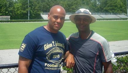
Football camp coaches Tim Mack (on the left) and Ty Willingham, former head football coach at Stanford University, University of Notre Dame, and the University of Washington
Over the course of his 19-year career in the U.S. Army, Mack rose through the ranks, and is retiring as a GEOINT Chief Warrant Officer III, based most recently with the XVIII Airborne Corps out of Fort Bragg, NC. Mack feels good about his time in the Army because many of the workflows and processes that he put together are still used.
“As a GEOINT Warrant Officer, I was responsible for the execution of the mission and advising the leadership on where to place assets, where to focus our attention, and giving the go-no-go for certain decisions. Basically, someone might live or die based off my assessment and analysis.”
Mack has received many recognitions throughout his career, but one stands out a bit more than the others. “I was awarded my third bronze star as a result of a rough deployment, where my efforts were directly attributed to saving lives. Being recognized for saving lives is the biggest pat on the back that I could receive.”
Mack’s other responsibilities included serving as a lead integrator of GEOINT capabilities and liaising between the commercial industry and the military. “I truly had to be a subject matter expert on everything from analysis, to systems, to process and workflows. I also had to be an expert on things like policy and Army acquisition and requirements cycle.”
Mack has been a part of many different types of missions including counterterrorism, counter-IED, humanitarian aid and disaster relief, and targeting. He has worked interagency and with the larger IC community as a whole. He learned something from every mission he has been on. “I always try to leave every assignment better than I found it. I have the mindset that if you open yourself to learn from anyone, you will learn from everyone.”
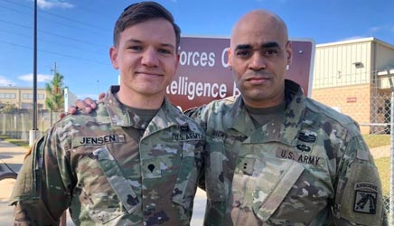
Tim Mack (on the right) congratulates a soldier being awarded for excellence
Even though Mack has only been with L3Harris Geospatial for a short time, he is already fully engaged with customers. “At Fort Bragg, everyone I work with is either preparing to deploy or just came back from deploying,” says Mack.
“It’s great because I can still contribute by teaching soldiers GEOINT best practices,” explains Mack. “I recently worked with the 2nd brigade of the 82nd Airborne Division on how to better use and maximize GEOINT capabilities within ENVI. On a daily basis, I work with tactical echelon users and support the training environment.”
One of the main assets Mack brings to L3Harris is ground truth. “I have credibility because the people who are in the seats now were my peers just a few months ago. I can talk to them about how ENVI is actually being used and show them capabilities they might not be utilizing. L3Harris is pushing the envelope with ENVI to provide more enhanced capabilities and an even better user experience. I am very excited to help influence where ENVI is headed.”
Mack is currently finishing his Doctorate in Education. “I am always hungry to learn, and school has been my respite from being so involved in the mission. I want to continue staying sharp, which is a message that I relay to soldiers.”
“Even though I changed uniforms, I am still helping to defend our nation. Every day, I try to become a better GEOINT professional.”