The Expanding Role of UAVs
Anonym
We hear a lot in the news regarding drones also known as Unmanned Aerial Vehicles (UAVs). There is an ever-expanding role of Unmanned Aerial Vehicles despite its historic focus on military applications. This article looks at a high-level, the first introduction of UAVs and their utility for situational awareness, including where the technology is moving in regards to not only situational awareness but also service in a number of different commercial markets.
Pre-Aviation UAVs date back to the late 1800’s. Corporal William Eddy using a kite like that of Englishman Douglas Archibald during the Spanish-American war of 1898 captured the first wartime aerial surveillance photographs providing critical information to American troops about their enemies locations and reinforcements. In 1952, Northrop Aircraft Incorporated acquired Reginald Denny’s Radioplane Company and led the way in post-World War II UAV development. In 1955, Northrop’s Radioplane RP-71 Falconer, designated as SD-1 by the U.S. Army, was the Army’s first reconnaissance UAV. The Falconer could carry a still film camera and transmit rudimentary video. During this period, the design and use of most UAVs was for target practice.
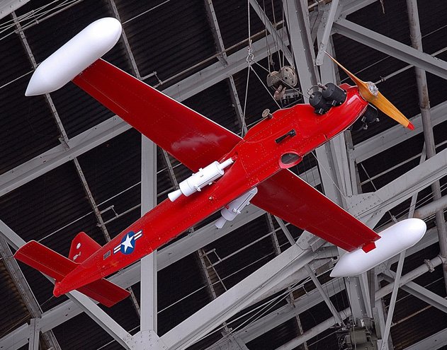
Image courtesy of Air & Space Smithsonian (USAF) Northrop Radioplane RP-71 Falconer
As of today, UAVs have flown tens of thousands of reconnaissance missions providing near real-time imagery and full motion video about terrain and enemy forces. This situational awareness provides critical information before sending U.S. troops into an area and to the warfighter on the ground keeping them safe from unexpected attacks.
Today, we see quite a bit of media coverage about UAVs in commercial markets. Amazon’s announcement of 30-minute package delivery via UAV has grabbed the attention of many and heightened the awareness of a new market sector besides defense, which the Federal Aviation Administration (FAA) has not yet signed off on Amazon’s plans.
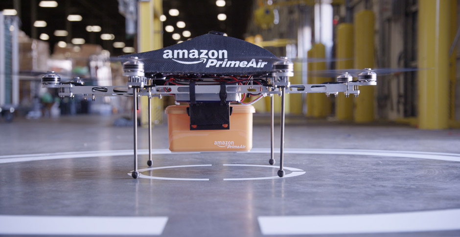
Image courtesy of Amazon Amazon’s Prime Air Drone
Currently, the FAA issues domestic UAV certificates of authorizations (COAs) on a case-by-case basis and are limited to government agencies, universities and law enforcement. The unmanned aircrafts are currently used for border surveillance, scientific and environmental research and to support law enforcement. In December 2013, the FAA selected six test sites to review safety issues in integrating unmanned aircraft systems (UAS) into the national airspace (NAS) over the next several years. The FAA must finalize plans for allowing UAVs in domestic airspace by 2015 under a law passed by Congress in 2012.
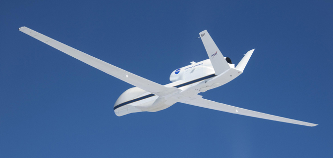
Image courtesy of NASA, Lori Losey Global Hawk equipped to fly high-altitude, long-endurance environmental science flights
UAV technology has and continues to advance rapidly. This ‘new’ industry fosters creativity, should create new jobs in engineering and manufacturing and entrepreneurs will generate new businesses. John Villasenor, a professor of electrical engineering at UCLA, told NPR “UAVs are in many ways going to be for our decade what the space program was in the ‘60s”. This is an exciting time. Not only will new applications be uncovered, expansions of current ones will progress. I continue to enjoy the opportunity working with enterprise content management systems providing on-demand access to critical geospatial intelligence data. I am excited to follow this industry and participate in new applications. No one would have thought that we could not leave home without the cell phone. One can only imagine what the next decade will bring with UAVs cruising the national airspace.
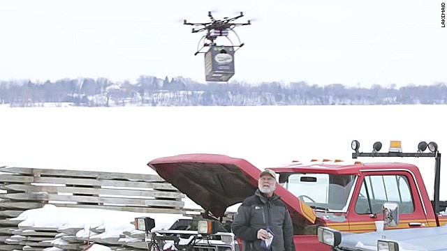
Image courtesy of CNN, Lakemaid aerial beer delivery