X

NV5 Geospatial Blog

Each month, NV5 Geospatial posts new blog content across a variety of categories. Browse our latest posts below to learn about important geospatial information or use the search bar to find a specific topic or author. Stay informed of the latest blog posts, events, and technologies by joining our email list!


Comparing Amplitude and Coherence Time Series With ICEYE US GTR Data and ENVI SARscape

Comparing Amplitude and Coherence Time Series With ICEYE US GTR Data and ENVI SARscape

12/3/2025

Large commercial SAR satellite constellations have opened a new era for persistent Earth monitoring, giving analysts the ability to move beyond simple two-image comparisons into robust time series analysis. By acquiring SAR data with near-identical geometry every 24 hours, Ground Track Repeat (GTR) missions minimize geometric decorrelation,... Read More >

Empowering D&I Analysts to Maximize the Value of SAR

Empowering D&I Analysts to Maximize the Value of SAR

12/1/2025

Defense and intelligence (D&I) analysts rely on high-resolution imagery with frequent revisit times to effectively monitor operational areas. While optical imagery is valuable, it faces limitations from cloud cover, smoke, and in some cases, infrequent revisit times. These challenges can hinder timely and accurate data collection and... Read More >

Easily Share Workflows With the Analytics Repository

Easily Share Workflows With the Analytics Repository

10/27/2025

With the recent release of ENVI® 6.2 and the Analytics Repository, it’s now easier than ever to create and share image processing workflows across your organization. With that in mind, we wrote this blog to: Introduce the Analytics Repository Describe how you can use ENVI’s interactive workflows to... Read More >

Deploy, Share, Repeat: AI Meets the Analytics Repository

Deploy, Share, Repeat: AI Meets the Analytics Repository

10/13/2025

The upcoming release of ENVI® Deep Learning 4.0 makes it easier than ever to import, deploy, and share AI models, including industry-standard ONNX models, using the integrated Analytics Repository. Whether you're building deep learning models in PyTorch, TensorFlow, or using ENVI’s native model creation tools, ENVI... Read More >

Blazing a trail: SaraniaSat-led Team Shapes the Future of Space-Based Analytics

Blazing a trail: SaraniaSat-led Team Shapes the Future of Space-Based Analytics

10/13/2025

On July 24, 2025, a unique international partnership of SaraniaSat, NV5 Geospatial Software, BruhnBruhn Innovation (BBI), Netnod, and Hewlett Packard Enterprise (HPE) achieved something unprecedented: a true demonstration of cloud-native computing onboard the International Space Station (ISS) (Fig. 1). Figure 1. Hewlett... Read More >

1345678910Last
18839 Rate this article:
5.0

The Real Value of Remotely Sensed Data

Anonym

This past week, I was reminded of just how nascent the remote sensing industry is while reading a blog post titled Google Maps turns 10! Was I the only one who heard this news and thought, "really, Google Maps is only 10 years old?" It's hard for me to even remember how I got around before Google Maps came along. I recall having a stack of maps in my back seat and actually having to pull over to use them from time to time. And if I didn't have the right map - well, then I was lost. And I'm much too proud (i.e. stubborn) to ask for directions.
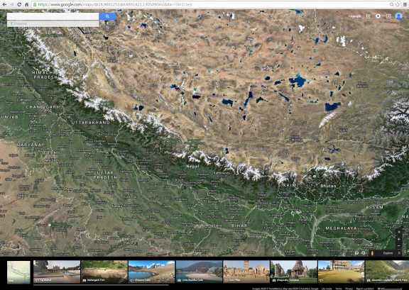

Google Maps

Beyond what Google Maps has done to "keep us found", I would think it has had a pretty profound influence on the way we view our world. With satellite, airborne, and terrestrial imagery from multiple providers, we can use Google Maps to actually get an idea of what far away places look like. Whether on a computer, a tablet, or a smartphone, with just a few clicks of a mouse or a swipe of the finger, we can zoom in to any location on the earth's surface. Zooming in to some remote region of the earth's surface will surely never replace the experience of actually being there, but what it does do is to help us make a connection - to see how it is linked to where we are and how it fits into this big puzzle we call planet earth.

Before Google Maps, there were other moments that changed the way we view our planet. On December 7, 1972, the crew of Apollo 17 captured a photograph of Earth from a distance of about 28,000 miles. This now famous photograph is known as The Blue Marble. Some say that it is the most widely distributed image in human history. 
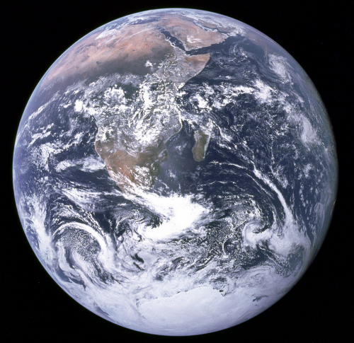
The Blue Marble

Mere months before The Blue Marble photograph was taken by the crew of Apollo 17, the Landsat 1 satellite was launched into orbit by NASA. Landsat 1, launched on July 23, 1972, was the first satellite in the Landsat program. The Landsat program is now the longest continuous earth observation program in history. With the Landsat program and the many government and commercial satellites that were to follow, a new era in our understanding of the world was ushered in. Remote sensing offers tools unlike anything the world has seen before and we are less than a half century in. We can now see our world - our whole world - as it looks from afar. We can monitor it's changes. We can watch for hazards. We can find out what is happening when a disaster strikes. We can search for things that have gone missing. And so much more. We might all be pretty used to this by now and for some of us, this is pretty much how it was the day we were born. But it's important to note that remote sensing is all so very new in the grand scheme of things and it's a much more powerful tool than it might appear on the surface.

Please login or register to post comments.