What's Happening to the Pine Island Glacier?
Anonym
Due to concerns over climate change and raising global sea levels there has been a noticeable increase in the study of Antarctica. Much of this work has been done within the filed of glaciology. Pine Island Glacier has been studied since the 1960s, but a research facility was not established in the area until 2004. This glacier has experienced a significant increase in speed since measurements began in 1974 - nearly 73%, in fact! (Rignot, 2008). It is now estimated that the glacier is moving at 4000 meters per year, or 1.5 feet per hour!!!
The Pine Island Glacier has an extension referred to as the Pine Island Glacier ice shelf. This ice shelf is helping drain the West Antarctic ice sheet into the Amundsen Sea, which is on the western portion of Antarctica. This graphic will help to give you a frame of reference (Image courtesy of NASA).
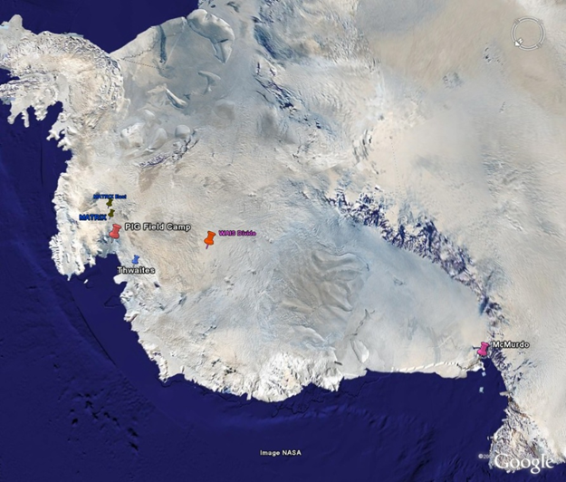
At the top left of the image you can see the Antarctic Peninsula that leads to the southern tip of South America. Below the Peninsula is the Amundsen Sea. You can see the Pine Island Glacier (PIG) Field Camp as well, which is where researchers attempt to spend a few months out of the year.
So, why are we talking about this glacier? Sometime between November 9 and November 11, 2013, an iceberg was calved from this glacier. Icebergs calve from glaciers all the time, so no big deal, right? Well, this particular iceberg happens to be approximately six times the size of Manhattan. This new iceberg is estimated to measure about 21 miles by 12 miles (35 km by 20 km), which is roughly the size of Singapore, and has a highest elevation of roughly 1,600 feet (500 m). The path of this massive iceberg will be tracked closely, and it will be interesting to see if the iceberg will end up in either the "coastal counter current" or the "circumpolar current". NASA scientist emeritus Robert Blindchadler postulates, "where it is going depends on the deeper currents into which its keel extends." http://earthobservatory.nasa.gov/IOTD/view.php?id=82392.
Although we will not be able to determine the path of the iceberg for a few months at the earliest, and more likely not for a few years, this will be another example of how important it is to work together across research institutions and scientific disciplines. The U.S. National Ice Center, Sheffield and Southhampton Universities, British Antarctic Survey (BAS), and NASA have already been collaborating on this project for years, and the addition of other scientists and research labs is surely expected.
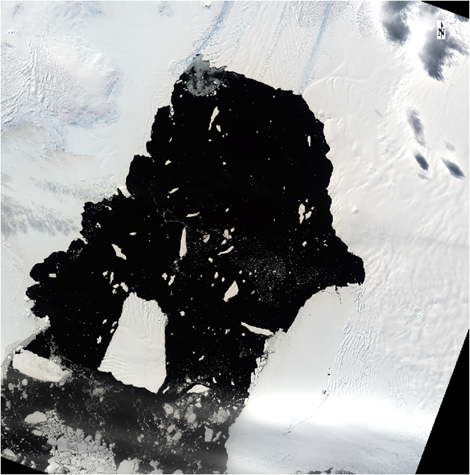
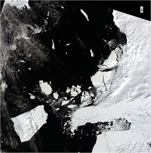
The processes that led up to such a massive iceberg calving are studied by research facilities around the globe, but the main collaborators at PIG are NASA and BAS. Better understanding exactly why and how this iceberg separated from the ice shelf will help us to develop a more comprehensive knowledge of the forces at work that will impact global sea levels for decades to come. Collaboration and hard work will be essential if we are to mitigate the impacts of global climate change and the vast array of issues we will experience in its wake. The images below were captured by Landsat 8, courtesy of the United States Geological Survey (USGS) Earth Resources Observation and Science Center (EROS).
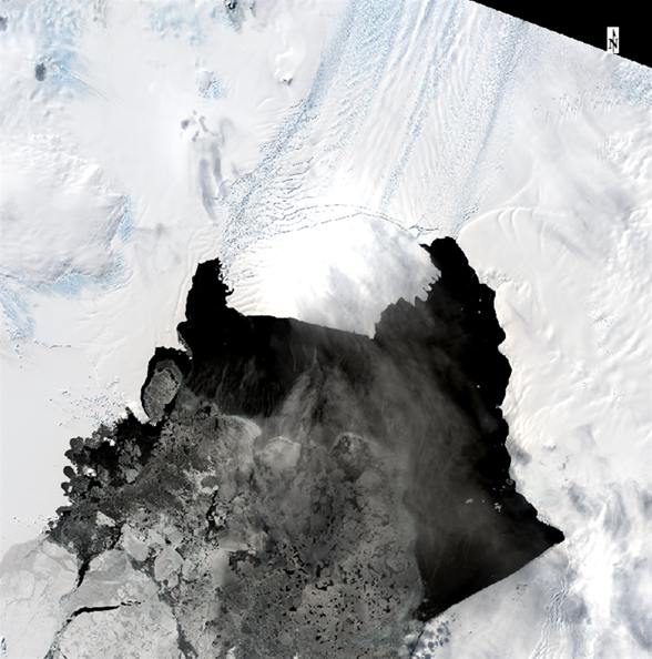
November 4, 2013
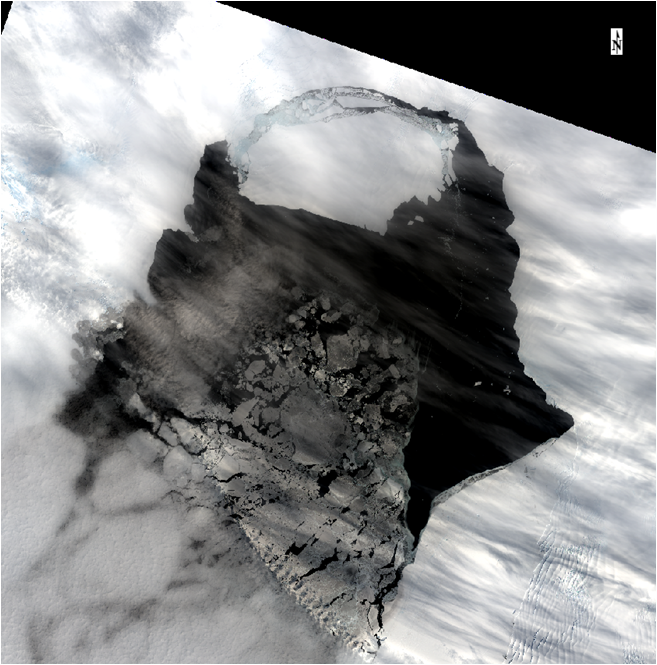
November 11, 2013
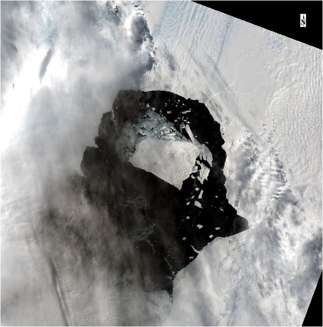
November 20, 2013
December 22, 2013
January 21, 2014
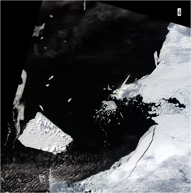
February 13, 2014
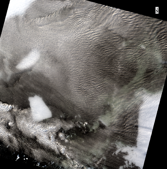
March 8, 2014
Looking at these images it appears as though this iceberg is moving extremely quickly, but don’t worry, it will be stopped up in ice for the foreseeable future as Antarctica begins its arduous and dismal winter months.