How do I use ENVI Tools in ArcGIS?
The ability to run ENVI analytics within ArcGIS is continually evolving to accommodate a wider range of tools and customization. Versions of ENVI prior to 5.5 included a set of geoprocessing tools (GPTools) that you could run in ArcMap™, called ENVI Tools for the ArcToolbox™. With the release of ENVI 5.5, these tools were replaced with a simpler and more powerful library called ENVI® Py for ArcGIS®.
ENVI Py for ArcGIS provides a Python client library that enables you to run ENVI analytics in ArcGIS Pro and ArcMap. If you are a current customer who has upgraded to ENVI (or ENVI+IDL) 5.5, installers for ENVI Py for ArcGIS will be available to your license administrator in the Download and License Center when they log into their Harris Geospatial Systems account. Two separate installers are provided, one for ArcGIS Pro and another for ArcMap. If you are installing ENVI from a DVD, installers are available in the \ENVIPy10 directory. ENVI Py for ArcGIS will work with ENVI 5.3.2 and later, but it is only available with ENVI 5.5. If you are using one of these previous versions of ENVI and would like to download ENVI Py for ArcGIS, please contact Technical Support for the installers.
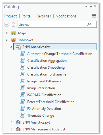
Once you install the appropriate option for your application, an ENVI Analytics toolbox is automatically added to ArcGIS Pro or ArcMap. This toolbox contains several image-processing tools that are ready to use. No further configuration is needed.

You can also create a custom toolbox with as many ENVI tools as you need. Each tool is based on an ENVITask in the ENVI application programming interface (API) that runs a specific analytic. A tutorial is available from Harris Geospatial Solutions that explains the setup and process for creating ENVI tools in ArcGIS Pro. This is the best place to get started.
A separate ENVI Py for ArcGIS Library provides tools for generating ArcGIS toolboxes using Python. Installation steps and Python code examples are available at https://pypi.org/project/envipyarclib/.
Finally, we provide a library called GSF Py for ArcGIS, which lets you run IDL and ENVI analytics provided by the Geospatial Services Framework through ArcGIS Pro, ArcMap, and ArcGIS Server.
See the following resources for more information: