Advanced GEOINT Series Blog 3 : Autonomous Feature Detection and Custody Tracking
Real-time monitoring and tracking are essential for organizations that need to enhance situational awareness and decision-making during operations. The ENVI® Ecosystem provides advanced autonomous detection and tracking capabilities that enable users to monitor, detect, and maintain custody of key features – this helps achieve operational goals, optimize resource utilization, minimize risks, and conserve costs.
Once trained, the ENVI Deep Learning module (one tool within the ENVI Ecosystem) can be deployed to continuously scan and flag features of interest in real time. Autonomous monitoring reduces the workload on analysts, enabling around-the-clock surveillance without requiring constant human oversight.
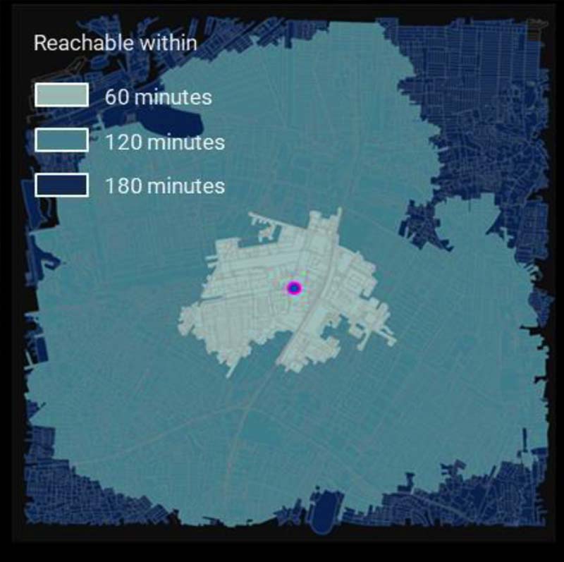
Figure 1 : Open-source-based time-distance analysis result. The target vehicle is located at the center of the AOI. The Open-Source algorithm is called from within the ENVI Ecosystem.
ENVI Ecosystem’s custody-tracking capabilities add another layer of insight by predicting future locations of moving objects based on speed and terrain, making it possible to track and manage assets continuously. This predictive capability is ideal for high-stakes scenarios such as monitoring transportation corridors, tracking resources, or managing traffic flow.
Key Features:
-
Autonomous Detection: Monitor critical areas with AI-driven detections, reducing the need for manual oversight.
-
Real-Time Custody Tracking: Predict future locations of tracked objects, enabling proactive decision-making.
- Broad Application Range: Ideal for security, emergency management, and defense and intelligence.
By combining real-time autonomous detection with predictive custody tracking, the ENVI Ecosystem provides a powerful, integrated approach to geospatial monitoring. This level of insight supports faster response times and more informed decisions in complex operational environments.
Our experts are happy to discuss how a solution like this can support your mission – email us.
Advanced GEOINT Blog Series