X

NV5 Geospatial Blog

Each month, NV5 Geospatial posts new blog content across a variety of categories. Browse our latest posts below to learn about important geospatial information or use the search bar to find a specific topic or author. Stay informed of the latest blog posts, events, and technologies by joining our email list!


From Image to Insight: How GEOINT Automation Is Changing the Speed of Decision-Making

From Image to Insight: How GEOINT Automation Is Changing the Speed of Decision-Making

4/28/2025

When every second counts, the ability to process geospatial data rapidly and accurately isn’t just helpful, it’s critical. Geospatial Intelligence (GEOINT) has always played a pivotal role in defense, security, and disaster response. But in high-tempo operations, traditional workflows are no longer fast enough. Analysts are... Read More >

Thermal Infrared Echoes: Illuminating the Last Gasp of a Dying Star

Thermal Infrared Echoes: Illuminating the Last Gasp of a Dying Star

4/24/2025

This blog was written by Eli Dwek, Emeritus, NASA Goddard Space Flight Center, Greenbelt, MD and Research Fellow, Center for Astrophysics, Harvard & Smithsonian, Cambridge, MA. It is the fifth blog in a series showcasing our IDL® Fellows program which supports passionate retired IDL users who may need support to continue their work... Read More >

A New Era of Hyperspectral Imaging with ENVI® and Wyvern’s Open Data Program

A New Era of Hyperspectral Imaging with ENVI® and Wyvern’s Open Data Program

2/25/2025

This blog was written in collaboration with Adam O’Connor from Wyvern.   As hyperspectral imaging (HSI) continues to grow in importance, access to high-quality satellite data is key to unlocking new insights in environmental monitoring, agriculture, forestry, mining, security, energy infrastructure management, and more.... Read More >

Ensure Mission Success With the Deployable Tactical Analytics Kit (DTAK)

Ensure Mission Success With the Deployable Tactical Analytics Kit (DTAK)

2/11/2025

In today’s fast-evolving world, operational success hinges on real-time geospatial intelligence and data-driven decisions. Whether it’s responding to natural disasters, securing borders, or executing military operations, having the right tools to integrate and analyze data can mean the difference between success and failure.... Read More >

How the COVID-19 Lockdown Improved Air Quality in Ecuador: A Deep Dive Using Satellite Data and ENVI® Software

How the COVID-19 Lockdown Improved Air Quality in Ecuador: A Deep Dive Using Satellite Data and ENVI® Software

1/21/2025

The COVID-19 pandemic drastically altered daily life, leading to unexpected environmental changes, particularly in air quality. Ecuador, like many other countries, experienced significant shifts in pollutant concentrations due to lockdown measures. In collaboration with Geospace Solutions and Universidad de las Fuerzas Armadas ESPE,... Read More >

1345678910Last
«May 2025»
SunMonTueWedThuFriSat
27282930123
45678910
11121314151617
18192021222324
25262728293031
1234567
15344 Rate this article:
5.0

Water, Water Everywhere

But never where you need it.

Anonym

For some reason, water has been a big theme for me lately. Two weeks ago, it was a snow storm causing problems for a class I was teaching in Virginia and delaying my flight home to Colorado. Then I got a bunch of followup work for the arctic coastal erosion and bathymetric projects I’ve been working on. The Winter Olympics started, and brought the usual concerns about snow quantities. Now, I’m back in the DC area again this week to teach another class, and sure enough another snow storm is forecast to make a mess of roads and air traffic.

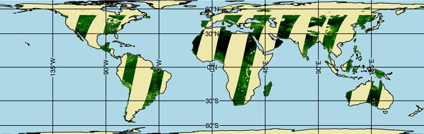
Precipitation, like most of nature, has a habit of following its own rules and systems which are at best loosely coupled to what we’d like to see. We get too much in some places, and not enough in others. But one project I get to work on in a small way promises to help us work with the water we have a lot more effectively. The first step in understanding an earth system is getting a decent map of it, and that’s not particularly easy. There have been some great earlier missions to develop and test the technology, like TRMM. The new missions, SMAP and GPM, however, will give us frequent global maps of where precipitation is falling, and where that water goes when it hits the ground. My little contribution is to make sure we can help get that data on screen in the ways scientists and end users want. When I get some more of the code finished, I’ll post it as a blog on making use of global data systems through HDF5 and map routines in IDL. But for now, here’s a sneak peek of where I’m at:


There aren’t many geospatial fields that don’t have a heavy dependency on precipitation and water. How will you use the new data from precipitation and soil moisture missions?


Please login or register to post comments.