You can create surface graphics using the SURFACE function. In this topic, we will use the SURFACE function using elevation data taken from the Maroon Bells area of the Rocky Mountains in Colorado.
For an additional example using SURFACE, see Plot 3D Terrain and Water Table.
The following example displays a very simple surface graphic:
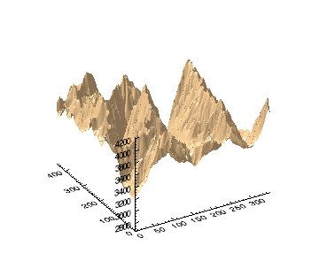
To reproduce this surface, enter the following lines on the IDL command line:
RESTORE, FILEPATH('marbells.dat', $
SUBDIRECTORY=['examples', 'data'])
s = SURFACE(elev, COLOR='burlywood')
The following simple example uses data that you create at the command line:
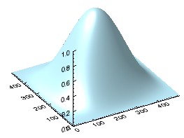
h1 = HANNING(500,500)
surf_hann = SURFACE(h1, COLOR='light_blue')
Resources